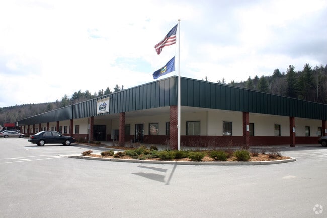
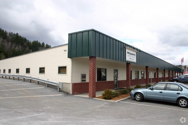
Property Record
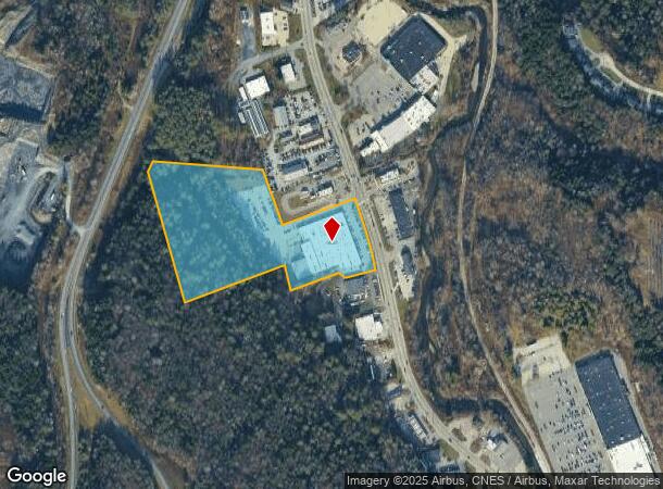
1311 Us Route 302, Barre, VT 05641
NEARBY LISTINGS FOR SALE OR LEASE
Property Detail
1311 Us Route 302
060-018-10147
10.85 ACRES & COMM BLDG
Commercialnec
Washington
X
Vermont
50023C0431E
10.85 AC
2024
Vermont North Area
2024
Other Market Areas
954500
Barre, VT
DEMOGRAPHICS near 1311 Us Route 302
1 Mile
3 Mile
5 Mile
2024 Total Population
1,031
14,116
26,391
2029 Population
1,055
14,288
26,597
Pop Growth 2024-2029
+ 2.33%
+ 1.22%
+ 0.78%
Average Age
46
44
43
2024 Total Households
404
6,522
11,980
HH Growth 2024-2029
+ 2.48%
+ 1.23%
+ 0.78%
Median Household Inc
$80,961
$70,255
$69,392
Avg Household Size
2.20
2.00
2.10
2024 Avg HH Vehicles
2.00
1.00
2.00
Median Home Value
$253,529
$249,800
$245,930
Median Year Built
1984
1966
1965
Nearby Places
Map Layers
Map Styles
 Street
 Aerial
- Restaurants
- Banks
- Shops
- Fitness
- Groceries
PUBLIC TRANSPORTATION
COMMUTER RAIL
Montpelier-Berlin Amtrak Station (Vermonter - Amtrak)
DRIVE
WALK
Distance
Montpelier-Berlin Amtrak Station (Vermonter - Amtrak)
10 min
4.9 mi
Freight Ports
Montreal
DRIVE
WALK
Distance
Montreal
172 min
138.0 mi
SALE & LEASE HISTORY
LISTING DATE
SALE/LEASE

Sep 23, 2021
For Lease
Nearby Properties
Address
Land Use
TOTAL SIZE
Lot Size
Zoning
Address
Land Use
TOTAL SIZE
Lot Size
Zoning
240.06 AC
Address
Land Use
TOTAL SIZE
Lot Size
Zoning
68,909 SF
23.27 AC
Address
Land Use
TOTAL SIZE
Lot Size
Zoning
78,724 SF
2.90 AC
Address
Land Use
TOTAL SIZE
Lot Size
Zoning
Address
Land Use
TOTAL SIZE
Lot Size
Zoning
130,942 SF
Address
Land Use
TOTAL SIZE
Lot Size
Zoning
5,353 SF
Address
Land Use
TOTAL SIZE
Lot Size
Zoning
Address
Land Use
TOTAL SIZE
Lot Size
Zoning
55.21 AC
Address
Land Use
TOTAL SIZE
Lot Size
Zoning
242.35 AC
Address
Land Use
TOTAL SIZE
Lot Size
Zoning
84,698 SF
2.81 AC
Address
Land Use
TOTAL SIZE
Lot Size
Zoning
62,700 SF
5.41 AC
Address
Land Use
TOTAL SIZE
Lot Size
Zoning
Address
Land Use
TOTAL SIZE
Lot Size
Zoning
1.94 AC
Address
Land Use
TOTAL SIZE
Lot Size
Zoning
36.11 AC
Address
Land Use
TOTAL SIZE
Lot Size
Zoning
241.56 AC
Address
Land Use
TOTAL SIZE
Lot Size
Zoning
96.42 AC
Address
Land Use
TOTAL SIZE
Lot Size
Zoning
17.40 AC
Address
Land Use
TOTAL SIZE
Lot Size
Zoning
54,324 SF
2.76 AC
MU-1
Address
Land Use
TOTAL SIZE
Lot Size
Zoning
71,718 SF
1.22 AC
Address
Land Use
TOTAL SIZE
Lot Size
Zoning
27,913 SF
10.45 AC
CIV
Address
Land Use
TOTAL SIZE
Lot Size
Zoning
Address
Land Use
TOTAL SIZE
Lot Size
Zoning
130,941 SF
Address
Land Use
TOTAL SIZE
Lot Size
Zoning
89,847 SF
20.67 AC
Address
Land Use
TOTAL SIZE
Lot Size
Zoning
50,996 SF
1.60 AC
Address
Land Use
TOTAL SIZE
Lot Size
Zoning
103,980 SF
0.95 AC
AE
Address
Land Use
TOTAL SIZE
Lot Size
Zoning
38,091 SF
4.57 AC
Address
Land Use
TOTAL SIZE
Lot Size
Zoning
0.93 AC
Address
Land Use
TOTAL SIZE
Lot Size
Zoning
3.10 AC
Address
Land Use
TOTAL SIZE
Lot Size
Zoning
20.30 AC
Address
Land Use
TOTAL SIZE
Lot Size
Zoning
28,902 SF
2.10 AC
The World's #1 Commercial Real Estate Marketplace
Connect with us
© 2026 CoStar Group
The information above has been obtained from sources believed reliable. While we do not doubt its accuracy we have not verified it and make no guarantee, warranty or representation about it. It is your responsibility to independently confirm its accuracy and completeness. Any projections, opinions, assumptions, or estimates used are for example only and do not represent the current or future performance of the property. The value of this transaction to you depends on tax and other factors which should be evaluated by your tax, financial, and legal advisors. You and your advisors should conduct a careful, independent investigation of the property to determine to your satisfaction the suitability of the property for your needs.