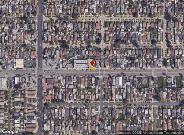
Property Record
1311 W Florence Ave, Los Angeles, CA 90044
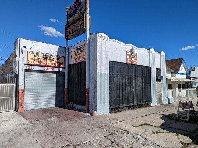
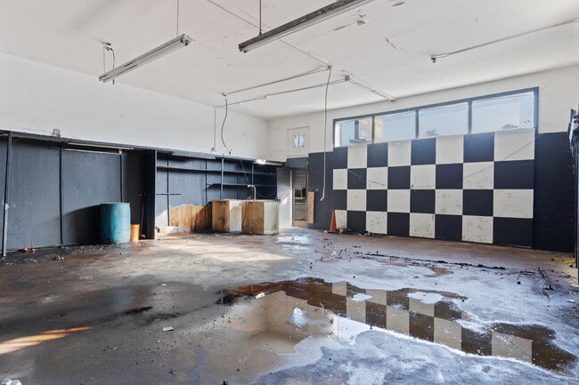
This Property Is For Sale
NEARBY LISTINGS FOR SALE OR LEASE
Property Detail
1311 W Florence Ave
Los Angeles-Long Beach-Glendale, CA
1356
6014-033-018
TRACT # 1356 EX OF ST LOT 496
Storemultistory
Los Angeles
X
California
06037C1781G
496
2024
0.09 AC
2025
Inglewood/South LA
237402
Los Angeles
3,697 SF
DEMOGRAPHICS near 1311 W Florence Ave
1 Mile
3 Mile
5 Mile
2024 Total Population
53,170
425,395
1,043,552
2029 Population
51,362
408,344
1,003,668
Pop Growth 2024-2029
(3.40%)
(4.01%)
(3.82%)
Average Age
37
36
37
2024 Total Households
15,417
120,911
309,906
HH Growth 2024-2029
(3.64%)
(4.25%)
(3.90%)
Median Household Inc
$48,515
$52,023
$53,505
Avg Household Size
3.30
3.30
3.20
2024 Avg HH Vehicles
2.00
2.00
2.00
Median Home Value
$556,989
$643,282
$677,553
Median Year Built
1948
1949
1953
Nearby Places
- Restaurants
- Banks
- Shops
- Fitness
- Groceries
PUBLIC TRANSPORTATION
COMMUTER RAIL
Los Angeles (Coast Starlight - Amtrak, Pacific Surfliner - Amtrak, Southwest Chief - Amtrak, Texas Eagle - Amtrak)
DRIVE
WALK
Distance
Los Angeles (Coast Starlight - Amtrak, Pacific Surfliner - Amtrak, Southwest Chief - Amtrak, Texas Eagle - Amtrak)
12 min
8.7 mi
Union Station (91 Line - Southern California Regional Rail Authority (Metrolink), Antelope Valley Line - Southern California Regional Rail Authority (Metrolink), Orange County Line - Southern California Regional Rail Authority (Metrolink), Riverside Line - Southern California Regional Rail Authority (Metrolink), San Bernardino Line - Southern California Regional Rail Authority (Metrolink), Ventura County Line - Southern California Regional Rail Authority (Metrolink))
DRIVE
WALK
Distance
Union Station (91 Line - Southern California Regional Rail Authority (Metrolink), Antelope Valley Line - Southern California Regional Rail Authority (Metrolink), Orange County Line - Southern California Regional Rail Authority (Metrolink), Riverside Line - Southern California Regional Rail Authority (Metrolink), San Bernardino Line - Southern California Regional Rail Authority (Metrolink), Ventura County Line - Southern California Regional Rail Authority (Metrolink))
15 min
8.9 mi
AIRPORT
Los Angeles International
DRIVE
WALK
Distance
Los Angeles International
14 min
7.6 mi
Long Beach (Daugherty Field)
DRIVE
WALK
Distance
Long Beach (Daugherty Field)
24 min
17.8 mi
Bob Hope
DRIVE
WALK
Distance
Bob Hope
32 min
23.8 mi
Freight Ports
Port of Long Beach
DRIVE
WALK
Distance
Port of Long Beach
27 min
19.7 mi
Nearby Properties
Address
Land Use
TOTAL SIZE
Lot Size
Zoning
Address
Land Use
TOTAL SIZE
Lot Size
Zoning
2,531,696 SF
79.60 AC
INCR*
Address
Land Use
TOTAL SIZE
Lot Size
Zoning
256,059 SF
Address
Land Use
TOTAL SIZE
Lot Size
Zoning
724,715 SF
5.76 AC
INCR*
Address
Land Use
TOTAL SIZE
Lot Size
Zoning
1,359,630 SF
29 AC
INCR*
Address
Land Use
TOTAL SIZE
Lot Size
Zoning
181,213 SF
3.96 AC
INCR*
Address
Land Use
TOTAL SIZE
Lot Size
Zoning
116,827 SF
0.64 AC
LAC2
Address
Land Use
TOTAL SIZE
Lot Size
Zoning
102,789 SF
0.86 AC
INR3*
Address
Land Use
TOTAL SIZE
Lot Size
Zoning
57,488 SF
4.30 AC
LAPF
Address
Land Use
TOTAL SIZE
Lot Size
Zoning
134,044 SF
1.90 AC
LAC2
Address
Land Use
TOTAL SIZE
Lot Size
Zoning
81,735 SF
4.10 AC
LAR4
Address
Land Use
TOTAL SIZE
Lot Size
Zoning
103,656 SF
6.98 AC
LCM1
Address
Land Use
TOTAL SIZE
Lot Size
Zoning
507,000 SF
11.96 AC
INCR
Address
Land Use
TOTAL SIZE
Lot Size
Zoning
402,118 SF
9.39 AC
LAC2
Address
Land Use
TOTAL SIZE
Lot Size
Zoning
460,912 SF
3.96 AC
INCR
Address
Land Use
TOTAL SIZE
Lot Size
Zoning
133,455 SF
1.04 AC
LAC2
Address
Land Use
TOTAL SIZE
Lot Size
Zoning
111,213 SF
12.04 AC
LAR4
Address
Land Use
TOTAL SIZE
Lot Size
Zoning
173,222 SF
0.96 AC
LAR3
Address
Land Use
TOTAL SIZE
Lot Size
Zoning
153,520 SF
15.72 AC
INM1L*
Address
Land Use
TOTAL SIZE
Lot Size
Zoning
188,030 SF
3.09 AC
LAR5
Address
Land Use
TOTAL SIZE
Lot Size
Zoning
115,366 SF
0.85 AC
LAM1
Address
Land Use
TOTAL SIZE
Lot Size
Zoning
135,060 SF
Address
Land Use
TOTAL SIZE
Lot Size
Zoning
122,154 SF
2.81 AC
LAP
Address
Land Use
TOTAL SIZE
Lot Size
Zoning
Address
Land Use
TOTAL SIZE
Lot Size
Zoning
51,006 SF
0.50 AC
LAC2
Address
Land Use
TOTAL SIZE
Lot Size
Zoning
102,260 SF
16.84 AC
LAR4
Address
Land Use
TOTAL SIZE
Lot Size
Zoning
80,606 SF
1.40 AC
INC2*
Address
Land Use
TOTAL SIZE
Lot Size
Zoning
73,697 SF
3.14 AC
LAC2
Address
Land Use
TOTAL SIZE
Lot Size
Zoning
135,195 SF
11.82 AC
INCR
Address
Land Use
TOTAL SIZE
Lot Size
Zoning
131,879 SF
1.96 AC
LAC2
Address
Land Use
TOTAL SIZE
Lot Size
Zoning
189,808 SF
4.07 AC
LAM2
The World's #1 Commercial Real Estate Marketplace
Connect with us
© 2025 CoStar Group
The information above has been obtained from sources believed reliable. While we do not doubt its accuracy we have not verified it and make no guarantee, warranty or representation about it. It is your responsibility to independently confirm its accuracy and completeness. Any projections, opinions, assumptions, or estimates used are for example only and do not represent the current or future performance of the property. The value of this transaction to you depends on tax and other factors which should be evaluated by your tax, financial, and legal advisors. You and your advisors should conduct a careful, independent investigation of the property to determine to your satisfaction the suitability of the property for your needs.