Property Record
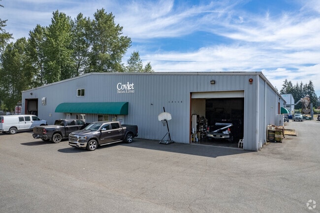
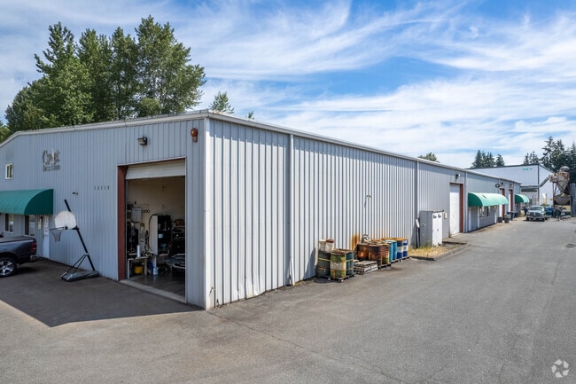
19121 94Th Dr Nw, Stanwood, WA 98292

This Property Is For Sale
NEARBY LISTINGS FOR SALE OR LEASE
Property Detail
19121 94Th Dr Nw
Seattle-Tacoma-Bellevue, WA
Marysville Office/Warehouse Condominium
011023-000-004-00
SECTION 04 TOWNSHIP 30 RANGE 05 QUARTER SW MARYSVILLE OFFICE/WAREHOUSE CONDOMINIUM - UNIT 4 TGW ASSIGNED PARKING & STORAGE, IF ANY, TGW UND 22.26% INT IN COM AREAS & FACS AS DESC IN DECL REC AFN 200807160762
Commercialcondominium
Snohomish
X
Washington
53061C0710F
4
2024
0.13 AC
2025
N Snohomish County
053201
Seattle/Puget Sound
5,534 SF
DEMOGRAPHICS near 19121 94Th Dr Nw
1 Mile
3 Mile
5 Mile
2024 Total Population
7,237
35,375
89,973
2029 Population
7,535
36,886
93,946
Pop Growth 2024-2029
+ 4.12%
+ 4.27%
+ 4.42%
Average Age
39
40
39
2024 Total Households
2,508
12,590
32,116
HH Growth 2024-2029
+ 4.27%
+ 4.38%
+ 4.52%
Median Household Inc
$94,206
$95,050
$93,247
Avg Household Size
2.70
2.70
2.70
2024 Avg HH Vehicles
2.00
2.00
2.00
Median Home Value
$456,530
$472,826
$482,004
Median Year Built
1983
1990
1991
Nearby Places
Map Layers
Map Styles
 Street
 Aerial
- Restaurants
- Banks
- Shops
- Fitness
- Groceries
PUBLIC TRANSPORTATION
AIRPORT
Seattle Paine Field International
DRIVE
WALK
Distance
Seattle Paine Field International
31 min
19.9 mi
Freight Ports
Port of Everett
DRIVE
WALK
Distance
Port of Everett
21 min
12.3 mi
Nearby Properties
Address
Land Use
TOTAL SIZE
Lot Size
Zoning
Address
Land Use
TOTAL SIZE
Lot Size
Zoning
2,623,172 SF
32.78 AC
Address
Land Use
TOTAL SIZE
Lot Size
Zoning
3.14 AC
IP
Address
Land Use
TOTAL SIZE
Lot Size
Zoning
336,508 SF
23.32 AC
LI
Address
Land Use
TOTAL SIZE
Lot Size
Zoning
113,927 SF
576.83 AC
TRIBES
Address
Land Use
TOTAL SIZE
Lot Size
Zoning
33,140 SF
135.95 AC
BP
Address
Land Use
TOTAL SIZE
Lot Size
Zoning
201,141 SF
7.37 AC
MU
Address
Land Use
TOTAL SIZE
Lot Size
Zoning
229,606 SF
9.28 AC
R18 MFM
Address
Land Use
TOTAL SIZE
Lot Size
Zoning
206,135 SF
4.05 AC
HC
Address
Land Use
TOTAL SIZE
Lot Size
Zoning
1,664 SF
16.93 AC
LI
Address
Land Use
TOTAL SIZE
Lot Size
Zoning
189,663 SF
8.21 AC
MU
Address
Land Use
TOTAL SIZE
Lot Size
Zoning
231,030 SF
18.48 AC
LI
Address
Land Use
TOTAL SIZE
Lot Size
Zoning
165,762 SF
7.12 AC
MU
Address
Land Use
TOTAL SIZE
Lot Size
Zoning
186,723 SF
5.36 AC
HC
Address
Land Use
TOTAL SIZE
Lot Size
Zoning
1,128 SF
40 AC
LI
Address
Land Use
TOTAL SIZE
Lot Size
Zoning
82.67 AC
R4.5 SFM
Address
Land Use
TOTAL SIZE
Lot Size
Zoning
9.87 AC
R4.5 SFM
Address
Land Use
TOTAL SIZE
Lot Size
Zoning
117,532 SF
4.72 AC
R18 MFM
Address
Land Use
TOTAL SIZE
Lot Size
Zoning
68,424 SF
2.09 AC
HC
Address
Land Use
TOTAL SIZE
Lot Size
Zoning
174,661 SF
12.98 AC
CB
Address
Land Use
TOTAL SIZE
Lot Size
Zoning
182,316 SF
15.03 AC
HC
Address
Land Use
TOTAL SIZE
Lot Size
Zoning
70,712 SF
4 AC
GC
Address
Land Use
TOTAL SIZE
Lot Size
Zoning
155,543 SF
20.20 AC
HC
Address
Land Use
TOTAL SIZE
Lot Size
Zoning
152,543 SF
15.32 AC
GC
Address
Land Use
TOTAL SIZE
Lot Size
Zoning
176,030 SF
18.67 AC
LI
Address
Land Use
TOTAL SIZE
Lot Size
Zoning
4.13 AC
GC
Address
Land Use
TOTAL SIZE
Lot Size
Zoning
224,324 SF
30.49 AC
LI
Address
Land Use
TOTAL SIZE
Lot Size
Zoning
60,128 SF
2.47 AC
GC
Address
Land Use
TOTAL SIZE
Lot Size
Zoning
168,494 SF
8.71 AC
The World's #1 Commercial Real Estate Marketplace
Connect with us
© 2025 CoStar Group
The information above has been obtained from sources believed reliable. While we do not doubt its accuracy we have not verified it and make no guarantee, warranty or representation about it. It is your responsibility to independently confirm its accuracy and completeness. Any projections, opinions, assumptions, or estimates used are for example only and do not represent the current or future performance of the property. The value of this transaction to you depends on tax and other factors which should be evaluated by your tax, financial, and legal advisors. You and your advisors should conduct a careful, independent investigation of the property to determine to your satisfaction the suitability of the property for your needs.