Property Record
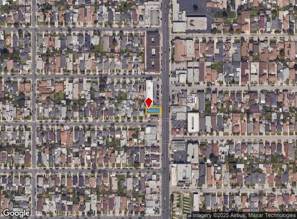
13119 Inglewood Ave, Hawthorne, CA 90250
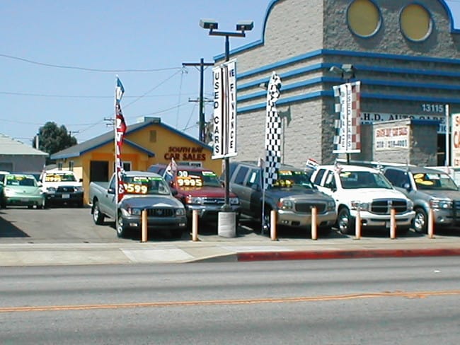

This Property Is For Sale
NEARBY LISTINGS FOR SALE OR LEASE
Property Detail
13119 Inglewood Ave
Los Angeles-Long Beach-Glendale, CA
5755
4144-010-021
TRQCT # 5755 EX OF ST LOT 11 BLK 12
Vehiclerentalsvehiclesales
Los Angeles
X
California
06037C1790F
11
2024
0.10 AC
2025
Hawthorne/Gardena
602301
Los Angeles
506 SF
DEMOGRAPHICS near 13119 Inglewood Ave
1 Mile
3 Mile
5 Mile
2024 Total Population
40,625
268,094
648,333
2029 Population
39,222
259,801
629,475
Pop Growth 2024-2029
(3.45%)
(3.09%)
(2.91%)
Average Age
38
38
39
2024 Total Households
13,731
88,917
229,349
HH Growth 2024-2029
(3.74%)
(3.27%)
(3.07%)
Median Household Inc
$80,230
$77,848
$83,099
Avg Household Size
2.90
2.90
2.70
2024 Avg HH Vehicles
2.00
2.00
2.00
Median Home Value
$778,212
$832,058
$851,968
Median Year Built
1959
1962
1961
Nearby Places
- Restaurants
- Banks
- Shops
- Fitness
- Groceries
PUBLIC TRANSPORTATION
AIRPORT
Los Angeles International
DRIVE
WALK
Distance
Los Angeles International
10 min
5.3 mi
Long Beach (Daugherty Field)
DRIVE
WALK
Distance
Long Beach (Daugherty Field)
22 min
15.6 mi
Bob Hope
DRIVE
WALK
Distance
Bob Hope
41 min
29.6 mi
Freight Ports
Port of Long Beach
DRIVE
WALK
Distance
Port of Long Beach
26 min
17.6 mi
Nearby Properties
Address
Land Use
TOTAL SIZE
Lot Size
Zoning
Address
Land Use
TOTAL SIZE
Lot Size
Zoning
1,807,845 SF
7.28 AC
ESC3
Address
Land Use
TOTAL SIZE
Lot Size
Zoning
584,746 SF
20.38 AC
MNIP
Address
Land Use
TOTAL SIZE
Lot Size
Zoning
Address
Land Use
TOTAL SIZE
Lot Size
Zoning
Address
Land Use
TOTAL SIZE
Lot Size
Zoning
Address
Land Use
TOTAL SIZE
Lot Size
Zoning
Address
Land Use
TOTAL SIZE
Lot Size
Zoning
1,315,931 SF
3.36 AC
ESC3
Address
Land Use
TOTAL SIZE
Lot Size
Zoning
565,264 SF
5.95 AC
Address
Land Use
TOTAL SIZE
Lot Size
Zoning
337,106 SF
9.56 AC
ESCM*
Address
Land Use
TOTAL SIZE
Lot Size
Zoning
724,715 SF
5.76 AC
INCR*
Address
Land Use
TOTAL SIZE
Lot Size
Zoning
329,810 SF
2.21 AC
LAC2
Address
Land Use
TOTAL SIZE
Lot Size
Zoning
944,791 SF
22.53 AC
ESCM*
Address
Land Use
TOTAL SIZE
Lot Size
Zoning
421,934 SF
8.24 AC
ESCM
Address
Land Use
TOTAL SIZE
Lot Size
Zoning
459,058 SF
8.84 AC
ESC3*
Address
Land Use
TOTAL SIZE
Lot Size
Zoning
632,476 SF
10.56 AC
LAC2
Address
Land Use
TOTAL SIZE
Lot Size
Zoning
652,774 SF
3.60 AC
LAC2
Address
Land Use
TOTAL SIZE
Lot Size
Zoning
553,161 SF
21.61 AC
ESM2*
Address
Land Use
TOTAL SIZE
Lot Size
Zoning
718,086 SF
41.24 AC
RBI-1A
Address
Land Use
TOTAL SIZE
Lot Size
Zoning
418,131 SF
3.03 AC
LCC1
Address
Land Use
TOTAL SIZE
Lot Size
Zoning
793,455 SF
31.88 AC
ESM2*
Address
Land Use
TOTAL SIZE
Lot Size
Zoning
848,217 SF
36.09 AC
RBI-1A
Address
Land Use
TOTAL SIZE
Lot Size
Zoning
1,410,144 SF
6.35 AC
ESM2*
Address
Land Use
TOTAL SIZE
Lot Size
Zoning
189,244 SF
3.64 AC
ESCM*
Address
Land Use
TOTAL SIZE
Lot Size
Zoning
859,786 SF
4.82 AC
LAC2
Address
Land Use
TOTAL SIZE
Lot Size
Zoning
319,589 SF
5.13 AC
MNPD
Address
Land Use
TOTAL SIZE
Lot Size
Zoning
227,596 SF
14.38 AC
HAM1YY
Address
Land Use
TOTAL SIZE
Lot Size
Zoning
876,121 SF
9.03 AC
ESC3
Address
Land Use
TOTAL SIZE
Lot Size
Zoning
1,972,924 SF
ESCM*
Address
Land Use
TOTAL SIZE
Lot Size
Zoning
801,040 SF
5.69 AC
LAC2
The World's #1 Commercial Real Estate Marketplace
Connect with us
© 2025 CoStar Group
The information above has been obtained from sources believed reliable. While we do not doubt its accuracy we have not verified it and make no guarantee, warranty or representation about it. It is your responsibility to independently confirm its accuracy and completeness. Any projections, opinions, assumptions, or estimates used are for example only and do not represent the current or future performance of the property. The value of this transaction to you depends on tax and other factors which should be evaluated by your tax, financial, and legal advisors. You and your advisors should conduct a careful, independent investigation of the property to determine to your satisfaction the suitability of the property for your needs.