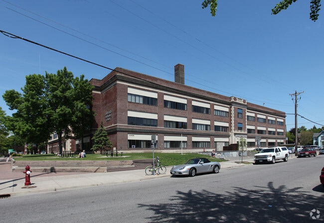
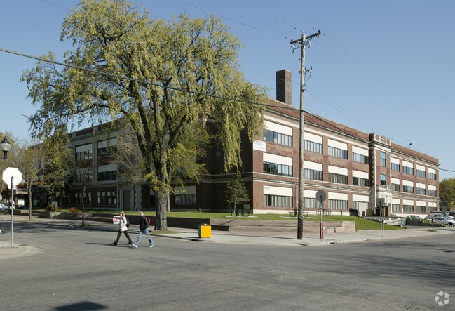
Property Record
1313 5Th St Se, Minneapolis, MN 55414

NEARBY LISTINGS FOR SALE OR LEASE
Property Detail
1313 5Th St Se
Minneapolis-St. Paul-Bloomington, MN-WI
Tuttles Addn To St Anthony
24-029-24-42-0135
LOT 001 A TUTTLES ADDN TO ST ANTHONY ALL OF BLK U INCL ADJ 1/2 OF 13TH AV VAC ALSO THAT PART OF LOTS 1 2 9 AND 10 BLK T LYING SWLY OF THE NELY 105 FT OF SAID LOTS 1 AND 2 AND LYING T IRREGULAR
Apartment
Hennepin
X
Minnesota
27053C0376F
1
2024
3.67 AC
2024
Midway
103900
Minneapolis/St Paul
583,052 SF
DEMOGRAPHICS near 1313 5Th St Se
1 Mile
3 Mile
5 Mile
2024 Total Population
34,785
208,526
486,347
2029 Population
34,426
205,855
478,861
Pop Growth 2024-2029
(1.03%)
(1.28%)
(1.54%)
Average Age
28
35
37
2024 Total Households
13,190
96,742
213,447
HH Growth 2024-2029
(1.17%)
(1.15%)
(1.52%)
Median Household Inc
$43,425
$59,255
$67,983
Avg Household Size
2.10
1.90
2.10
2024 Avg HH Vehicles
1.00
1.00
1.00
Median Home Value
$421,631
$330,552
$316,540
Median Year Built
1988
1971
1957
Nearby Places
Map Layers
Map Styles
 Street
 Aerial
- Restaurants
- Banks
- Shops
- Fitness
- Groceries
PUBLIC TRANSPORTATION
TRANSIT/SUBWAY
East Bank Station (METRO Green Line - Metro Transit)
DRIVE
WALK
Distance
East Bank Station (METRO Green Line - Metro Transit)
4 min
20 min
1.1 mi
COMMUTER RAIL
Target Field Station (Northstar Corridor - Northstar Commuter Rail)
DRIVE
WALK
Distance
Target Field Station (Northstar Corridor - Northstar Commuter Rail)
9 min
2.7 mi
Fridley Station (Northstar Corridor - Northstar Commuter Rail)
DRIVE
WALK
Distance
Fridley Station (Northstar Corridor - Northstar Commuter Rail)
18 min
8.4 mi
AIRPORT
Minneapolis-St Paul International/Wold-Chamberlain
DRIVE
WALK
Distance
Minneapolis-St Paul International/Wold-Chamberlain
22 min
11.1 mi
Freight Ports
Port Milwaukee
DRIVE
WALK
Distance
Port Milwaukee
376 min
337.6 mi
SALE & LEASE HISTORY
LISTING DATE
SALE/LEASE

Mar 28, 2017
For Lease
Nearby Properties
Address
Land Use
TOTAL SIZE
Lot Size
Zoning
Address
Land Use
TOTAL SIZE
Lot Size
Zoning
36,300 SF
223.37 AC
Address
Land Use
TOTAL SIZE
Lot Size
Zoning
1,462,182 SF
1 AC
B4-2
Address
Land Use
TOTAL SIZE
Lot Size
Zoning
2,094,377 SF
2.10 AC
B4-2
Address
Land Use
TOTAL SIZE
Lot Size
Zoning
1,821,999 SF
2.51 AC
B4-2
Address
Land Use
TOTAL SIZE
Lot Size
Zoning
Address
Land Use
TOTAL SIZE
Lot Size
Zoning
1,934,403 SF
1.67 AC
B4-2
Address
Land Use
TOTAL SIZE
Lot Size
Zoning
1,021,060 SF
1.71 AC
B4S-2
Address
Land Use
TOTAL SIZE
Lot Size
Zoning
2,282,334 SF
3.25 AC
B4-2
Address
Land Use
TOTAL SIZE
Lot Size
Zoning
1,054,492 SF
1.70 AC
B4-1
Address
Land Use
TOTAL SIZE
Lot Size
Zoning
495,632 SF
1.72 AC
C1
Address
Land Use
TOTAL SIZE
Lot Size
Zoning
1,208,190 SF
1.20 AC
B4-2
Address
Land Use
TOTAL SIZE
Lot Size
Zoning
621,608 SF
1.03 AC
B4-2
Address
Land Use
TOTAL SIZE
Lot Size
Zoning
458,470 SF
1.18 AC
OR3
Address
Land Use
TOTAL SIZE
Lot Size
Zoning
907,129 SF
1.65 AC
B4-1
Address
Land Use
TOTAL SIZE
Lot Size
Zoning
442,731 SF
0.97 AC
B4S-2
Address
Land Use
TOTAL SIZE
Lot Size
Zoning
1,044,454 SF
1.08 AC
B4-2
Address
Land Use
TOTAL SIZE
Lot Size
Zoning
1,261,574 SF
2.52 AC
B4-2
Address
Land Use
TOTAL SIZE
Lot Size
Zoning
2.67 AC
C3A
Address
Land Use
TOTAL SIZE
Lot Size
Zoning
615,172 SF
1.98 AC
I1
Address
Land Use
TOTAL SIZE
Lot Size
Zoning
722,423 SF
1.33 AC
B4-2
Address
Land Use
TOTAL SIZE
Lot Size
Zoning
1,424,796 SF
1.13 AC
B4-1
Address
Land Use
TOTAL SIZE
Lot Size
Zoning
577,656 SF
2.92 AC
C3A
Address
Land Use
TOTAL SIZE
Lot Size
Zoning
557,654 SF
3.15 AC
C2
Address
Land Use
TOTAL SIZE
Lot Size
Zoning
478,616 SF
2.28 AC
C2
Address
Land Use
TOTAL SIZE
Lot Size
Zoning
513,403 SF
0.73 AC
C2
Address
Land Use
TOTAL SIZE
Lot Size
Zoning
1,235,416 SF
1.12 AC
B4-2
Address
Land Use
TOTAL SIZE
Lot Size
Zoning
323,404 SF
2.54 AC
B4S-2
Address
Land Use
TOTAL SIZE
Lot Size
Zoning
561,603 SF
1 AC
B4N
Address
Land Use
TOTAL SIZE
Lot Size
Zoning
403,792 SF
2.51 AC
B4N
The World's #1 Commercial Real Estate Marketplace
Connect with us
© 2025 CoStar Group
The information above has been obtained from sources believed reliable. While we do not doubt its accuracy we have not verified it and make no guarantee, warranty or representation about it. It is your responsibility to independently confirm its accuracy and completeness. Any projections, opinions, assumptions, or estimates used are for example only and do not represent the current or future performance of the property. The value of this transaction to you depends on tax and other factors which should be evaluated by your tax, financial, and legal advisors. You and your advisors should conduct a careful, independent investigation of the property to determine to your satisfaction the suitability of the property for your needs.