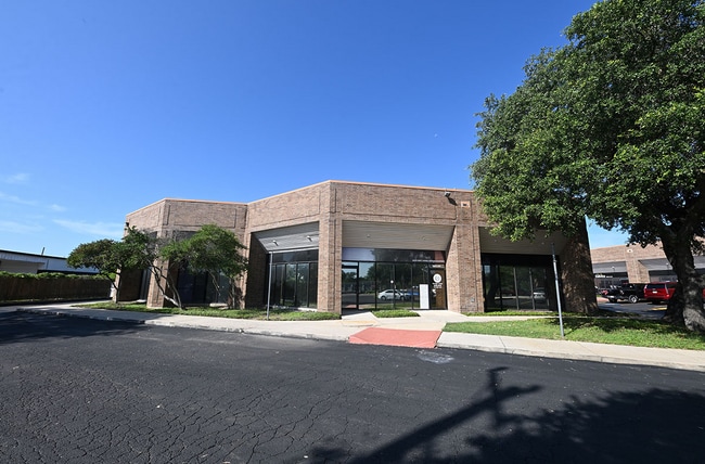
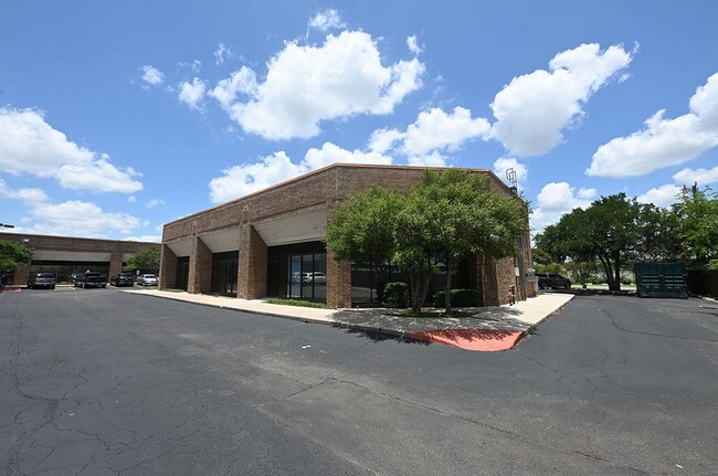
Property Record
1313 Se Military Dr, San Antonio, TX 78214

NEARBY LISTINGS FOR SALE OR LEASE
Property Detail
1313 Se Military Dr
San Antonio-New Braunfels, TX
Red Mac Sub Bl 7676
07676-000-0333
NCB: 7676 LOT: SE IRR 342.38 FT OF NE IRR 240.15 OF 33 2023 MERGE/RSVY PER DEED 20220270512 //
Officebuilding
Bexar
X
Texas
48029C0580G
333
2024
3.04 AC
2025
South
150800
San Antonio
39,199 SF
DEMOGRAPHICS near 1313 Se Military Dr
1 Mile
3 Mile
5 Mile
2024 Total Population
6,083
105,007
248,169
2029 Population
6,389
111,776
264,936
Pop Growth 2024-2029
+ 5.03%
+ 6.45%
+ 6.76%
Average Age
38
38
37
2024 Total Households
2,179
36,829
86,819
HH Growth 2024-2029
+ 5.19%
+ 6.60%
+ 7.03%
Median Household Inc
$36,617
$41,695
$43,682
Avg Household Size
2.60
2.80
2.80
2024 Avg HH Vehicles
2.00
2.00
2.00
Median Home Value
$118,980
$127,897
$136,658
Median Year Built
1958
1961
1964
Nearby Places
Map Layers
Map Styles
 Street
 Aerial
- Restaurants
- Banks
- Shops
- Fitness
- Groceries
PUBLIC TRANSPORTATION
COMMUTER RAIL
San Antonio Amtrak Station (Sunset Limited - Amtrak, Texas Eagle - Amtrak)
DRIVE
WALK
Distance
San Antonio Amtrak Station (Sunset Limited - Amtrak, Texas Eagle - Amtrak)
11 min
5.7 mi
AIRPORT
San Antonio International
DRIVE
WALK
Distance
San Antonio International
20 min
13.5 mi
Freight Ports
Calhoun Port
DRIVE
WALK
Distance
Calhoun Port
181 min
147.5 mi
SALE & LEASE HISTORY
LISTING DATE
SALE/LEASE

Sep 25, 2016
For Lease
Sep 23, 2020
For Lease
Jan 23, 2023
For Lease
Nearby Properties
Address
Land Use
TOTAL SIZE
Lot Size
Zoning
Address
Land Use
TOTAL SIZE
Lot Size
Zoning
639,848 SF
85.65 AC
Address
Land Use
TOTAL SIZE
Lot Size
Zoning
220,079 SF
28.12 AC
Address
Land Use
TOTAL SIZE
Lot Size
Zoning
348,974 SF
20.98 AC
Address
Land Use
TOTAL SIZE
Lot Size
Zoning
291,374 SF
13.49 AC
Address
Land Use
TOTAL SIZE
Lot Size
Zoning
250,400 SF
20.55 AC
Address
Land Use
TOTAL SIZE
Lot Size
Zoning
61,085 SF
16.73 AC
Address
Land Use
TOTAL SIZE
Lot Size
Zoning
158,546 SF
6.45 AC
Address
Land Use
TOTAL SIZE
Lot Size
Zoning
211,200 SF
7.49 AC
Address
Land Use
TOTAL SIZE
Lot Size
Zoning
12,504,292 SF
32.18 AC
Address
Land Use
TOTAL SIZE
Lot Size
Zoning
245,745 SF
11.99 AC
Address
Land Use
TOTAL SIZE
Lot Size
Zoning
174,316 SF
15.38 AC
Address
Land Use
TOTAL SIZE
Lot Size
Zoning
88,420 SF
7.62 AC
Address
Land Use
TOTAL SIZE
Lot Size
Zoning
353,148 SF
14.10 AC
Address
Land Use
TOTAL SIZE
Lot Size
Zoning
447,169 SF
46.74 AC
Address
Land Use
TOTAL SIZE
Lot Size
Zoning
148,525 SF
30.72 AC
Address
Land Use
TOTAL SIZE
Lot Size
Zoning
163.70 AC
Address
Land Use
TOTAL SIZE
Lot Size
Zoning
63,850 SF
33.42 AC
Address
Land Use
TOTAL SIZE
Lot Size
Zoning
145,389 SF
18.70 AC
Address
Land Use
TOTAL SIZE
Lot Size
Zoning
372,078 SF
10.95 AC
Address
Land Use
TOTAL SIZE
Lot Size
Zoning
71,607 SF
10.46 AC
Address
Land Use
TOTAL SIZE
Lot Size
Zoning
148,672 SF
11.84 AC
Address
Land Use
TOTAL SIZE
Lot Size
Zoning
79,740 SF
0.60 AC
Address
Land Use
TOTAL SIZE
Lot Size
Zoning
186,995 SF
14.18 AC
Address
Land Use
TOTAL SIZE
Lot Size
Zoning
144,692 SF
10.83 AC
Address
Land Use
TOTAL SIZE
Lot Size
Zoning
42.31 AC
Address
Land Use
TOTAL SIZE
Lot Size
Zoning
20.58 AC
Address
Land Use
TOTAL SIZE
Lot Size
Zoning
217,483 SF
21.94 AC
Address
Land Use
TOTAL SIZE
Lot Size
Zoning
38,671 SF
5.20 AC
Address
Land Use
TOTAL SIZE
Lot Size
Zoning
Address
Land Use
TOTAL SIZE
Lot Size
Zoning
203,232 SF
24.20 AC
The World's #1 Commercial Real Estate Marketplace
Connect with us
© 2025 CoStar Group
The information above has been obtained from sources believed reliable. While we do not doubt its accuracy we have not verified it and make no guarantee, warranty or representation about it. It is your responsibility to independently confirm its accuracy and completeness. Any projections, opinions, assumptions, or estimates used are for example only and do not represent the current or future performance of the property. The value of this transaction to you depends on tax and other factors which should be evaluated by your tax, financial, and legal advisors. You and your advisors should conduct a careful, independent investigation of the property to determine to your satisfaction the suitability of the property for your needs.