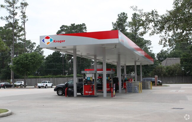
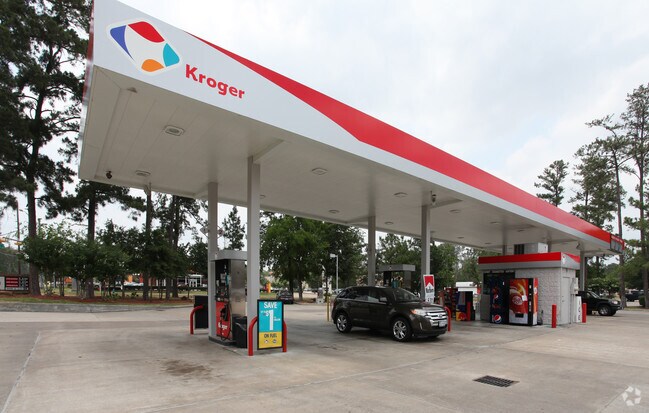
Property Record
13135 Louetta Rd, Cypress, TX 77429

Property Detail
13135 Louetta Rd
1123530000002
RES D2 BLK 13 (G/0*1123530000008) LAKEWOOD FOREST SEC 10
Supermarket
HARRIS
B and X Area of moderate flood hazard, usually the area between the limits of the 100-year and 500-year floods.
Texas
2024
6.53 AC
2025
Fairfield
554600
Houston
66,964 SF
Houston-Pasadena-The Woodlands, TX
NEARBY LISTINGS FOR SALE OR LEASE
DEMOGRAPHICS near 13135 Louetta Rd
1 mile
3 mile
5 mile
2025 Total Population
10,255
90,517
241,024
2030 Population
10,772
95,986
255,570
Pop Growth 2025-2030
+ 5.04%
+ 6.04%
+ 6.04%
Average Age
42
38
38
2025 Total Households
3,530
30,998
83,902
HH Growth 2025-2030
+ 5.21%
+ 6.18%
+ 6.23%
Median Household Inc
$135,875
$122,110
$99,869
Avg Household Size
2.90
2.90
2.80
2025 Avg HH Vehicles
2.00
2.00
2.00
Median Home Value
$371,995
$371,263
$339,099
Median Year Built
1991
2001
2001
Nearby Places
Map Layers
Map Styles
 Street
 Aerial
Transit
 Traffic
 Biking
Places
Listings with unknown addresses are not visible on the map
- Restaurants
- Banks
- Shops
- Fitness
- Groceries
PUBLIC TRANSPORTATION
AIRPORT
George Bush Intcntl/Houston
Drive
Walk
Distance
George Bush Intcntl/Houston
31 min
22.4 mi
William P Hobby
Drive
Walk
Distance
William P Hobby
59 min
37.5 mi
Freight Ports
Port of Houston
Drive
Walk
Distance
Port of Houston
51 min
33.0 mi
Nearby Properties
Address
Land Use
TOTAL SIZE
Lot Size
Zoning
Address
Land Use
TOTAL SIZE
Lot Size
Zoning
1,648,539 SF
28.70 AC
Address
Land Use
TOTAL SIZE
Lot Size
Zoning
339,067 SF
34.40 AC
Address
Land Use
TOTAL SIZE
Lot Size
Zoning
1,073,104 SF
4.74 AC
Address
Land Use
TOTAL SIZE
Lot Size
Zoning
543,414 SF
22.58 AC
Address
Land Use
TOTAL SIZE
Lot Size
Zoning
327,365 SF
13.85 AC
Address
Land Use
TOTAL SIZE
Lot Size
Zoning
535,370 SF
28.74 AC
Address
Land Use
TOTAL SIZE
Lot Size
Zoning
426,203 SF
23.88 AC
Address
Land Use
TOTAL SIZE
Lot Size
Zoning
333,337 SF
21.66 AC
Address
Land Use
TOTAL SIZE
Lot Size
Zoning
351,343 SF
12.82 AC
Address
Land Use
TOTAL SIZE
Lot Size
Zoning
387,938 SF
16.05 AC
Address
Land Use
TOTAL SIZE
Lot Size
Zoning
231,734 SF
8.48 AC
Address
Land Use
TOTAL SIZE
Lot Size
Zoning
245,453 SF
10.11 AC
Address
Land Use
TOTAL SIZE
Lot Size
Zoning
314,385 SF
13.78 AC
Address
Land Use
TOTAL SIZE
Lot Size
Zoning
127,408 SF
3.08 AC
Address
Land Use
TOTAL SIZE
Lot Size
Zoning
267,258 SF
11.99 AC
Address
Land Use
TOTAL SIZE
Lot Size
Zoning
334,495 SF
13.38 AC
Address
Land Use
TOTAL SIZE
Lot Size
Zoning
177,104 SF
14.30 AC
Address
Land Use
TOTAL SIZE
Lot Size
Zoning
127,570 SF
33.51 AC
Address
Land Use
TOTAL SIZE
Lot Size
Zoning
148,931 SF
9.94 AC
Address
Land Use
TOTAL SIZE
Lot Size
Zoning
129,174 SF
13.65 AC
Address
Land Use
TOTAL SIZE
Lot Size
Zoning
102,710 SF
14.90 AC
Address
Land Use
TOTAL SIZE
Lot Size
Zoning
117,473 SF
14.92 AC
Address
Land Use
TOTAL SIZE
Lot Size
Zoning
240,766 SF
11.30 AC
Address
Land Use
TOTAL SIZE
Lot Size
Zoning
91,356 SF
8.45 AC
Address
Land Use
TOTAL SIZE
Lot Size
Zoning
60,368 SF
9.62 AC
Address
Land Use
TOTAL SIZE
Lot Size
Zoning
123,764 SF
5.48 AC
Address
Land Use
TOTAL SIZE
Lot Size
Zoning
326,800 SF
3.12 AC
Address
Land Use
TOTAL SIZE
Lot Size
Zoning
135,586 SF
21.45 AC
Address
Land Use
TOTAL SIZE
Lot Size
Zoning
453,324 SF
15.54 AC
Address
Land Use
TOTAL SIZE
Lot Size
Zoning
314,401 SF
27.50 AC
The World's #1 Commercial Real Estate Marketplace
Connect with us
© 2026 CoStar Group
The information above has been obtained from sources believed reliable. While we do not doubt its accuracy we have not verified it and make no guarantee, warranty or representation about it. It is your responsibility to independently confirm its accuracy and completeness. Any projections, opinions, assumptions, or estimates used are for example only and do not represent the current or future performance of the property. The value of this transaction to you depends on tax and other factors which should be evaluated by your tax, financial, and legal advisors. You and your advisors should conduct a careful, independent investigation of the property to determine to your satisfaction the suitability of the property for your needs.