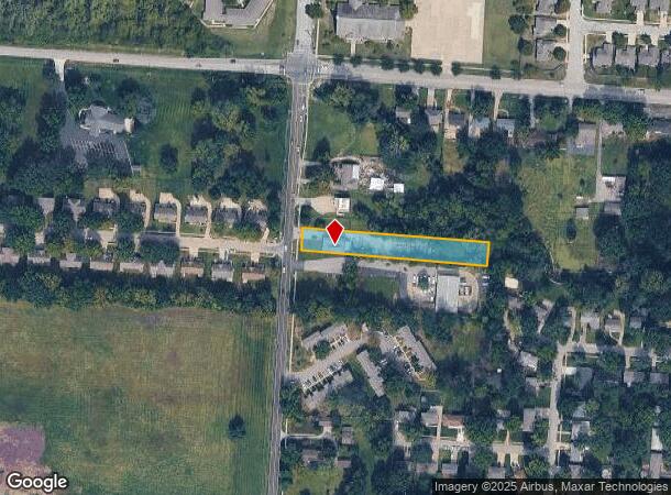
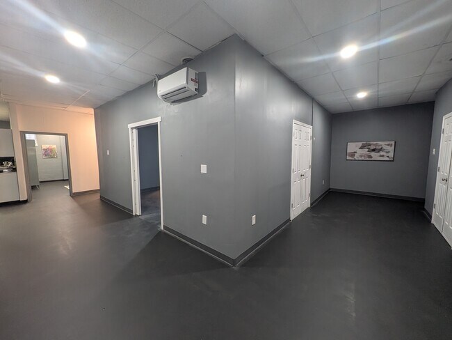
Property Record
13137 Wornall Rd, Kansas City, MO 64145
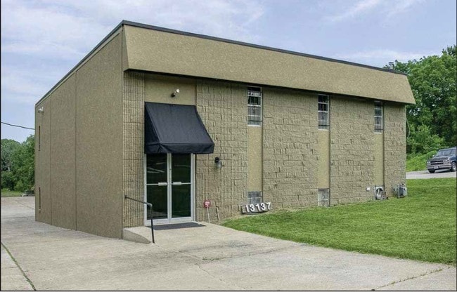
This Property Is For Sale
NEARBY LISTINGS FOR SALE OR LEASE
Property Detail
13137 Wornall Rd
66-220-01-12-00-0-00-000
SEC-20 TWP-47 RNG-33 ALL TH PT OF NE 1/4 NW 1/4 DAF BEG AT A PT IN W LI OF SD 1/4 1/4 SEC 433.80 S OF NW COR TH S 60 T H E 550 TH N60 TO A PT 433.80 S OF N LI OF SD 1/4 1/4 SEC
Governmentalpublicusegeneral
Jackson
X
Missouri
29095C0388G
0.76 AC
2024
South Kansas City MO
2025
Kansas City
013405
Kansas City, MO-KS
2,400 SF
DEMOGRAPHICS near 13137 Wornall Rd
1 Mile
3 Mile
5 Mile
2024 Total Population
3,538
37,792
144,489
2029 Population
3,529
38,392
148,416
Pop Growth 2024-2029
(0.25%)
+ 1.59%
+ 2.72%
Average Age
49
44
42
2024 Total Households
1,569
15,126
60,656
HH Growth 2024-2029
(0.45%)
+ 1.30%
+ 2.80%
Median Household Inc
$87,560
$107,260
$88,325
Avg Household Size
2.20
2.40
2.30
2024 Avg HH Vehicles
2.00
2.00
2.00
Median Home Value
$321,030
$427,292
$361,251
Median Year Built
1982
1986
1986
Nearby Places
Map Layers
Map Styles
 Street
 Aerial
- Restaurants
- Banks
- Shops
- Fitness
- Groceries
PUBLIC TRANSPORTATION
AIRPORT
Kansas City International
DRIVE
WALK
Distance
Kansas City International
53 min
41.7 mi
Freight Ports
Tulsa Port Of Catoosa
DRIVE
WALK
Distance
Tulsa Port Of Catoosa
250 min
223.9 mi
Nearby Properties
Address
Land Use
TOTAL SIZE
Lot Size
Zoning
Address
Land Use
TOTAL SIZE
Lot Size
Zoning
1,314,506 SF
174 AC
Address
Land Use
TOTAL SIZE
Lot Size
Zoning
384,819 SF
67.59 AC
AG
Address
Land Use
TOTAL SIZE
Lot Size
Zoning
184,524 SF
33.20 AC
AG
Address
Land Use
TOTAL SIZE
Lot Size
Zoning
79,917 SF
7.86 AC
SD-NCR
Address
Land Use
TOTAL SIZE
Lot Size
Zoning
59,570 SF
8.46 AC
SD-O
Address
Land Use
TOTAL SIZE
Lot Size
Zoning
166,097 SF
37.29 AC
R-1
Address
Land Use
TOTAL SIZE
Lot Size
Zoning
105,110 SF
8.93 AC
AG
Address
Land Use
TOTAL SIZE
Lot Size
Zoning
72,184 SF
9.53 AC
AG
Address
Land Use
TOTAL SIZE
Lot Size
Zoning
319,892 SF
Address
Land Use
TOTAL SIZE
Lot Size
Zoning
159,274 SF
14.38 AC
SD-CR
Address
Land Use
TOTAL SIZE
Lot Size
Zoning
68,493 SF
9.92 AC
R-1
Address
Land Use
TOTAL SIZE
Lot Size
Zoning
43,021 SF
7.47 AC
SD-O
Address
Land Use
TOTAL SIZE
Lot Size
Zoning
36,012 SF
18.10 AC
AG
Address
Land Use
TOTAL SIZE
Lot Size
Zoning
227,676 SF
15.86 AC
Address
Land Use
TOTAL SIZE
Lot Size
Zoning
60,960 SF
4.82 AC
SD-NCR
Address
Land Use
TOTAL SIZE
Lot Size
Zoning
45,775 SF
17.05 AC
BP
Address
Land Use
TOTAL SIZE
Lot Size
Zoning
92,726 SF
6.83 AC
CP-2
Address
Land Use
TOTAL SIZE
Lot Size
Zoning
64,785 SF
24.54 AC
RP-4 (CURR
Address
Land Use
TOTAL SIZE
Lot Size
Zoning
61,456 SF
15.15 AC
SD-O
Address
Land Use
TOTAL SIZE
Lot Size
Zoning
220,756 SF
19.65 AC
Address
Land Use
TOTAL SIZE
Lot Size
Zoning
355,091 SF
41.50 AC
Address
Land Use
TOTAL SIZE
Lot Size
Zoning
119,387 SF
15.28 AC
SD-NCR
Address
Land Use
TOTAL SIZE
Lot Size
Zoning
504,100 SF
39.25 AC
Address
Land Use
TOTAL SIZE
Lot Size
Zoning
140,970 SF
7.88 AC
Address
Land Use
TOTAL SIZE
Lot Size
Zoning
114,669 SF
8.43 AC
SD-CR
Address
Land Use
TOTAL SIZE
Lot Size
Zoning
628,134 SF
37.62 AC
Address
Land Use
TOTAL SIZE
Lot Size
Zoning
94,080 SF
5.83 AC
Address
Land Use
TOTAL SIZE
Lot Size
Zoning
145,368 SF
15.68 AC
RP-5
Address
Land Use
TOTAL SIZE
Lot Size
Zoning
52,863 SF
20.80 AC
RP-4 (CURR
Address
Land Use
TOTAL SIZE
Lot Size
Zoning
85,513 SF
9.10 AC
SD-CR
The World's #1 Commercial Real Estate Marketplace
Connect with us
© 2025 CoStar Group
The information above has been obtained from sources believed reliable. While we do not doubt its accuracy we have not verified it and make no guarantee, warranty or representation about it. It is your responsibility to independently confirm its accuracy and completeness. Any projections, opinions, assumptions, or estimates used are for example only and do not represent the current or future performance of the property. The value of this transaction to you depends on tax and other factors which should be evaluated by your tax, financial, and legal advisors. You and your advisors should conduct a careful, independent investigation of the property to determine to your satisfaction the suitability of the property for your needs.