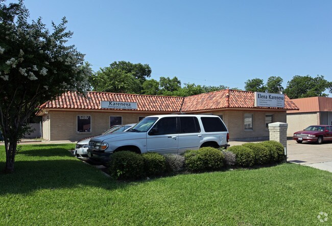
Property Record
1314 E Belt Line Rd, Carrollton, TX 75006


NEARBY LISTINGS FOR SALE OR LEASE
Property Detail
1314 E Belt Line Rd
Dallas-Fort Worth-Arlington, TX
J B Lesleys
14056500000030000
J B LESLEYS LT 3 ACS 0.2025 VOL2004149/8722 DD08022004 CO-DC 0565000000300 1CC05650000
Officebuilding
Dallas
X
Texas
48113C0160K
3
2024
0.20 AC
2025
Lewisville
013729
Dallas/Ft Worth
2,476 SF
DEMOGRAPHICS near 1314 E Belt Line Rd
1 Mile
3 Mile
5 Mile
2024 Total Population
12,365
82,253
309,140
2029 Population
12,430
83,168
327,432
Pop Growth 2024-2029
+ 0.53%
+ 1.11%
+ 5.92%
Average Age
35
38
38
2024 Total Households
4,185
30,501
126,995
HH Growth 2024-2029
+ 0.72%
+ 1.03%
+ 6.12%
Median Household Inc
$67,082
$78,179
$82,628
Avg Household Size
2.80
2.60
2.40
2024 Avg HH Vehicles
2.00
2.00
2.00
Median Home Value
$235,742
$286,238
$341,211
Median Year Built
1975
1980
1988
Nearby Places
Map Layers
Map Styles
 Street
 Aerial
- Restaurants
- Banks
- Shops
- Fitness
- Groceries
PUBLIC TRANSPORTATION
COMMUTER RAIL
Trinity Mills Station (Green Line - Dallas Area Rapid Transit (DART))
DRIVE
WALK
Distance
Trinity Mills Station (Green Line - Dallas Area Rapid Transit (DART))
6 min
2.8 mi
DRIVE
WALK
Distance
11 min
5.8 mi
AIRPORT
Dallas Love Field
DRIVE
WALK
Distance
Dallas Love Field
21 min
12.9 mi
Dallas-Fort Worth International
DRIVE
WALK
Distance
Dallas-Fort Worth International
21 min
15.6 mi
Nearby Properties
Address
Land Use
TOTAL SIZE
Lot Size
Zoning
Address
Land Use
TOTAL SIZE
Lot Size
Zoning
605,278 SF
10.70 AC
Z236
Address
Land Use
TOTAL SIZE
Lot Size
Zoning
513,871 SF
3.63 AC
Z235
Address
Land Use
TOTAL SIZE
Lot Size
Zoning
368,845 SF
20.96 AC
Z172
Address
Land Use
TOTAL SIZE
Lot Size
Zoning
321,732 SF
4.05 AC
Z235
Address
Land Use
TOTAL SIZE
Lot Size
Zoning
345,320 SF
20.50 AC
Z172
Address
Land Use
TOTAL SIZE
Lot Size
Zoning
266,871 SF
87 SF
Address
Land Use
TOTAL SIZE
Lot Size
Zoning
725,972 SF
4 AC
Address
Land Use
TOTAL SIZE
Lot Size
Zoning
283,285 SF
16.80 AC
Z172
Address
Land Use
TOTAL SIZE
Lot Size
Zoning
292,049 SF
11.44 AC
Z243
Address
Land Use
TOTAL SIZE
Lot Size
Zoning
270,915 SF
3.91 AC
Z84
Address
Land Use
TOTAL SIZE
Lot Size
Zoning
396,899 SF
3.68 AC
Z236
Address
Land Use
TOTAL SIZE
Lot Size
Zoning
330,000 SF
3.05 AC
Z236
Address
Land Use
TOTAL SIZE
Lot Size
Zoning
374,093 SF
21.54 AC
Z268
Address
Land Use
TOTAL SIZE
Lot Size
Zoning
210,289 SF
10.16 AC
Z147
Address
Land Use
TOTAL SIZE
Lot Size
Zoning
300,956 SF
8.79 AC
Z236
Address
Land Use
TOTAL SIZE
Lot Size
Zoning
228,674 SF
11.81 AC
Z235
Address
Land Use
TOTAL SIZE
Lot Size
Zoning
227,032 SF
11 AC
Z243
Address
Land Use
TOTAL SIZE
Lot Size
Zoning
231,628 SF
12.21 AC
RMR2
Address
Land Use
TOTAL SIZE
Lot Size
Zoning
399,880 SF
25.21 AC
Z236
Address
Land Use
TOTAL SIZE
Lot Size
Zoning
218,630 SF
10.42 AC
Z393
Address
Land Use
TOTAL SIZE
Lot Size
Zoning
223,391 SF
10.90 AC
RMR2
Address
Land Use
TOTAL SIZE
Lot Size
Zoning
214,033 SF
10.39 AC
RMR2
Address
Land Use
TOTAL SIZE
Lot Size
Zoning
311,298 SF
2.66 AC
Z236
Address
Land Use
TOTAL SIZE
Lot Size
Zoning
360,360 SF
17.33 AC
Z236
Address
Land Use
TOTAL SIZE
Lot Size
Zoning
171,826 SF
12.49 AC
Z235
Address
Land Use
TOTAL SIZE
Lot Size
Zoning
404,200 SF
16.43 AC
Z123
Address
Land Use
TOTAL SIZE
Lot Size
Zoning
340,000 SF
15.61 AC
Z239
Address
Land Use
TOTAL SIZE
Lot Size
Zoning
197,024 SF
11.89 AC
Z235
Address
Land Use
TOTAL SIZE
Lot Size
Zoning
190,374 SF
10.88 AC
Z235
Address
Land Use
TOTAL SIZE
Lot Size
Zoning
176,418 SF
11.31 AC
Z393
The World's #1 Commercial Real Estate Marketplace
Connect with us
© 2026 CoStar Group
The information above has been obtained from sources believed reliable. While we do not doubt its accuracy we have not verified it and make no guarantee, warranty or representation about it. It is your responsibility to independently confirm its accuracy and completeness. Any projections, opinions, assumptions, or estimates used are for example only and do not represent the current or future performance of the property. The value of this transaction to you depends on tax and other factors which should be evaluated by your tax, financial, and legal advisors. You and your advisors should conduct a careful, independent investigation of the property to determine to your satisfaction the suitability of the property for your needs.