Property Record
1314 N Main St, Liberty, TX 77575


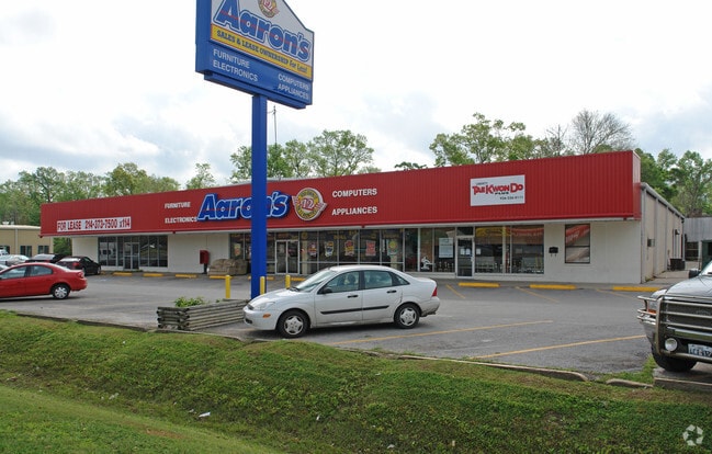
Property Detail
1314 N Main St
Houston-Pasadena-The Woodlands, TX
NEW MAIN STREET, LOT 2, ACRES .8594
006730-000002-000
Liberty
Commercialnec
Texas
C and X Area of minimal flood hazard, usually depicted on FIRMs as above the 500-year flood level.
2
2024
0.86 AC
2025
Liberty County
701400
Houston
14,810 SF
NEARBY LISTINGS FOR SALE OR LEASE
DEMOGRAPHICS near 1314 N Main St
1 mile
3 mile
5 mile
2025 Total Population
5,719
9,816
15,112
2030 Population
6,833
11,728
17,774
Pop Growth 2025-2030
+ 19.48%
+ 19.48%
+ 17.62%
Average Age
38
38
37
2025 Total Households
2,027
3,501
4,916
HH Growth 2025-2030
+ 19.09%
+ 19.05%
+ 18.84%
Median Household Inc
$71,308
$72,626
$79,287
Avg Household Size
2.60
2.60
2.70
2025 Avg HH Vehicles
2.00
2.00
2.00
Median Home Value
$166,158
$170,009
$184,340
Median Year Built
1975
1978
1984
Nearby Places
Map Layers
Map Styles
 Street
 Aerial
Transit
 Traffic
 Biking
Places
Listings with unknown addresses are not visible on the map
- Restaurants
- Banks
- Shops
- Fitness
- Groceries
PUBLIC TRANSPORTATION
AIRPORT
George Bush Intcntl/Houston
Drive
Walk
Distance
George Bush Intcntl/Houston
58 min
39.1 mi
William P Hobby
Drive
Walk
Distance
William P Hobby
67 min
48.5 mi
SALE & LEASE HISTORY
LISTING DATE
SALE/LEASE

Oct 23, 2017
For Sale
Jun 15, 2017
For Sale
Nearby Properties
Address
Land Use
TOTAL SIZE
Lot Size
Zoning
Address
Land Use
TOTAL SIZE
Lot Size
Zoning
175,007 SF
17.24 AC
Address
Land Use
TOTAL SIZE
Lot Size
Zoning
142,289 SF
42.96 AC
Address
Land Use
TOTAL SIZE
Lot Size
Zoning
215,653 SF
22.62 AC
Address
Land Use
TOTAL SIZE
Lot Size
Zoning
96,387 SF
8.82 AC
Address
Land Use
TOTAL SIZE
Lot Size
Zoning
38,468 SF
7.49 AC
Address
Land Use
TOTAL SIZE
Lot Size
Zoning
73,149 SF
12 AC
Address
Land Use
TOTAL SIZE
Lot Size
Zoning
63,256 SF
12 AC
Address
Land Use
TOTAL SIZE
Lot Size
Zoning
5,561 SF
1,243.20 AC
Address
Land Use
TOTAL SIZE
Lot Size
Zoning
85,428 SF
10.57 AC
Address
Land Use
TOTAL SIZE
Lot Size
Zoning
47,435 SF
2.55 AC
Address
Land Use
TOTAL SIZE
Lot Size
Zoning
35,070 SF
5 AC
Address
Land Use
TOTAL SIZE
Lot Size
Zoning
38,227 SF
1.22 AC
Address
Land Use
TOTAL SIZE
Lot Size
Zoning
34,699 SF
2.44 AC
Address
Land Use
TOTAL SIZE
Lot Size
Zoning
34,570 SF
5.48 AC
Address
Land Use
TOTAL SIZE
Lot Size
Zoning
15,578 SF
40.60 AC
Address
Land Use
TOTAL SIZE
Lot Size
Zoning
22,958 SF
116.97 AC
Address
Land Use
TOTAL SIZE
Lot Size
Zoning
26,724 SF
1.10 AC
Address
Land Use
TOTAL SIZE
Lot Size
Zoning
26,749 SF
2.55 AC
Address
Land Use
TOTAL SIZE
Lot Size
Zoning
27,415 SF
7.32 AC
Address
Land Use
TOTAL SIZE
Lot Size
Zoning
26,545 SF
2.18 AC
Address
Land Use
TOTAL SIZE
Lot Size
Zoning
25,502 SF
2.55 AC
Address
Land Use
TOTAL SIZE
Lot Size
Zoning
31,384 SF
4 AC
Address
Land Use
TOTAL SIZE
Lot Size
Zoning
40,520 SF
4.07 AC
Address
Land Use
TOTAL SIZE
Lot Size
Zoning
38,429 SF
2.88 AC
Address
Land Use
TOTAL SIZE
Lot Size
Zoning
48,083 SF
3.32 AC
Address
Land Use
TOTAL SIZE
Lot Size
Zoning
24,015 SF
1.52 AC
Address
Land Use
TOTAL SIZE
Lot Size
Zoning
6,728 SF
4.67 AC
Address
Land Use
TOTAL SIZE
Lot Size
Zoning
29.12 AC
Address
Land Use
TOTAL SIZE
Lot Size
Zoning
60,352 SF
3.08 AC
Address
Land Use
TOTAL SIZE
Lot Size
Zoning
28,821 SF
2.05 AC
The World's #1 Commercial Real Estate Marketplace
Connect with us
© 2026 CoStar Group
The information above has been obtained from sources believed reliable. While we do not doubt its accuracy we have not verified it and make no guarantee, warranty or representation about it. It is your responsibility to independently confirm its accuracy and completeness. Any projections, opinions, assumptions, or estimates used are for example only and do not represent the current or future performance of the property. The value of this transaction to you depends on tax and other factors which should be evaluated by your tax, financial, and legal advisors. You and your advisors should conduct a careful, independent investigation of the property to determine to your satisfaction the suitability of the property for your needs.