Property Record
1314 Stuart Engals Blvd, Mount Pleasant, SC 29464


NEARBY LISTINGS FOR SALE OR LEASE
Property Detail
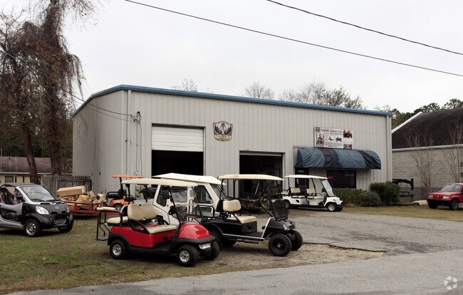
1314 Stuart Engals Blvd
560-02-00-042
DESCRIPTION -LOT 3-A
Commercialnec
Charleston
X
South Carolina
45019C0536K
3-a
2025
0.30 AC
2024
East Islands/Mt Pleasant
004619
Charleston/N Charleston
2,438 SF
Charleston-North Charleston, SC
DEMOGRAPHICS near 1314 Stuart Engals Blvd
1 Mile
3 Mile
5 Mile
2024 Total Population
9,920
48,371
76,410
2029 Population
10,760
51,596
82,587
Pop Growth 2024-2029
+ 8.47%
+ 6.67%
+ 8.08%
Average Age
43
42
42
2024 Total Households
4,558
21,235
32,954
HH Growth 2024-2029
+ 8.62%
+ 6.61%
+ 8.05%
Median Household Inc
$69,649
$97,391
$100,336
Avg Household Size
2.00
2.20
2.30
2024 Avg HH Vehicles
2.00
2.00
2.00
Median Home Value
$484,077
$574,229
$621,607
Median Year Built
1992
1990
1993
Nearby Places
Map Layers
Map Styles
 Street
 Aerial
- Restaurants
- Banks
- Shops
- Fitness
- Groceries
PUBLIC TRANSPORTATION
AIRPORT
Charleston AFB/International
DRIVE
WALK
Distance
Charleston AFB/International
28 min
19.2 mi
Freight Ports
Wando Welch Terminal
DRIVE
WALK
Distance
Wando Welch Terminal
7 min
3.9 mi
SALE & LEASE HISTORY
LISTING DATE
SALE/LEASE

Apr 08, 2025
For Lease
Nearby Properties
Address
Land Use
TOTAL SIZE
Lot Size
Zoning
Address
Land Use
TOTAL SIZE
Lot Size
Zoning
247,883 SF
16.26 AC
Address
Land Use
TOTAL SIZE
Lot Size
Zoning
39,150 SF
7.76 AC
Address
Land Use
TOTAL SIZE
Lot Size
Zoning
Address
Land Use
TOTAL SIZE
Lot Size
Zoning
18,316 SF
14.16 AC
Address
Land Use
TOTAL SIZE
Lot Size
Zoning
15,957 SF
3.80 AC
Address
Land Use
TOTAL SIZE
Lot Size
Zoning
31,094 SF
5.97 AC
Address
Land Use
TOTAL SIZE
Lot Size
Zoning
12,358 SF
15.08 AC
Address
Land Use
TOTAL SIZE
Lot Size
Zoning
6,572 SF
23.28 AC
Address
Land Use
TOTAL SIZE
Lot Size
Zoning
Address
Land Use
TOTAL SIZE
Lot Size
Zoning
1,222 SF
13.62 AC
Address
Land Use
TOTAL SIZE
Lot Size
Zoning
37,472 SF
9.04 AC
Address
Land Use
TOTAL SIZE
Lot Size
Zoning
9,993 SF
0.15 AC
LAR3
Address
Land Use
TOTAL SIZE
Lot Size
Zoning
1,872 SF
4.48 AC
Address
Land Use
TOTAL SIZE
Lot Size
Zoning
1,064 SF
20.39 AC
Address
Land Use
TOTAL SIZE
Lot Size
Zoning
70,052 SF
14.67 AC
Address
Land Use
TOTAL SIZE
Lot Size
Zoning
1,615 SF
32.59 AC
Address
Land Use
TOTAL SIZE
Lot Size
Zoning
11.29 AC
Address
Land Use
TOTAL SIZE
Lot Size
Zoning
10,165 SF
1.38 AC
Address
Land Use
TOTAL SIZE
Lot Size
Zoning
Address
Land Use
TOTAL SIZE
Lot Size
Zoning
1,898 SF
11.80 AC
Address
Land Use
TOTAL SIZE
Lot Size
Zoning
648 SF
19.68 AC
Address
Land Use
TOTAL SIZE
Lot Size
Zoning
4,351 SF
29.03 AC
Address
Land Use
TOTAL SIZE
Lot Size
Zoning
63,836 SF
2.76 AC
Address
Land Use
TOTAL SIZE
Lot Size
Zoning
2.32 AC
Address
Land Use
TOTAL SIZE
Lot Size
Zoning
80,395 SF
15.24 AC
Address
Land Use
TOTAL SIZE
Lot Size
Zoning
2,624 SF
2 AC
Address
Land Use
TOTAL SIZE
Lot Size
Zoning
65,904 SF
3.87 AC
Address
Land Use
TOTAL SIZE
Lot Size
Zoning
5,884 SF
8.02 AC
Address
Land Use
TOTAL SIZE
Lot Size
Zoning
5,884 SF
6.56 AC
Address
Land Use
TOTAL SIZE
Lot Size
Zoning
10.05 AC
The World's #1 Commercial Real Estate Marketplace
Connect with us
© 2026 CoStar Group
The information above has been obtained from sources believed reliable. While we do not doubt its accuracy we have not verified it and make no guarantee, warranty or representation about it. It is your responsibility to independently confirm its accuracy and completeness. Any projections, opinions, assumptions, or estimates used are for example only and do not represent the current or future performance of the property. The value of this transaction to you depends on tax and other factors which should be evaluated by your tax, financial, and legal advisors. You and your advisors should conduct a careful, independent investigation of the property to determine to your satisfaction the suitability of the property for your needs.