Property Record
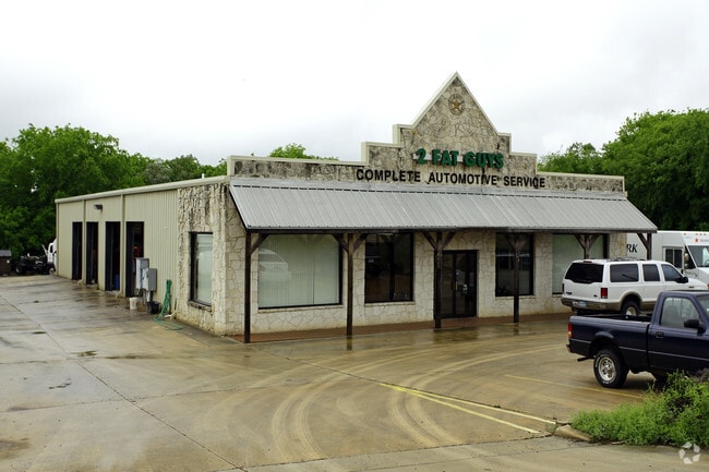
13147 Bandera Rd, Helotes, TX 78023


NEARBY LISTINGS FOR SALE OR LEASE
Property Detail
13147 Bandera Rd
San Antonio-New Braunfels, TX
F S Subd
04525-401-0010
CB 4525D BLK 1 LOT N IRR 95.2 FT OF 1 (F S SUBD) 2017 LEGAL/MAP UPDATE PER DEED 18155/804 EXE 9/20/16 2009 MAP CORR
Autorepair
Bexar
X
Texas
48029C0205G
1
2024
1.11 AC
2025
Far Northwest
182106
San Antonio
5,096 SF
DEMOGRAPHICS near 13147 Bandera Rd
1 Mile
3 Mile
5 Mile
2024 Total Population
3,657
61,947
197,631
2029 Population
3,886
65,729
210,540
Pop Growth 2024-2029
+ 6.26%
+ 6.11%
+ 6.53%
Average Age
40
36
36
2024 Total Households
1,355
21,140
68,230
HH Growth 2024-2029
+ 6.13%
+ 6.21%
+ 6.67%
Median Household Inc
$98,966
$105,124
$91,888
Avg Household Size
2.70
2.90
2.80
2024 Avg HH Vehicles
2.00
2.00
2.00
Median Home Value
$350,326
$273,149
$251,931
Median Year Built
2003
2002
2000
Nearby Places
Map Layers
Map Styles
 Street
 Aerial
- Restaurants
- Banks
- Shops
- Fitness
- Groceries
PUBLIC TRANSPORTATION
AIRPORT
San Antonio International
DRIVE
WALK
Distance
San Antonio International
26 min
16.9 mi
Nearby Properties
Address
Land Use
TOTAL SIZE
Lot Size
Zoning
Address
Land Use
TOTAL SIZE
Lot Size
Zoning
413,362 SF
33.77 AC
Address
Land Use
TOTAL SIZE
Lot Size
Zoning
149,500 SF
9.36 AC
Address
Land Use
TOTAL SIZE
Lot Size
Zoning
305,600 SF
30.64 AC
Address
Land Use
TOTAL SIZE
Lot Size
Zoning
268,854 SF
15.88 AC
Address
Land Use
TOTAL SIZE
Lot Size
Zoning
237,499 SF
37.26 AC
Address
Land Use
TOTAL SIZE
Lot Size
Zoning
220,719 SF
25.86 AC
Address
Land Use
TOTAL SIZE
Lot Size
Zoning
217,267 SF
17.63 AC
Address
Land Use
TOTAL SIZE
Lot Size
Zoning
229,430 SF
11.92 AC
Address
Land Use
TOTAL SIZE
Lot Size
Zoning
255,890 SF
14.23 AC
Address
Land Use
TOTAL SIZE
Lot Size
Zoning
232,610 SF
13.16 AC
Address
Land Use
TOTAL SIZE
Lot Size
Zoning
185,896 SF
26.12 AC
Address
Land Use
TOTAL SIZE
Lot Size
Zoning
1,080 SF
92.05 AC
Address
Land Use
TOTAL SIZE
Lot Size
Zoning
193,004 SF
16.43 AC
Address
Land Use
TOTAL SIZE
Lot Size
Zoning
228,364 SF
16.14 AC
Address
Land Use
TOTAL SIZE
Lot Size
Zoning
246,381 SF
10.56 AC
Address
Land Use
TOTAL SIZE
Lot Size
Zoning
248,352 SF
14.72 AC
Address
Land Use
TOTAL SIZE
Lot Size
Zoning
74,514 SF
15.57 AC
Address
Land Use
TOTAL SIZE
Lot Size
Zoning
169,822 SF
7 AC
Address
Land Use
TOTAL SIZE
Lot Size
Zoning
157,714 SF
16.22 AC
Address
Land Use
TOTAL SIZE
Lot Size
Zoning
52,631 SF
5.54 AC
Address
Land Use
TOTAL SIZE
Lot Size
Zoning
122,275 SF
3.51 AC
Address
Land Use
TOTAL SIZE
Lot Size
Zoning
62,157 SF
7.64 AC
Address
Land Use
TOTAL SIZE
Lot Size
Zoning
67.52 AC
Address
Land Use
TOTAL SIZE
Lot Size
Zoning
27,712 SF
11.48 AC
Address
Land Use
TOTAL SIZE
Lot Size
Zoning
103,616 SF
5.94 AC
Address
Land Use
TOTAL SIZE
Lot Size
Zoning
114,677 SF
2.43 AC
Address
Land Use
TOTAL SIZE
Lot Size
Zoning
36,384 SF
2.79 AC
Address
Land Use
TOTAL SIZE
Lot Size
Zoning
38,082 SF
5.11 AC
Address
Land Use
TOTAL SIZE
Lot Size
Zoning
172,517 SF
13.95 AC
Address
Land Use
TOTAL SIZE
Lot Size
Zoning
50,381 SF
5.40 AC
The World's #1 Commercial Real Estate Marketplace
Connect with us
© 2026 CoStar Group
The information above has been obtained from sources believed reliable. While we do not doubt its accuracy we have not verified it and make no guarantee, warranty or representation about it. It is your responsibility to independently confirm its accuracy and completeness. Any projections, opinions, assumptions, or estimates used are for example only and do not represent the current or future performance of the property. The value of this transaction to you depends on tax and other factors which should be evaluated by your tax, financial, and legal advisors. You and your advisors should conduct a careful, independent investigation of the property to determine to your satisfaction the suitability of the property for your needs.