Property Record
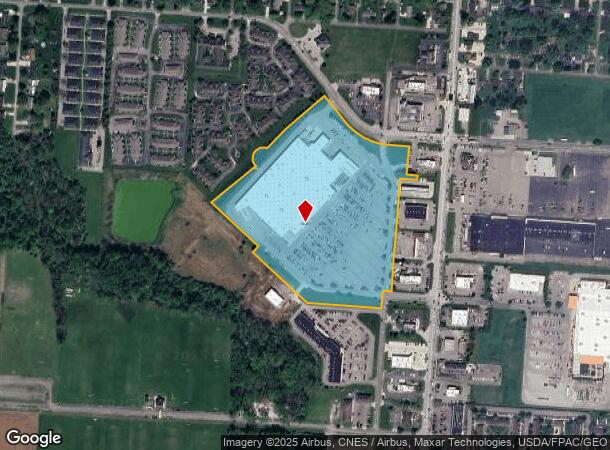
1315 N 21St St, Newark, OH 43055

NEARBY LISTINGS FOR SALE OR LEASE
Property Detail
1315 N 21St St
Columbus, OH
N 21St St (Commercial)
054-269904-00.088
21.657 AC LOT 8 HUMMERICKHOUSE LOTS + LOT 2 SKINNER LOTS R12 T2 Q2
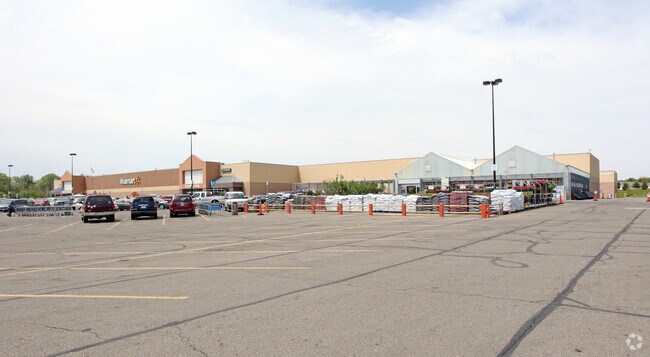
Wholesaleoutletdiscountstore
Licking
AE
Ohio
39089C0333J
8
2024
21.65 AC
2024
Licking County
754104
Columbus
206,532 SF
DEMOGRAPHICS near 1315 N 21St St
1 Mile
3 Mile
5 Mile
2024 Total Population
8,682
44,515
73,085
2029 Population
9,097
46,665
76,507
Pop Growth 2024-2029
+ 4.78%
+ 4.83%
+ 4.68%
Average Age
44
41
40
2024 Total Households
4,131
18,555
29,735
HH Growth 2024-2029
+ 4.74%
+ 4.83%
+ 4.72%
Median Household Inc
$52,384
$56,430
$59,214
Avg Household Size
2.00
2.30
2.30
2024 Avg HH Vehicles
2.00
2.00
2.00
Median Home Value
$152,760
$151,702
$164,008
Median Year Built
1980
1963
1967
Nearby Places
Map Layers
Map Styles
 Street
 Aerial
- Restaurants
- Banks
- Shops
- Fitness
- Groceries
PUBLIC TRANSPORTATION
AIRPORT
John Glenn Columbus International
DRIVE
WALK
Distance
John Glenn Columbus International
44 min
32.6 mi
Freight Ports
Port of Toledo
DRIVE
WALK
Distance
Port of Toledo
198 min
161.3 mi
Nearby Properties
Address
Land Use
TOTAL SIZE
Lot Size
Zoning
Address
Land Use
TOTAL SIZE
Lot Size
Zoning
212,744 SF
19.16 AC
Address
Land Use
TOTAL SIZE
Lot Size
Zoning
54,600 SF
101.38 AC
Address
Land Use
TOTAL SIZE
Lot Size
Zoning
288,448 SF
56.10 AC
Address
Land Use
TOTAL SIZE
Lot Size
Zoning
87,785 SF
37.26 AC
Address
Land Use
TOTAL SIZE
Lot Size
Zoning
68,326 SF
28.51 AC
Address
Land Use
TOTAL SIZE
Lot Size
Zoning
1,537,139 SF
11.11 AC
Address
Land Use
TOTAL SIZE
Lot Size
Zoning
143,636 SF
7.25 AC
Address
Land Use
TOTAL SIZE
Lot Size
Zoning
118,791 SF
16.01 AC
Address
Land Use
TOTAL SIZE
Lot Size
Zoning
73,269 SF
15.64 AC
Address
Land Use
TOTAL SIZE
Lot Size
Zoning
31,271 SF
20.10 AC
Address
Land Use
TOTAL SIZE
Lot Size
Zoning
33,492 SF
1.07 AC
Address
Land Use
TOTAL SIZE
Lot Size
Zoning
22,974 SF
1.64 AC
Address
Land Use
TOTAL SIZE
Lot Size
Zoning
79,454 SF
19.13 AC
Address
Land Use
TOTAL SIZE
Lot Size
Zoning
63,635 SF
13.97 AC
Address
Land Use
TOTAL SIZE
Lot Size
Zoning
63,635 SF
7.91 AC
Address
Land Use
TOTAL SIZE
Lot Size
Zoning
65,860 SF
3.35 AC
Address
Land Use
TOTAL SIZE
Lot Size
Zoning
316,800 SF
10.74 AC
Address
Land Use
TOTAL SIZE
Lot Size
Zoning
7,400 SF
10.50 AC
Address
Land Use
TOTAL SIZE
Lot Size
Zoning
5,158 SF
15.45 AC
Address
Land Use
TOTAL SIZE
Lot Size
Zoning
97,368 SF
31.71 AC
Address
Land Use
TOTAL SIZE
Lot Size
Zoning
7,038 SF
3.15 AC
Address
Land Use
TOTAL SIZE
Lot Size
Zoning
17,144 SF
4.55 AC
Address
Land Use
TOTAL SIZE
Lot Size
Zoning
204,400 SF
84.83 AC
Address
Land Use
TOTAL SIZE
Lot Size
Zoning
45,951 SF
6.64 AC
Address
Land Use
TOTAL SIZE
Lot Size
Zoning
47,361 SF
4.96 AC
Address
Land Use
TOTAL SIZE
Lot Size
Zoning
99,664 SF
16.18 AC
Address
Land Use
TOTAL SIZE
Lot Size
Zoning
85.95 AC
Address
Land Use
TOTAL SIZE
Lot Size
Zoning
1,768 SF
15.87 AC
Address
Land Use
TOTAL SIZE
Lot Size
Zoning
37,176 SF
0.90 AC
The World's #1 Commercial Real Estate Marketplace
Connect with us
© 2026 CoStar Group
The information above has been obtained from sources believed reliable. While we do not doubt its accuracy we have not verified it and make no guarantee, warranty or representation about it. It is your responsibility to independently confirm its accuracy and completeness. Any projections, opinions, assumptions, or estimates used are for example only and do not represent the current or future performance of the property. The value of this transaction to you depends on tax and other factors which should be evaluated by your tax, financial, and legal advisors. You and your advisors should conduct a careful, independent investigation of the property to determine to your satisfaction the suitability of the property for your needs.