Property Record
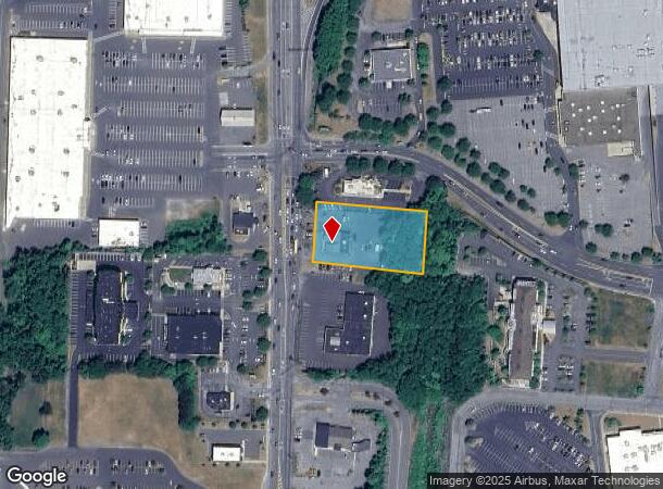
1316 Ulster Ave, Kingston, NY 12401
NEARBY LISTINGS FOR SALE OR LEASE
Property Detail
1316 Ulster Ave
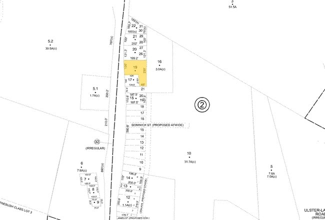
5400-048.008-0001-001.220-0000
Ulster
Restaurantbuilding
New York
X
1.220
36111C0480E
1.14 AC
2025
Newburgh/Kingston
2024
Other Market Areas
951400
Kingston, NY
3,460 SF
DEMOGRAPHICS near 1316 Ulster Ave
1 Mile
3 Mile
5 Mile
2024 Total Population
1,861
19,722
47,235
2029 Population
1,879
19,682
47,068
Pop Growth 2024-2029
+ 0.97%
(0.20%)
(0.35%)
Average Age
48
43
44
2024 Total Households
796
8,251
20,196
HH Growth 2024-2029
+ 1.26%
(0.17%)
(0.36%)
Median Household Inc
$59,840
$64,528
$73,473
Avg Household Size
1.90
2.20
2.20
2024 Avg HH Vehicles
1.00
2.00
2.00
Median Home Value
$226,800
$237,112
$264,447
Median Year Built
1978
1957
1958
Nearby Places
- Restaurants
- Banks
- Shops
- Fitness
- Groceries
PUBLIC TRANSPORTATION
COMMUTER RAIL
Rhinecliff Amtrak Station (Adirondack - Amtrak, Empire Service - Amtrak, Ethan Allen Express - Amtrak, Lake Shore Limited - Amtrak, Maple Leaf - Amtrak)
DRIVE
WALK
Distance
Rhinecliff Amtrak Station (Adirondack - Amtrak, Empire Service - Amtrak, Ethan Allen Express - Amtrak, Lake Shore Limited - Amtrak, Maple Leaf - Amtrak)
14 min
8.2 mi
Rhinecliff (Toronto - New York - VIA Rail)
DRIVE
WALK
Distance
Rhinecliff (Toronto - New York - VIA Rail)
14 min
8.3 mi
Freight Ports
Albany, NY Port
DRIVE
WALK
Distance
Albany, NY Port
67 min
50.5 mi
Nearby Properties
Address
Land Use
TOTAL SIZE
Lot Size
Zoning
Address
Land Use
TOTAL SIZE
Lot Size
Zoning
80,640 SF
6.10 AC
37
Address
Land Use
TOTAL SIZE
Lot Size
Zoning
198,029 SF
14.10 AC
37
Address
Land Use
TOTAL SIZE
Lot Size
Zoning
425,087 SF
16.10 AC
36
Address
Land Use
TOTAL SIZE
Lot Size
Zoning
142,823 SF
47.67 AC
33
Address
Land Use
TOTAL SIZE
Lot Size
Zoning
24,321 SF
46.40 AC
T2C
Address
Land Use
TOTAL SIZE
Lot Size
Zoning
109,860 SF
8.60 AC
35
Address
Land Use
TOTAL SIZE
Lot Size
Zoning
Address
Land Use
TOTAL SIZE
Lot Size
Zoning
16,933 SF
14.90 AC
SD
Address
Land Use
TOTAL SIZE
Lot Size
Zoning
205,740 SF
15 AC
36
Address
Land Use
TOTAL SIZE
Lot Size
Zoning
152,723 SF
9.60 AC
SD
Address
Land Use
TOTAL SIZE
Lot Size
Zoning
97,636 SF
2.60 AC
T5MS
Address
Land Use
TOTAL SIZE
Lot Size
Zoning
116,744 SF
12.40 AC
33
Address
Land Use
TOTAL SIZE
Lot Size
Zoning
8,674 SF
10.90 AC
SD
Address
Land Use
TOTAL SIZE
Lot Size
Zoning
76,577 SF
1.30 AC
T5F
Address
Land Use
TOTAL SIZE
Lot Size
Zoning
12.70 AC
36
Address
Land Use
TOTAL SIZE
Lot Size
Zoning
129,612 SF
11.30 AC
36
Address
Land Use
TOTAL SIZE
Lot Size
Zoning
135,674 SF
13.90 AC
36
Address
Land Use
TOTAL SIZE
Lot Size
Zoning
6,000 SF
6.40 AC
SD
Address
Land Use
TOTAL SIZE
Lot Size
Zoning
65,640 SF
18.30 AC
35
Address
Land Use
TOTAL SIZE
Lot Size
Zoning
115,834 SF
11.70 AC
36
Address
Land Use
TOTAL SIZE
Lot Size
Zoning
53,839 SF
3 AC
36
Address
Land Use
TOTAL SIZE
Lot Size
Zoning
88,000 SF
8.90 AC
36
Address
Land Use
TOTAL SIZE
Lot Size
Zoning
123,455 SF
8.70 AC
36
Address
Land Use
TOTAL SIZE
Lot Size
Zoning
62,224 SF
3.30 AC
36
Address
Land Use
TOTAL SIZE
Lot Size
Zoning
60,105 SF
11.70 AC
36
Address
Land Use
TOTAL SIZE
Lot Size
Zoning
47,038 SF
4.96 AC
T5N
Address
Land Use
TOTAL SIZE
Lot Size
Zoning
76,911 SF
1.60 AC
T5F
Address
Land Use
TOTAL SIZE
Lot Size
Zoning
640 SF
2.60 AC
T3L
Address
Land Use
TOTAL SIZE
Lot Size
Zoning
8,192 SF
3.50 AC
SD
Address
Land Use
TOTAL SIZE
Lot Size
Zoning
71,982 SF
11.20 AC
36
The World's #1 Commercial Real Estate Marketplace
Connect with us
© 2025 CoStar Group
The information above has been obtained from sources believed reliable. While we do not doubt its accuracy we have not verified it and make no guarantee, warranty or representation about it. It is your responsibility to independently confirm its accuracy and completeness. Any projections, opinions, assumptions, or estimates used are for example only and do not represent the current or future performance of the property. The value of this transaction to you depends on tax and other factors which should be evaluated by your tax, financial, and legal advisors. You and your advisors should conduct a careful, independent investigation of the property to determine to your satisfaction the suitability of the property for your needs.