Property Record
1317 4Th Ave, Auburn, GA 30011


NEARBY LISTINGS FOR SALE OR LEASE
-
-
View all Auburn listings for lease on LoopNet.com
Property Detail
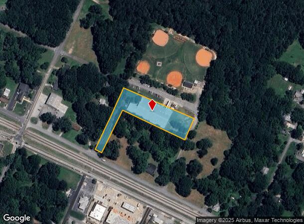
1317 4Th Ave
AU11-106
Oxford Ridge
Manufacturinglight
1317 FOURTH AVE
X
Barrow
13013C0040D
Georgia
2024
2.60 AC
2024
S Barrow
180107
Atlanta
28,844 SF
Atlanta-Sandy Springs-Roswell, GA
DEMOGRAPHICS near 1317 4Th Ave
1 Mile
3 Mile
5 Mile
2024 Total Population
2,777
17,516
61,567
2029 Population
3,240
20,325
68,791
Pop Growth 2024-2029
+ 16.67%
+ 16.04%
+ 11.73%
Average Age
37
38
37
2024 Total Households
958
5,933
19,778
HH Growth 2024-2029
+ 16.81%
+ 16.38%
+ 12.20%
Median Household Inc
$65,968
$71,165
$87,460
Avg Household Size
2.90
2.90
3.10
2024 Avg HH Vehicles
2.00
2.00
2.00
Median Home Value
$171,822
$195,366
$269,470
Median Year Built
1989
1993
2000
Nearby Places
Map Layers
Map Styles
 Street
 Aerial
- Restaurants
- Banks
- Shops
- Fitness
- Groceries
SALE & LEASE HISTORY
LISTING DATE
SALE/LEASE

Sep 24, 2016
For Lease
Sep 23, 2016
For Sale
Nearby Properties
Address
Land Use
TOTAL SIZE
Lot Size
Zoning
Address
Land Use
TOTAL SIZE
Lot Size
Zoning
222,481 SF
23.20 AC
M-1
Address
Land Use
TOTAL SIZE
Lot Size
Zoning
134,673 SF
29.74 AC
RA200
Address
Land Use
TOTAL SIZE
Lot Size
Zoning
Address
Land Use
TOTAL SIZE
Lot Size
Zoning
202,250 SF
36.80 AC
M-1
Address
Land Use
TOTAL SIZE
Lot Size
Zoning
137,200 SF
20 AC
M-2
Address
Land Use
TOTAL SIZE
Lot Size
Zoning
24,188 SF
40.70 AC
M-1
Address
Land Use
TOTAL SIZE
Lot Size
Zoning
26,616 SF
0.70 AC
Address
Land Use
TOTAL SIZE
Lot Size
Zoning
26,616 SF
0.70 AC
Address
Land Use
TOTAL SIZE
Lot Size
Zoning
84,363 SF
20.80 AC
C-2
Address
Land Use
TOTAL SIZE
Lot Size
Zoning
69,285 SF
53.10 AC
M-2
Address
Land Use
TOTAL SIZE
Lot Size
Zoning
151.81 AC
Address
Land Use
TOTAL SIZE
Lot Size
Zoning
65,500 SF
10.50 AC
DOWNTOWN O
Address
Land Use
TOTAL SIZE
Lot Size
Zoning
71,300 SF
13.80 AC
M-2
Address
Land Use
TOTAL SIZE
Lot Size
Zoning
60,307 SF
33.40 AC
AG
Address
Land Use
TOTAL SIZE
Lot Size
Zoning
387.40 AC
AG
Address
Land Use
TOTAL SIZE
Lot Size
Zoning
24,400 SF
20 AC
M-2
Address
Land Use
TOTAL SIZE
Lot Size
Zoning
2,455 SF
14.70 AC
RM8
Address
Land Use
TOTAL SIZE
Lot Size
Zoning
1,736 SF
24.20 AC
RM8
Address
Land Use
TOTAL SIZE
Lot Size
Zoning
6,000 SF
25.40 AC
M-2
Address
Land Use
TOTAL SIZE
Lot Size
Zoning
36,450 SF
7.80 AC
M-2
Address
Land Use
TOTAL SIZE
Lot Size
Zoning
3,960 SF
5 AC
M-2
Address
Land Use
TOTAL SIZE
Lot Size
Zoning
100 AC
RA200
Address
Land Use
TOTAL SIZE
Lot Size
Zoning
76.58 AC
RA200
Address
Land Use
TOTAL SIZE
Lot Size
Zoning
70.98 AC
Address
Land Use
TOTAL SIZE
Lot Size
Zoning
7,800 SF
2.20 AC
PSV
Address
Land Use
TOTAL SIZE
Lot Size
Zoning
117.66 AC
RA200
Address
Land Use
TOTAL SIZE
Lot Size
Zoning
82.32 AC
RA200
Address
Land Use
TOTAL SIZE
Lot Size
Zoning
9,459 SF
2.60 AC
AG
Address
Land Use
TOTAL SIZE
Lot Size
Zoning
14,950 SF
6.50 AC
M-1
Address
Land Use
TOTAL SIZE
Lot Size
Zoning
58,715 SF
11.40 AC
C-2
The World's #1 Commercial Real Estate Marketplace
Connect with us
© 2025 CoStar Group
The information above has been obtained from sources believed reliable. While we do not doubt its accuracy we have not verified it and make no guarantee, warranty or representation about it. It is your responsibility to independently confirm its accuracy and completeness. Any projections, opinions, assumptions, or estimates used are for example only and do not represent the current or future performance of the property. The value of this transaction to you depends on tax and other factors which should be evaluated by your tax, financial, and legal advisors. You and your advisors should conduct a careful, independent investigation of the property to determine to your satisfaction the suitability of the property for your needs.