Property Record
1317 Waterloo Rd, Mogadore, OH 44260


Save to a Folder
{{folder.Name}}
{{folder.ListingIds.length}} Properties
{{folder.ListingIds.length}} Property
Create a New Folder
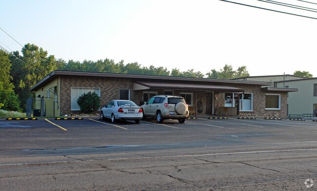
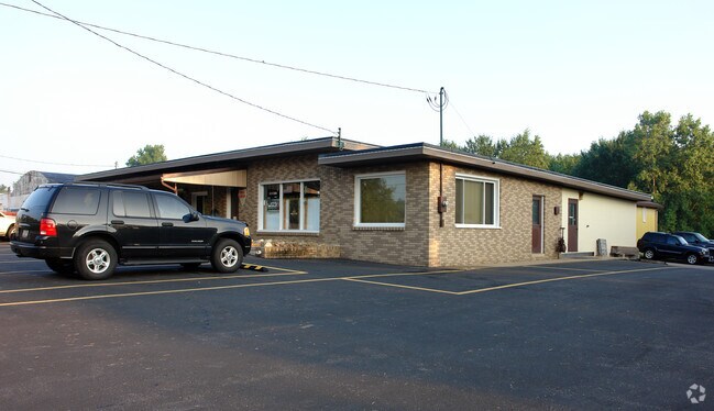
Property Detail
1317 Waterloo Rd
Akron, OH
LOT 26R SUF-HOME CRA AGREEMENT 2015-2026
36-023-10-00-051-001
Portage
Storebuilding
Ohio
B and X Area of moderate flood hazard, usually the area between the limits of the 100-year and 500-year floods.
26r
2025
3.98 AC
2025
Portage County
602102
Cleveland
38,170 SF
NEARBY LISTINGS FOR SALE OR LEASE
-
-
View all Mogadore listings for sale on LoopNet.com
DEMOGRAPHICS near 1317 Waterloo Rd
1 mile
3 mile
5 mile
2025 Total Population
991
8,011
45,349
2030 Population
995
8,028
45,292
Pop Growth 2025-2030
+ 0.40%
+ 0.21%
(0.13%)
Average Age
46
45
43
2025 Total Households
414
3,313
18,541
HH Growth 2025-2030
+ 0.24%
+ 0.18%
(0.10%)
Median Household Inc
$76,989
$74,898
$72,329
Avg Household Size
2.40
2.40
2.40
2025 Avg HH Vehicles
2.00
2.00
2.00
Median Home Value
$236,134
$218,930
$200,569
Median Year Built
1972
1971
1969
Nearby Places
Map Layers
Map Styles
 Street
 Aerial
Layers
 Traffic
 Biking
Places
Listings with unknown addresses are not visible on the map
- Restaurants
- Banks
- Shops
- Fitness
- Groceries
PUBLIC TRANSPORTATION
AIRPORT
Akron-Canton Regional
Drive
Walk
Distance
Akron-Canton Regional
25 min
13.4 mi
Freight Ports
Port of Toledo
Drive
Walk
Distance
Port of Toledo
177 min
147.9 mi
Nearby Properties
Address
Land Use
TOTAL SIZE
Lot Size
Zoning
Address
Land Use
TOTAL SIZE
Lot Size
Zoning
53,454 SF
3.78 AC
Address
Land Use
TOTAL SIZE
Lot Size
Zoning
Address
Land Use
TOTAL SIZE
Lot Size
Zoning
40.64 AC
Address
Land Use
TOTAL SIZE
Lot Size
Zoning
273,024 SF
14 AC
Address
Land Use
TOTAL SIZE
Lot Size
Zoning
4,128 SF
257.85 AC
Address
Land Use
TOTAL SIZE
Lot Size
Zoning
16,838 SF
0.75 AC
Address
Land Use
TOTAL SIZE
Lot Size
Zoning
1,544 SF
87.83 AC
Address
Land Use
TOTAL SIZE
Lot Size
Zoning
123,112 SF
77 AC
Address
Land Use
TOTAL SIZE
Lot Size
Zoning
42,529 SF
20.38 AC
Address
Land Use
TOTAL SIZE
Lot Size
Zoning
Address
Land Use
TOTAL SIZE
Lot Size
Zoning
2,060 SF
85.55 AC
Address
Land Use
TOTAL SIZE
Lot Size
Zoning
1,710 SF
81.24 AC
Address
Land Use
TOTAL SIZE
Lot Size
Zoning
14,481 SF
1.49 AC
Address
Land Use
TOTAL SIZE
Lot Size
Zoning
19,080 SF
1.41 AC
Address
Land Use
TOTAL SIZE
Lot Size
Zoning
5,760 SF
119.50 AC
Address
Land Use
TOTAL SIZE
Lot Size
Zoning
9,987 SF
56.59 AC
Address
Land Use
TOTAL SIZE
Lot Size
Zoning
16,674 SF
55.66 AC
Address
Land Use
TOTAL SIZE
Lot Size
Zoning
69.48 AC
Address
Land Use
TOTAL SIZE
Lot Size
Zoning
10,332 SF
56.41 AC
Address
Land Use
TOTAL SIZE
Lot Size
Zoning
134.36 AC
Address
Land Use
TOTAL SIZE
Lot Size
Zoning
1,731 SF
119.92 AC
Address
Land Use
TOTAL SIZE
Lot Size
Zoning
33,060 SF
9.28 AC
Address
Land Use
TOTAL SIZE
Lot Size
Zoning
15,856 SF
3.93 AC
Address
Land Use
TOTAL SIZE
Lot Size
Zoning
61,160 SF
66.66 AC
Address
Land Use
TOTAL SIZE
Lot Size
Zoning
39,124 SF
11.48 AC
Address
Land Use
TOTAL SIZE
Lot Size
Zoning
28,174 SF
2.80 AC
Address
Land Use
TOTAL SIZE
Lot Size
Zoning
15,160 SF
5 AC
Address
Land Use
TOTAL SIZE
Lot Size
Zoning
5,484 SF
2.11 AC
Address
Land Use
TOTAL SIZE
Lot Size
Zoning
7,478 SF
53.32 AC
The World's #1 Commercial Real Estate Marketplace
Connect with us
© 2026 CoStar Group
The information above has been obtained from sources believed reliable. While we do not doubt its accuracy we have not verified it and make no guarantee, warranty or representation about it. It is your responsibility to independently confirm its accuracy and completeness. Any projections, opinions, assumptions, or estimates used are for example only and do not represent the current or future performance of the property. The value of this transaction to you depends on tax and other factors which should be evaluated by your tax, financial, and legal advisors. You and your advisors should conduct a careful, independent investigation of the property to determine to your satisfaction the suitability of the property for your needs.