Property Record
1318 162Nd St, Dolton, IL 60419
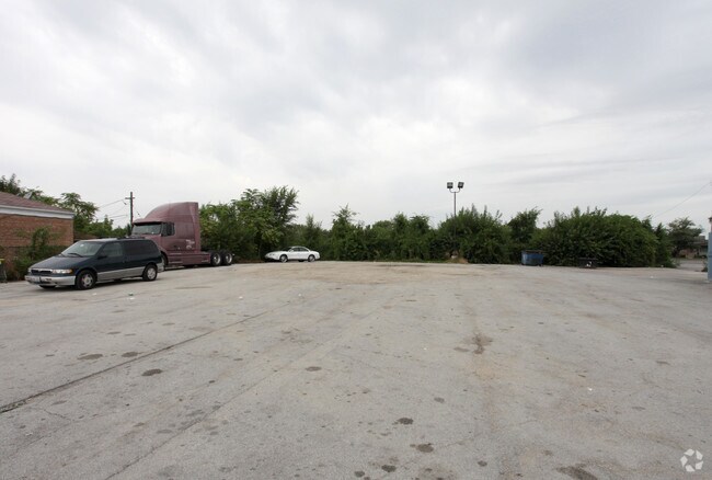


Property Detail
1318 162Nd St
Chicago-Naperville-Elgin, IL-IN
EAST50 FT S80 FT LOT11 PART W2 SE4 SEC02 PART W2NE4 S11+ T36N R14E 3P
29-11-226-020-0000
COOK
Vacantlandnec
Illinois
B and X Area of moderate flood hazard, usually the area between the limits of the 100-year and 500-year floods.
11
2023
0.28 AC
2025
Near South Cook
826402
Chicago
NEARBY LISTINGS FOR SALE OR LEASE
DEMOGRAPHICS near 1318 162Nd St
1 mile
3 mile
5 mile
2025 Total Population
22,133
108,939
254,884
2030 Population
22,440
110,777
258,977
Pop Growth 2025-2030
+ 1.39%
+ 1.69%
+ 1.61%
Average Age
41
40
40
2025 Total Households
8,412
40,492
94,221
HH Growth 2025-2030
+ 1.17%
+ 1.44%
+ 1.38%
Median Household Inc
$56,949
$54,956
$54,227
Avg Household Size
2.50
2.60
2.60
2025 Avg HH Vehicles
1.00
1.00
2.00
Median Home Value
$142,137
$153,575
$152,594
Median Year Built
1968
1964
1959
Nearby Places
Map Layers
Map Styles
 Street
 Aerial
Layers
 Traffic
 Biking
Places
Listings with unknown addresses are not visible on the map
- Restaurants
- Banks
- Shops
- Fitness
- Groceries
PUBLIC TRANSPORTATION
COMMUTER RAIL
Drive
Walk
Distance
5 min
2.7 mi
Ivanhoe Station (Metra Electric Line - Northeast Illinois Regional Commuter Railroad (Metra))
Drive
Walk
Distance
Ivanhoe Station (Metra Electric Line - Northeast Illinois Regional Commuter Railroad (Metra))
7 min
2.9 mi
AIRPORT
Chicago Midway International
Drive
Walk
Distance
Chicago Midway International
32 min
18.1 mi
Chicago O'Hare International
Drive
Walk
Distance
Chicago O'Hare International
74 min
40.1 mi
Nearby Properties
Address
Land Use
TOTAL SIZE
Lot Size
Zoning
Address
Land Use
TOTAL SIZE
Lot Size
Zoning
24.56 AC
Address
Land Use
TOTAL SIZE
Lot Size
Zoning
Address
Land Use
TOTAL SIZE
Lot Size
Zoning
29.25 AC
PMD 6
Address
Land Use
TOTAL SIZE
Lot Size
Zoning
119,082 SF
11.26 AC
Address
Land Use
TOTAL SIZE
Lot Size
Zoning
48,134 SF
5.33 AC
Address
Land Use
TOTAL SIZE
Lot Size
Zoning
69,894 SF
7.60 AC
Address
Land Use
TOTAL SIZE
Lot Size
Zoning
454,999 SF
27.43 AC
Address
Land Use
TOTAL SIZE
Lot Size
Zoning
60,864 SF
5.55 AC
Address
Land Use
TOTAL SIZE
Lot Size
Zoning
7.31 AC
Address
Land Use
TOTAL SIZE
Lot Size
Zoning
40,489 SF
6.43 AC
Address
Land Use
TOTAL SIZE
Lot Size
Zoning
44,189 SF
3.09 AC
Address
Land Use
TOTAL SIZE
Lot Size
Zoning
Address
Land Use
TOTAL SIZE
Lot Size
Zoning
27,606 SF
2.87 AC
Address
Land Use
TOTAL SIZE
Lot Size
Zoning
362,552 SF
44.53 AC
PD 1350
Address
Land Use
TOTAL SIZE
Lot Size
Zoning
89,853 SF
2.68 AC
Address
Land Use
TOTAL SIZE
Lot Size
Zoning
159,145 SF
15.36 AC
Address
Land Use
TOTAL SIZE
Lot Size
Zoning
142,376 SF
24 AC
Address
Land Use
TOTAL SIZE
Lot Size
Zoning
216,386 SF
16.84 AC
PD 42
Address
Land Use
TOTAL SIZE
Lot Size
Zoning
38,111 SF
6.70 AC
Address
Land Use
TOTAL SIZE
Lot Size
Zoning
80,560 SF
31.92 AC
PMD 6,PD 4
Address
Land Use
TOTAL SIZE
Lot Size
Zoning
233,490 SF
10.19 AC
Address
Land Use
TOTAL SIZE
Lot Size
Zoning
2,678,631 SF
11.03 AC
PMD 6
Address
Land Use
TOTAL SIZE
Lot Size
Zoning
Address
Land Use
TOTAL SIZE
Lot Size
Zoning
180,139 SF
18.78 AC
Address
Land Use
TOTAL SIZE
Lot Size
Zoning
13.57 AC
PMD 6
Address
Land Use
TOTAL SIZE
Lot Size
Zoning
10.62 AC
PMD 6
Address
Land Use
TOTAL SIZE
Lot Size
Zoning
225,800 SF
22.52 AC
M3-2,M1-2
Address
Land Use
TOTAL SIZE
Lot Size
Zoning
136,486 SF
8.73 AC
Address
Land Use
TOTAL SIZE
Lot Size
Zoning
3,099 SF
24.79 AC
PMD 6
Address
Land Use
TOTAL SIZE
Lot Size
Zoning
72,652 SF
0.94 AC
The World's #1 Commercial Real Estate Marketplace
Connect with us
© 2026 CoStar Group
The information above has been obtained from sources believed reliable. While we do not doubt its accuracy we have not verified it and make no guarantee, warranty or representation about it. It is your responsibility to independently confirm its accuracy and completeness. Any projections, opinions, assumptions, or estimates used are for example only and do not represent the current or future performance of the property. The value of this transaction to you depends on tax and other factors which should be evaluated by your tax, financial, and legal advisors. You and your advisors should conduct a careful, independent investigation of the property to determine to your satisfaction the suitability of the property for your needs.