Property Record
1318 Route 16, Ossipee, NH 03864
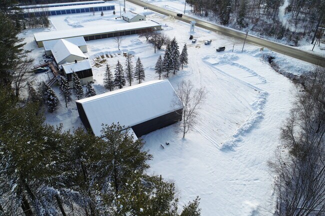

Property Detail
1318 Route 16
Commercialbuilding
CARROLL
RSC
New Hampshire
B and X Area of moderate flood hazard, usually the area between the limits of the 100-year and 500-year floods.
20000
2024
1.87 AC
2024
Concord/New Hampshire North Area
955902
Other Market Areas
2,941 SF
OSSI-000099-000000-020000
NEARBY LISTINGS FOR SALE OR LEASE
DEMOGRAPHICS near 1318 Route 16
1 mile
3 mile
5 mile
2025 Total Population
379
2,302
6,066
2030 Population
382
2,389
6,395
Pop Growth 2025-2030
+ 0.79%
+ 3.78%
+ 5.42%
Average Age
43
46
48
2025 Total Households
157
975
2,753
HH Growth 2025-2030
+ 1.27%
+ 3.90%
+ 5.96%
Median Household Inc
$66,847
$70,908
$69,030
Avg Household Size
2.20
2.20
2.10
2025 Avg HH Vehicles
2.00
2.00
2.00
Median Home Value
$323,077
$334,539
$363,760
Median Year Built
1978
1982
1985
Nearby Places
Map Layers
Map Styles
 Street
 Aerial
Layers
 Traffic
 Biking
Places
Listings with unknown addresses are not visible on the map
- Restaurants
- Banks
- Shops
- Fitness
- Groceries
SALE & LEASE HISTORY
LISTING DATE
SALE/LEASE

Sep 24, 2016
For Sale
Jan 12, 2018
For Lease
Jan 10, 2022
For Sale
Aug 30, 2021
For Sale
Nearby Properties
Address
Land Use
TOTAL SIZE
Lot Size
Zoning
Address
Land Use
TOTAL SIZE
Lot Size
Zoning
63,847 SF
13.93 AC
VIL DC
Address
Land Use
TOTAL SIZE
Lot Size
Zoning
5.91 AC
VIL DC
Address
Land Use
TOTAL SIZE
Lot Size
Zoning
46,853 SF
2.50 AC
RSC
Address
Land Use
TOTAL SIZE
Lot Size
Zoning
100.08 AC
COM
Address
Land Use
TOTAL SIZE
Lot Size
Zoning
8.20 AC
VIL DC
Address
Land Use
TOTAL SIZE
Lot Size
Zoning
672 SF
134.70 AC
C/I GR
Address
Land Use
TOTAL SIZE
Lot Size
Zoning
9.33 AC
VIL DC
Address
Land Use
TOTAL SIZE
Lot Size
Zoning
8.80 AC
C/I GR
Address
Land Use
TOTAL SIZE
Lot Size
Zoning
6.73 AC
VIL DC
Address
Land Use
TOTAL SIZE
Lot Size
Zoning
3,772 SF
0.46 AC
RUR LO
Address
Land Use
TOTAL SIZE
Lot Size
Zoning
202 SF
107 AC
RUR OS
Address
Land Use
TOTAL SIZE
Lot Size
Zoning
26.70 AC
RUR OS
Address
Land Use
TOTAL SIZE
Lot Size
Zoning
429 AC
RUR OS
Address
Land Use
TOTAL SIZE
Lot Size
Zoning
11,209 SF
75 AC
RSC
Address
Land Use
TOTAL SIZE
Lot Size
Zoning
10.78 AC
COM
Address
Land Use
TOTAL SIZE
Lot Size
Zoning
3,107 SF
0.52 AC
RUR LO
Address
Land Use
TOTAL SIZE
Lot Size
Zoning
2.57 AC
VIL DC
Address
Land Use
TOTAL SIZE
Lot Size
Zoning
0.70 AC
RUR OS
Address
Land Use
TOTAL SIZE
Lot Size
Zoning
13,633 SF
5.01 AC
RSC
Address
Land Use
TOTAL SIZE
Lot Size
Zoning
13,142 SF
0.71 AC
VIL DC
Address
Land Use
TOTAL SIZE
Lot Size
Zoning
3.20 AC
COM
Address
Land Use
TOTAL SIZE
Lot Size
Zoning
0.94 AC
RUR OS
Address
Land Use
TOTAL SIZE
Lot Size
Zoning
4,089 SF
15 AC
RUR
Address
Land Use
TOTAL SIZE
Lot Size
Zoning
42.20 AC
RUR
Address
Land Use
TOTAL SIZE
Lot Size
Zoning
1,222 SF
0.28 AC
RUR OS
Address
Land Use
TOTAL SIZE
Lot Size
Zoning
6,052 SF
0.69 AC
VIL DC
Address
Land Use
TOTAL SIZE
Lot Size
Zoning
11,380 SF
3.60 AC
RA RU
Address
Land Use
TOTAL SIZE
Lot Size
Zoning
0.51 AC
RUR OS
Address
Land Use
TOTAL SIZE
Lot Size
Zoning
19.99 AC
C/I GR
Address
Land Use
TOTAL SIZE
Lot Size
Zoning
3,073 SF
0.93 AC
COM
The World's #1 Commercial Real Estate Marketplace
Connect with us
© 2026 CoStar Group
The information above has been obtained from sources believed reliable. While we do not doubt its accuracy we have not verified it and make no guarantee, warranty or representation about it. It is your responsibility to independently confirm its accuracy and completeness. Any projections, opinions, assumptions, or estimates used are for example only and do not represent the current or future performance of the property. The value of this transaction to you depends on tax and other factors which should be evaluated by your tax, financial, and legal advisors. You and your advisors should conduct a careful, independent investigation of the property to determine to your satisfaction the suitability of the property for your needs.