Property Record
1319 E King Ave, Kingsland, GA 31548
NEARBY LISTINGS FOR SALE OR LEASE
-
-
View all Kingsland listings for sale on LoopNet.com
Property Detail
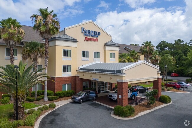
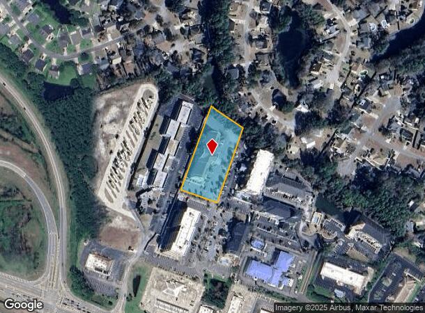
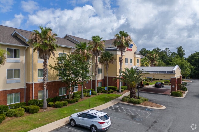
1319 E King Ave
Kingsland, GA
Kingsland 95 Interchange Ac
107-003A
COMM (HOTEL)/ L FAIRFIELD INN
Commercialnec
Camden
2025
Georgia
2025
1.73 AC
010302
Brunswick/Kingsland
43,213 SF
Other Market Areas
DEMOGRAPHICS near 1319 E King Ave
1 Mile
3 Mile
5 Mile
2024 Total Population
5,391
20,345
36,151
2029 Population
5,930
22,455
39,631
Pop Growth 2024-2029
+ 10.00%
+ 10.37%
+ 9.63%
Average Age
34
36
37
2024 Total Households
1,941
7,661
13,671
HH Growth 2024-2029
+ 10.15%
+ 10.46%
+ 9.76%
Median Household Inc
$58,201
$58,888
$67,748
Avg Household Size
2.70
2.60
2.60
2024 Avg HH Vehicles
2.00
2.00
2.00
Median Home Value
$183,683
$192,978
$219,709
Median Year Built
1997
1998
1998
Nearby Places
Map Layers
Map Styles
 Street
 Aerial
- Restaurants
- Banks
- Shops
- Fitness
- Groceries
PUBLIC TRANSPORTATION
AIRPORT
Jacksonville International
DRIVE
WALK
Distance
Jacksonville International
33 min
25.9 mi
Freight Ports
Georgia Ports - Brunswick
DRIVE
WALK
Distance
Georgia Ports - Brunswick
38 min
30.1 mi
SALE & LEASE HISTORY
LISTING DATE
SALE/LEASE

Jun 13, 2024
For Sale
Nearby Properties
Address
Land Use
TOTAL SIZE
Lot Size
Zoning
Address
Land Use
TOTAL SIZE
Lot Size
Zoning
256,459 SF
38.54 AC
R-1
Address
Land Use
TOTAL SIZE
Lot Size
Zoning
2,856 SF
51.84 AC
R-3
Address
Land Use
TOTAL SIZE
Lot Size
Zoning
184,547 SF
34.90 AC
R-1
Address
Land Use
TOTAL SIZE
Lot Size
Zoning
94,156 SF
74.30 AC
PD/R-1
Address
Land Use
TOTAL SIZE
Lot Size
Zoning
144,338 SF
35 AC
R-1
Address
Land Use
TOTAL SIZE
Lot Size
Zoning
26,410 SF
3.21 AC
C-3
Address
Land Use
TOTAL SIZE
Lot Size
Zoning
79,447 SF
25 AC
PD/R-1
Address
Land Use
TOTAL SIZE
Lot Size
Zoning
80,714 SF
26.12 AC
R1
Address
Land Use
TOTAL SIZE
Lot Size
Zoning
64,504 SF
20 AC
C-ED
Address
Land Use
TOTAL SIZE
Lot Size
Zoning
2,305 SF
20.92 AC
C-2
Address
Land Use
TOTAL SIZE
Lot Size
Zoning
123,108 SF
11.83 AC
R-3
Address
Land Use
TOTAL SIZE
Lot Size
Zoning
3,879 SF
10.72 AC
PD/R-3
Address
Land Use
TOTAL SIZE
Lot Size
Zoning
5 AC
C-3
Address
Land Use
TOTAL SIZE
Lot Size
Zoning
8,544 SF
18.64 AC
C2
Address
Land Use
TOTAL SIZE
Lot Size
Zoning
139,255 SF
16.27 AC
I-L
Address
Land Use
TOTAL SIZE
Lot Size
Zoning
31,428 SF
5.80 AC
R-2
Address
Land Use
TOTAL SIZE
Lot Size
Zoning
16,598 SF
24.13 AC
PD/R-3
Address
Land Use
TOTAL SIZE
Lot Size
Zoning
95,196 SF
8.64 AC
C2
Address
Land Use
TOTAL SIZE
Lot Size
Zoning
2,833 SF
22.34 AC
PD/C2
Address
Land Use
TOTAL SIZE
Lot Size
Zoning
182,489 SF
22.88 AC
C-2
Address
Land Use
TOTAL SIZE
Lot Size
Zoning
15,590 SF
0.71 AC
C-4
Address
Land Use
TOTAL SIZE
Lot Size
Zoning
22,311 SF
6.39 AC
C-2
Address
Land Use
TOTAL SIZE
Lot Size
Zoning
3,000 SF
8.78 AC
C-2
Address
Land Use
TOTAL SIZE
Lot Size
Zoning
626.23 AC
P-D
Address
Land Use
TOTAL SIZE
Lot Size
Zoning
51,948 SF
2.08 AC
C-4
Address
Land Use
TOTAL SIZE
Lot Size
Zoning
55,497 SF
1.68 AC
C-4
Address
Land Use
TOTAL SIZE
Lot Size
Zoning
16,768 SF
8.96 AC
R-3
Address
Land Use
TOTAL SIZE
Lot Size
Zoning
56,037 SF
8.66 AC
C2
Address
Land Use
TOTAL SIZE
Lot Size
Zoning
9,530 SF
10.71 AC
PD/R-3
Address
Land Use
TOTAL SIZE
Lot Size
Zoning
5,472 SF
31 AC
C-2
The World's #1 Commercial Real Estate Marketplace
Connect with us
© 2026 CoStar Group
The information above has been obtained from sources believed reliable. While we do not doubt its accuracy we have not verified it and make no guarantee, warranty or representation about it. It is your responsibility to independently confirm its accuracy and completeness. Any projections, opinions, assumptions, or estimates used are for example only and do not represent the current or future performance of the property. The value of this transaction to you depends on tax and other factors which should be evaluated by your tax, financial, and legal advisors. You and your advisors should conduct a careful, independent investigation of the property to determine to your satisfaction the suitability of the property for your needs.