Property Record
1319 Highway 2, Sandpoint, ID 83864

Property Detail
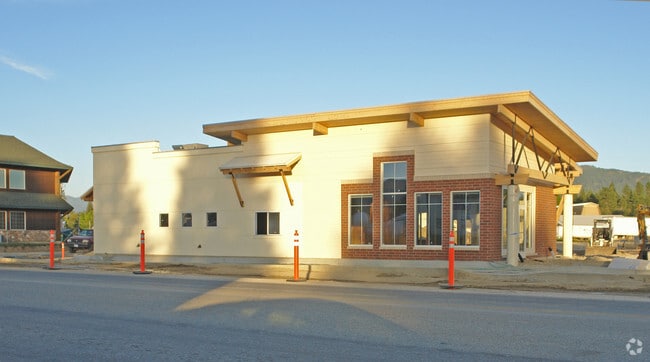
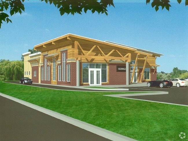
1319 Highway 2
Sandpoint, ID
22-57N-2W LIGHTS OUT REPLAT BLK 1 LOT 3A WESTPOINTE PLAZA SUBWAY/BABS PIZZERIA/WHITE CROSS PHARMACY
RPS37-680-0103A0A
Bonner
Commercialnec
Idaho
B and X Area of moderate flood hazard, usually the area between the limits of the 100-year and 500-year floods.
3a
2025
0.68 AC
2025
Bonner
950403
Coeur D'Alene
5,379 SF
NEARBY LISTINGS FOR SALE OR LEASE
DEMOGRAPHICS near 1319 Highway 2
1 mile
3 mile
5 mile
2025 Total Population
6,874
14,145
21,921
2030 Population
7,555
15,590
24,231
Pop Growth 2025-2030
+ 9.91%
+ 10.22%
+ 10.54%
Average Age
43
43
44
2025 Total Households
2,995
6,095
9,204
HH Growth 2025-2030
+ 9.62%
+ 9.88%
+ 10.17%
Median Household Inc
$71,320
$68,796
$70,521
Avg Household Size
2.20
2.20
2.30
2025 Avg HH Vehicles
2.00
2.00
2.00
Median Home Value
$541,667
$522,365
$513,683
Median Year Built
1982
1989
1991
Nearby Places
Map Layers
Map Styles
 Street
 Aerial
Transit
 Traffic
 Biking
Places
Listings with unknown addresses are not visible on the map
- Restaurants
- Banks
- Shops
- Fitness
- Groceries
PUBLIC TRANSPORTATION
COMMUTER RAIL
Drive
Walk
Distance
5 min
1.4 mi
SALE & LEASE HISTORY
LISTING DATE
SALE/LEASE

Sep 25, 2016
For Lease
Nov 18, 2016
For Sale
Aug 23, 2023
For Sale
Aug 03, 2017
For Sale
Nearby Properties
Address
Land Use
TOTAL SIZE
Lot Size
Zoning
Address
Land Use
TOTAL SIZE
Lot Size
Zoning
3.84 AC
Address
Land Use
TOTAL SIZE
Lot Size
Zoning
24,639 SF
3 AC
Address
Land Use
TOTAL SIZE
Lot Size
Zoning
86,100 SF
1.79 AC
Address
Land Use
TOTAL SIZE
Lot Size
Zoning
49,500 SF
16.53 AC
Address
Land Use
TOTAL SIZE
Lot Size
Zoning
Address
Land Use
TOTAL SIZE
Lot Size
Zoning
4,413 SF
4.79 AC
Address
Land Use
TOTAL SIZE
Lot Size
Zoning
4,512 SF
3.90 AC
Address
Land Use
TOTAL SIZE
Lot Size
Zoning
29,154 SF
3.80 AC
Address
Land Use
TOTAL SIZE
Lot Size
Zoning
92,969 SF
15.72 AC
Address
Land Use
TOTAL SIZE
Lot Size
Zoning
82,053 SF
5.26 AC
Address
Land Use
TOTAL SIZE
Lot Size
Zoning
35,708 SF
2.47 AC
Address
Land Use
TOTAL SIZE
Lot Size
Zoning
12,024 SF
2.86 AC
Address
Land Use
TOTAL SIZE
Lot Size
Zoning
1,306 SF
3.05 AC
Rec
Address
Land Use
TOTAL SIZE
Lot Size
Zoning
53,580 SF
5.63 AC
Address
Land Use
TOTAL SIZE
Lot Size
Zoning
5,148 SF
0.91 AC
Address
Land Use
TOTAL SIZE
Lot Size
Zoning
38,980 SF
2.71 AC
Address
Land Use
TOTAL SIZE
Lot Size
Zoning
432 SF
7.46 AC
R-5
Address
Land Use
TOTAL SIZE
Lot Size
Zoning
16,462 SF
1.63 AC
Address
Land Use
TOTAL SIZE
Lot Size
Zoning
32,130 SF
4.33 AC
Address
Land Use
TOTAL SIZE
Lot Size
Zoning
17,828 SF
1.21 AC
Address
Land Use
TOTAL SIZE
Lot Size
Zoning
20,396 SF
1.40 AC
Address
Land Use
TOTAL SIZE
Lot Size
Zoning
29,910 SF
2.96 AC
Address
Land Use
TOTAL SIZE
Lot Size
Zoning
38,496 SF
6.63 AC
Address
Land Use
TOTAL SIZE
Lot Size
Zoning
3.30 AC
Address
Land Use
TOTAL SIZE
Lot Size
Zoning
0.83 AC
Address
Land Use
TOTAL SIZE
Lot Size
Zoning
92,969 SF
6.74 AC
Address
Land Use
TOTAL SIZE
Lot Size
Zoning
41,930 SF
9.63 AC
S
Address
Land Use
TOTAL SIZE
Lot Size
Zoning
20,720 SF
2.86 AC
Address
Land Use
TOTAL SIZE
Lot Size
Zoning
3,540 SF
4 AC
Address
Land Use
TOTAL SIZE
Lot Size
Zoning
26,220 SF
1 AC
The World's #1 Commercial Real Estate Marketplace
Connect with us
© 2026 CoStar Group
The information above has been obtained from sources believed reliable. While we do not doubt its accuracy we have not verified it and make no guarantee, warranty or representation about it. It is your responsibility to independently confirm its accuracy and completeness. Any projections, opinions, assumptions, or estimates used are for example only and do not represent the current or future performance of the property. The value of this transaction to you depends on tax and other factors which should be evaluated by your tax, financial, and legal advisors. You and your advisors should conduct a careful, independent investigation of the property to determine to your satisfaction the suitability of the property for your needs.