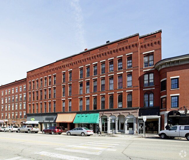
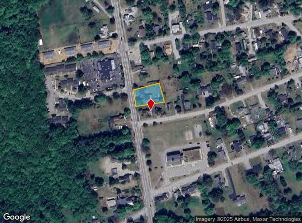
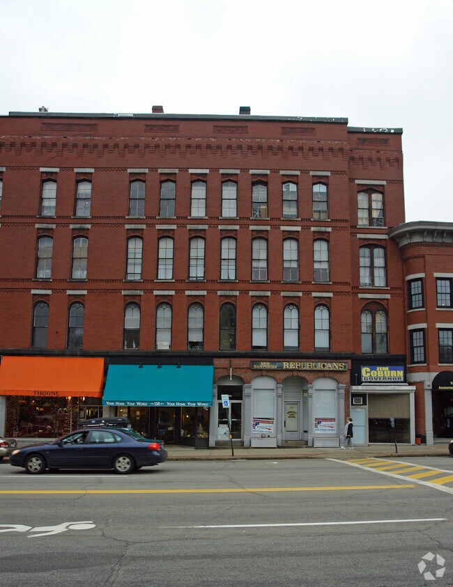
Property Record
132 1/2 N Main St, Boscawen, NH 03303
NEARBY LISTINGS FOR SALE OR LEASE
Property Detail
132 1/2 N Main St
CNCD-000045-000006-000013
Merrimack
Departmentstore
New Hampshire
X
13
33013C0336E
0.21 AC
2024
Concord/New Hampshire North Area
2024
Other Market Areas
038000
Concord, NH
28,614 SF
DEMOGRAPHICS near 132 1/2 N Main St
1 Mile
3 Mile
5 Mile
2024 Total Population
11,254
29,129
47,026
2029 Population
11,839
30,534
49,436
Pop Growth 2024-2029
+ 5.20%
+ 4.82%
+ 5.12%
Average Age
41
43
43
2024 Total Households
4,987
12,695
19,356
HH Growth 2024-2029
+ 5.45%
+ 4.94%
+ 5.21%
Median Household Inc
$56,272
$68,839
$79,154
Avg Household Size
2.00
2.10
2.20
2024 Avg HH Vehicles
1.00
2.00
2.00
Median Home Value
$294,320
$286,271
$305,539
Median Year Built
1947
1964
1974
Nearby Places
- Restaurants
- Banks
- Shops
- Fitness
- Groceries
PUBLIC TRANSPORTATION
AIRPORT
Manchester Boston Regional
DRIVE
WALK
Distance
Manchester Boston Regional
48 min
31.8 mi
Freight Ports
Port of Boston
DRIVE
WALK
Distance
Port of Boston
114 min
80.3 mi
Nearby Properties
Address
Land Use
TOTAL SIZE
Lot Size
Zoning
Address
Land Use
TOTAL SIZE
Lot Size
Zoning
23.80 AC
IN
Address
Land Use
TOTAL SIZE
Lot Size
Zoning
56.19 AC
IN
Address
Land Use
TOTAL SIZE
Lot Size
Zoning
RES/AG
Address
Land Use
TOTAL SIZE
Lot Size
Zoning
14.41 AC
GWP
Address
Land Use
TOTAL SIZE
Lot Size
Zoning
8.50 AC
CG
Address
Land Use
TOTAL SIZE
Lot Size
Zoning
66,460 SF
20.98 AC
RM
Address
Land Use
TOTAL SIZE
Lot Size
Zoning
61,687 SF
8.69 AC
CG
Address
Land Use
TOTAL SIZE
Lot Size
Zoning
47,273 SF
91.79 AC
COM W
Address
Land Use
TOTAL SIZE
Lot Size
Zoning
5.50 AC
DEFAUL
Address
Land Use
TOTAL SIZE
Lot Size
Zoning
12 AC
RH
Address
Land Use
TOTAL SIZE
Lot Size
Zoning
25,363 SF
6.21 AC
CG
Address
Land Use
TOTAL SIZE
Lot Size
Zoning
4.90 AC
RH
Address
Land Use
TOTAL SIZE
Lot Size
Zoning
9.60 AC
RD
Address
Land Use
TOTAL SIZE
Lot Size
Zoning
6,316 SF
0.29 AC
R2 - R
Address
Land Use
TOTAL SIZE
Lot Size
Zoning
1,875 SF
2.30 AC
R2 - R
Address
Land Use
TOTAL SIZE
Lot Size
Zoning
2.49 AC
CG
Address
Land Use
TOTAL SIZE
Lot Size
Zoning
169 AC
RO
Address
Land Use
TOTAL SIZE
Lot Size
Zoning
630 SF
2.47 AC
R2 - R
Address
Land Use
TOTAL SIZE
Lot Size
Zoning
3,736 SF
0.56 AC
R2 - R
Address
Land Use
TOTAL SIZE
Lot Size
Zoning
70,566 SF
11.09 AC
IN
Address
Land Use
TOTAL SIZE
Lot Size
Zoning
32.08 AC
RH
Address
Land Use
TOTAL SIZE
Lot Size
Zoning
396 SF
0.19 AC
R2 - R
Address
Land Use
TOTAL SIZE
Lot Size
Zoning
2,205 SF
37 AC
ARR -
Address
Land Use
TOTAL SIZE
Lot Size
Zoning
8.21 AC
IN
Address
Land Use
TOTAL SIZE
Lot Size
Zoning
2,685 SF
11.42 AC
VD
Address
Land Use
TOTAL SIZE
Lot Size
Zoning
19,578 SF
2.88 AC
CMW&S
Address
Land Use
TOTAL SIZE
Lot Size
Zoning
3,347 SF
7.20 AC
VD
Address
Land Use
TOTAL SIZE
Lot Size
Zoning
1.25 AC
MRD
Address
Land Use
TOTAL SIZE
Lot Size
Zoning
3.58 AC
CG
Address
Land Use
TOTAL SIZE
Lot Size
Zoning
30.15 AC
RH
The World's #1 Commercial Real Estate Marketplace
Connect with us
© 2025 CoStar Group
The information above has been obtained from sources believed reliable. While we do not doubt its accuracy we have not verified it and make no guarantee, warranty or representation about it. It is your responsibility to independently confirm its accuracy and completeness. Any projections, opinions, assumptions, or estimates used are for example only and do not represent the current or future performance of the property. The value of this transaction to you depends on tax and other factors which should be evaluated by your tax, financial, and legal advisors. You and your advisors should conduct a careful, independent investigation of the property to determine to your satisfaction the suitability of the property for your needs.