Property Record
132 Harris Dr, Poca, WV 25159


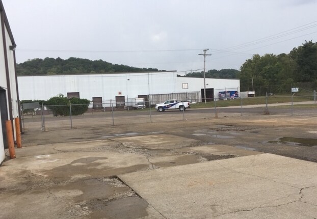
Property Detail
132 Harris Dr
Huntington-Ashland, WV-KY-OH
PRT PARCEL 9-B (5.6667 AC) ROCK BRANCH IND PARK
08-226L-00040000
Putnam
Warehouse
West Virginia
C and X Area of minimal flood hazard, usually depicted on FIRMs as above the 500-year flood level.
5.67 AC
2025
Putnam County
2025
Charleston WV
020500
NEARBY LISTINGS FOR SALE OR LEASE
DEMOGRAPHICS near 132 Harris Dr
1 mile
3 mile
5 mile
2025 Total Population
1,723
16,448
42,563
2030 Population
1,724
16,203
41,927
Pop Growth 2025-2030
+ 0.06%
(1.49%)
(1.49%)
Average Age
42
42
43
2025 Total Households
698
6,962
18,233
HH Growth 2025-2030
0.00%
(1.58%)
(1.60%)
Median Household Inc
$70,499
$60,789
$59,910
Avg Household Size
2.40
2.30
2.30
2025 Avg HH Vehicles
2.00
2.00
2.00
Median Home Value
$156,666
$171,597
$164,750
Median Year Built
1977
1975
1971
Nearby Places
Map Layers
Map Styles
 Street
 Aerial
Transit
 Traffic
 Biking
Places
Listings with unknown addresses are not visible on the map
- Restaurants
- Banks
- Shops
- Fitness
- Groceries
PUBLIC TRANSPORTATION
AIRPORT
West Virginia International Yeager
Drive
Walk
Distance
West Virginia International Yeager
33 min
21.7 mi
Freight Ports
Port of Toledo
Drive
Walk
Distance
Port of Toledo
363 min
284.5 mi
SALE & LEASE HISTORY
LISTING DATE
SALE/LEASE

Nov 04, 2016
For Lease
Mar 11, 2020
For Lease
Nearby Properties
Address
Land Use
TOTAL SIZE
Lot Size
Zoning
Address
Land Use
TOTAL SIZE
Lot Size
Zoning
106.70 AC
Address
Land Use
TOTAL SIZE
Lot Size
Zoning
31.67 AC
Address
Land Use
TOTAL SIZE
Lot Size
Zoning
26.28 AC
Address
Land Use
TOTAL SIZE
Lot Size
Zoning
5.07 AC
Address
Land Use
TOTAL SIZE
Lot Size
Zoning
6.49 AC
Address
Land Use
TOTAL SIZE
Lot Size
Zoning
15.57 AC
Address
Land Use
TOTAL SIZE
Lot Size
Zoning
Address
Land Use
TOTAL SIZE
Lot Size
Zoning
15.43 AC
Address
Land Use
TOTAL SIZE
Lot Size
Zoning
3.51 AC
Address
Land Use
TOTAL SIZE
Lot Size
Zoning
11.77 AC
Address
Land Use
TOTAL SIZE
Lot Size
Zoning
18.12 AC
Address
Land Use
TOTAL SIZE
Lot Size
Zoning
2.13 AC
Address
Land Use
TOTAL SIZE
Lot Size
Zoning
23.49 AC
Address
Land Use
TOTAL SIZE
Lot Size
Zoning
Address
Land Use
TOTAL SIZE
Lot Size
Zoning
16.95 AC
Address
Land Use
TOTAL SIZE
Lot Size
Zoning
26.95 AC
Address
Land Use
TOTAL SIZE
Lot Size
Zoning
9.02 AC
Address
Land Use
TOTAL SIZE
Lot Size
Zoning
10.33 AC
Address
Land Use
TOTAL SIZE
Lot Size
Zoning
7.55 AC
Address
Land Use
TOTAL SIZE
Lot Size
Zoning
69.30 AC
Address
Land Use
TOTAL SIZE
Lot Size
Zoning
3.98 AC
Address
Land Use
TOTAL SIZE
Lot Size
Zoning
5.06 AC
Address
Land Use
TOTAL SIZE
Lot Size
Zoning
4.10 AC
Address
Land Use
TOTAL SIZE
Lot Size
Zoning
1.96 AC
Address
Land Use
TOTAL SIZE
Lot Size
Zoning
Address
Land Use
TOTAL SIZE
Lot Size
Zoning
83.12 AC
Address
Land Use
TOTAL SIZE
Lot Size
Zoning
Address
Land Use
TOTAL SIZE
Lot Size
Zoning
Address
Land Use
TOTAL SIZE
Lot Size
Zoning
10.32 AC
Address
Land Use
TOTAL SIZE
Lot Size
Zoning
12.17 AC
The World's #1 Commercial Real Estate Marketplace
Connect with us
© 2026 CoStar Group
The information above has been obtained from sources believed reliable. While we do not doubt its accuracy we have not verified it and make no guarantee, warranty or representation about it. It is your responsibility to independently confirm its accuracy and completeness. Any projections, opinions, assumptions, or estimates used are for example only and do not represent the current or future performance of the property. The value of this transaction to you depends on tax and other factors which should be evaluated by your tax, financial, and legal advisors. You and your advisors should conduct a careful, independent investigation of the property to determine to your satisfaction the suitability of the property for your needs.