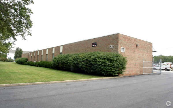
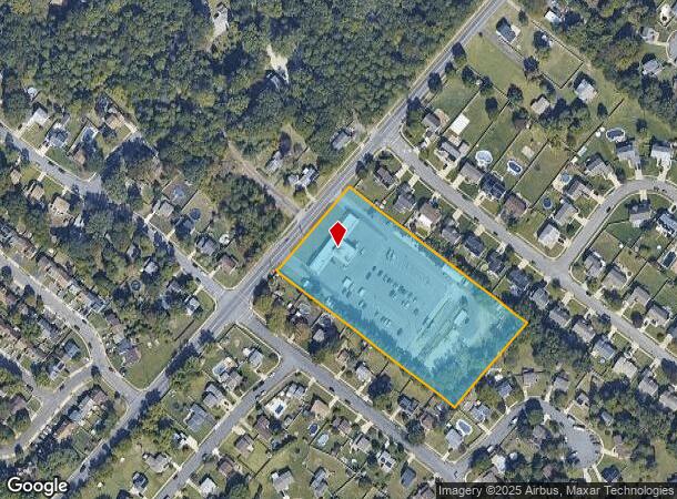
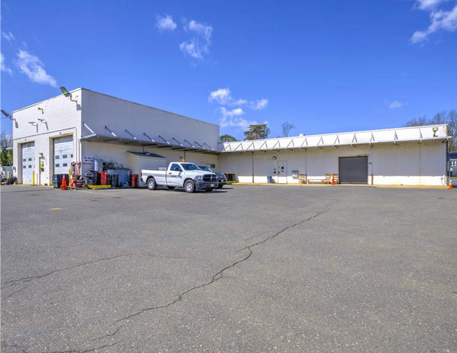
Property Record
132 Jarvis Rd, Sicklerville, NJ 08081

NEARBY LISTINGS FOR SALE OR LEASE
Property Detail
132 Jarvis Rd
15-16704-0000-00001
Camden
Commercialnec
New Jersey
X
1
34015C0119E
4 AC
2024
Camden County
2025
Philadelphia
608403
Philadelphia-Camden-Wilmington, PA-NJ-DE-MD
DEMOGRAPHICS near 132 Jarvis Rd
1 Mile
3 Mile
5 Mile
2024 Total Population
9,449
68,929
175,095
2029 Population
9,513
69,694
177,048
Pop Growth 2024-2029
+ 0.68%
+ 1.11%
+ 1.12%
Average Age
39
40
40
2024 Total Households
3,263
25,012
66,228
HH Growth 2024-2029
+ 0.77%
+ 1.23%
+ 1.11%
Median Household Inc
$119,278
$94,015
$87,387
Avg Household Size
2.80
2.70
2.60
2024 Avg HH Vehicles
2.00
2.00
2.00
Median Home Value
$255,720
$254,155
$245,881
Median Year Built
1985
1983
1979
Nearby Places
Map Layers
Map Styles
 Street
 Aerial
- Restaurants
- Banks
- Shops
- Fitness
- Groceries
PUBLIC TRANSPORTATION
COMMUTER RAIL
Lindenwold (NJT) (Atlantic City Line - NJ Transit Commuter Rail (NJ Transit))
DRIVE
WALK
Distance
Lindenwold (NJT) (Atlantic City Line - NJ Transit Commuter Rail (NJ Transit))
15 min
8.1 mi
Atco (Atlantic City Line - NJ Transit Commuter Rail (NJ Transit))
DRIVE
WALK
Distance
Atco (Atlantic City Line - NJ Transit Commuter Rail (NJ Transit))
15 min
9.9 mi
AIRPORT
Philadelphia International
DRIVE
WALK
Distance
Philadelphia International
36 min
22.1 mi
Atlantic City International
DRIVE
WALK
Distance
Atlantic City International
65 min
37.1 mi
Freight Ports
Broadway Terminal - Pier 5
DRIVE
WALK
Distance
Broadway Terminal - Pier 5
21 min
13.6 mi
SALE & LEASE HISTORY
LISTING DATE
SALE/LEASE

Oct 30, 2017
For Sale
Apr 12, 2022
For Sale
Nearby Properties
Address
Land Use
TOTAL SIZE
Lot Size
Zoning
Address
Land Use
TOTAL SIZE
Lot Size
Zoning
Address
Land Use
TOTAL SIZE
Lot Size
Zoning
14.21 AC
INS
Address
Land Use
TOTAL SIZE
Lot Size
Zoning
54.91 AC
Address
Land Use
TOTAL SIZE
Lot Size
Zoning
136.22 AC
Address
Land Use
TOTAL SIZE
Lot Size
Zoning
68.30 AC
Address
Land Use
TOTAL SIZE
Lot Size
Zoning
48 AC
R-3
Address
Land Use
TOTAL SIZE
Lot Size
Zoning
64.09 AC
HC
Address
Land Use
TOTAL SIZE
Lot Size
Zoning
38.92 AC
HC
Address
Land Use
TOTAL SIZE
Lot Size
Zoning
33.24 AC
INS
Address
Land Use
TOTAL SIZE
Lot Size
Zoning
38.57 AC
INS
Address
Land Use
TOTAL SIZE
Lot Size
Zoning
26.77 AC
HC
Address
Land Use
TOTAL SIZE
Lot Size
Zoning
14.07 AC
Address
Land Use
TOTAL SIZE
Lot Size
Zoning
Address
Land Use
TOTAL SIZE
Lot Size
Zoning
18.02 AC
HC
Address
Land Use
TOTAL SIZE
Lot Size
Zoning
28.68 AC
HC
Address
Land Use
TOTAL SIZE
Lot Size
Zoning
23.61 AC
SC
Address
Land Use
TOTAL SIZE
Lot Size
Zoning
1,796 SF
13.47 AC
Address
Land Use
TOTAL SIZE
Lot Size
Zoning
20.63 AC
C
Address
Land Use
TOTAL SIZE
Lot Size
Zoning
15.36 AC
Address
Land Use
TOTAL SIZE
Lot Size
Zoning
1,563 SF
32.90 AC
RL
Address
Land Use
TOTAL SIZE
Lot Size
Zoning
8.34 AC
INS
Address
Land Use
TOTAL SIZE
Lot Size
Zoning
14.92 AC
HC
Address
Land Use
TOTAL SIZE
Lot Size
Zoning
7.04 AC
INS
Address
Land Use
TOTAL SIZE
Lot Size
Zoning
4.76 AC
Address
Land Use
TOTAL SIZE
Lot Size
Zoning
136,951 SF
18 AC
HC
Address
Land Use
TOTAL SIZE
Lot Size
Zoning
17.54 AC
RD
Address
Land Use
TOTAL SIZE
Lot Size
Zoning
17.53 AC
HC
Address
Land Use
TOTAL SIZE
Lot Size
Zoning
Address
Land Use
TOTAL SIZE
Lot Size
Zoning
13.69 AC
CC
Address
Land Use
TOTAL SIZE
Lot Size
Zoning
15.45 AC
HC
The World's #1 Commercial Real Estate Marketplace
Connect with us
© 2025 CoStar Group
The information above has been obtained from sources believed reliable. While we do not doubt its accuracy we have not verified it and make no guarantee, warranty or representation about it. It is your responsibility to independently confirm its accuracy and completeness. Any projections, opinions, assumptions, or estimates used are for example only and do not represent the current or future performance of the property. The value of this transaction to you depends on tax and other factors which should be evaluated by your tax, financial, and legal advisors. You and your advisors should conduct a careful, independent investigation of the property to determine to your satisfaction the suitability of the property for your needs.