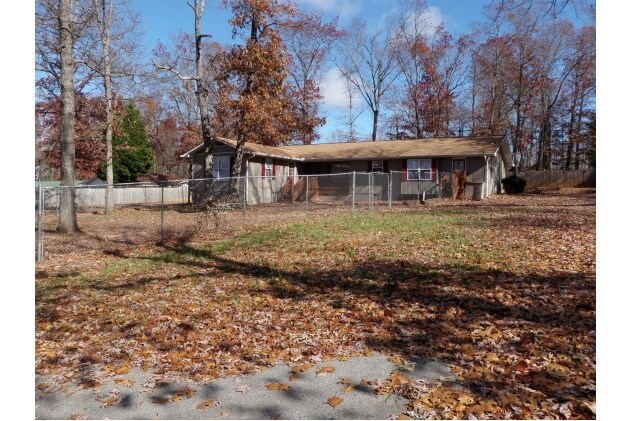
Property Record
132 Locke Rd, Cornelia, GA 30531


NEARBY LISTINGS FOR SALE OR LEASE
Property Detail
132 Locke Rd
Cornelia, GA
Prepared Page B Brks & Pr
083-095
10-114 PB 48-59 1316-1069
Daycare
Habersham
X
Georgia
13137C0217D
114
2025
0.88 AC
2025
Georgia Northeast
000501
Other Market Areas
2,836 SF
DEMOGRAPHICS near 132 Locke Rd
1 mile
3 mile
5 mile
2024 Total Population
1,121
15,332
27,018
2029 Population
1,240
16,857
29,722
Pop Growth 2024-2029
+ 10.62%
+ 9.95%
+ 10.01%
Average Age
38
38
39
2024 Total Households
373
5,405
9,647
HH Growth 2024-2029
+ 10.46%
+ 9.79%
+ 9.75%
Median Household Inc
$79,647
$56,933
$57,049
Avg Household Size
2.80
2.60
2.70
2024 Avg HH Vehicles
2.00
2.00
2.00
Median Home Value
$144,247
$164,007
$169,991
Median Year Built
1981
1987
1989
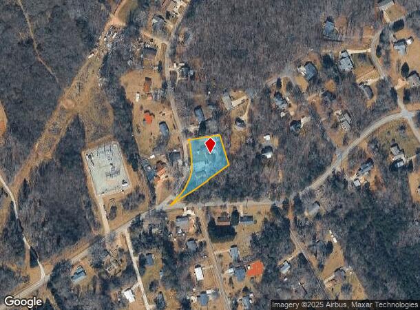
Nearby Places
Map Layers
Map Styles
 Street
 Aerial
Transit
 Traffic
 Biking
Places
Listings with unknown addresses are not visible on the map
- Restaurants
- Banks
- Shops
- Fitness
- Groceries
SALE & LEASE HISTORY
LISTING DATE
SALE/LEASE

Sep 24, 2016
For Sale
Sep 21, 2017
For Lease
Sep 21, 2017
For Sale
Sep 07, 2017
For Lease
Nearby Properties
Address
Land Use
TOTAL SIZE
Lot Size
Zoning
Address
Land Use
TOTAL SIZE
Lot Size
Zoning
200,600 SF
46.46 AC
LI
Address
Land Use
TOTAL SIZE
Lot Size
Zoning
216,507 SF
159.83 AC
MI
Address
Land Use
TOTAL SIZE
Lot Size
Zoning
253,404 SF
22 AC
HI
Address
Land Use
TOTAL SIZE
Lot Size
Zoning
11,264 SF
2 AC
R1B
Address
Land Use
TOTAL SIZE
Lot Size
Zoning
1,332 SF
42.74 AC
I
Address
Land Use
TOTAL SIZE
Lot Size
Zoning
97,144 SF
18 AC
R1A
Address
Land Use
TOTAL SIZE
Lot Size
Zoning
88,728 SF
37.73 AC
LI
Address
Land Use
TOTAL SIZE
Lot Size
Zoning
616 SF
36.38 AC
HI
Address
Land Use
TOTAL SIZE
Lot Size
Zoning
195,516 SF
19.95 AC
B2
Address
Land Use
TOTAL SIZE
Lot Size
Zoning
153,996 SF
24.72 AC
HI
Address
Land Use
TOTAL SIZE
Lot Size
Zoning
75,612 SF
29.13 AC
LI
Address
Land Use
TOTAL SIZE
Lot Size
Zoning
266,882 SF
152.11 AC
I
Address
Land Use
TOTAL SIZE
Lot Size
Zoning
119,632 SF
7.49 AC
HB
Address
Land Use
TOTAL SIZE
Lot Size
Zoning
57,800 SF
2.58 AC
SFR
Address
Land Use
TOTAL SIZE
Lot Size
Zoning
77,729 SF
69.23 AC
I
Address
Land Use
TOTAL SIZE
Lot Size
Zoning
55,608 SF
27.85 AC
I
Address
Land Use
TOTAL SIZE
Lot Size
Zoning
1,247 SF
73.27 AC
LI
Address
Land Use
TOTAL SIZE
Lot Size
Zoning
137,005 SF
20.74 AC
HI
Address
Land Use
TOTAL SIZE
Lot Size
Zoning
131,703 SF
15.25 AC
B1
Address
Land Use
TOTAL SIZE
Lot Size
Zoning
119,181 SF
12.98 AC
HI
Address
Land Use
TOTAL SIZE
Lot Size
Zoning
210,142 SF
27.50 AC
HI
Address
Land Use
TOTAL SIZE
Lot Size
Zoning
175,337 SF
10.63 AC
I
Address
Land Use
TOTAL SIZE
Lot Size
Zoning
75,762 SF
9.98 AC
R2
Address
Land Use
TOTAL SIZE
Lot Size
Zoning
27,492 SF
25.58 AC
LI
Address
Land Use
TOTAL SIZE
Lot Size
Zoning
53,453 SF
27.79 AC
R1
Address
Land Use
TOTAL SIZE
Lot Size
Zoning
21,168 SF
5.32 AC
HI
Address
Land Use
TOTAL SIZE
Lot Size
Zoning
5,291 SF
0.37 AC
RS
Address
Land Use
TOTAL SIZE
Lot Size
Zoning
76,344 SF
38.40 AC
HI
Address
Land Use
TOTAL SIZE
Lot Size
Zoning
47,520 SF
2.02 AC
HI
Address
Land Use
TOTAL SIZE
Lot Size
Zoning
30,632 SF
16.42 AC
LI
The World's #1 Commercial Real Estate Marketplace
Connect with us
© 2026 CoStar Group
The information above has been obtained from sources believed reliable. While we do not doubt its accuracy we have not verified it and make no guarantee, warranty or representation about it. It is your responsibility to independently confirm its accuracy and completeness. Any projections, opinions, assumptions, or estimates used are for example only and do not represent the current or future performance of the property. The value of this transaction to you depends on tax and other factors which should be evaluated by your tax, financial, and legal advisors. You and your advisors should conduct a careful, independent investigation of the property to determine to your satisfaction the suitability of the property for your needs.