Property Record
132 Ohara Ave, Oakley, CA 94561
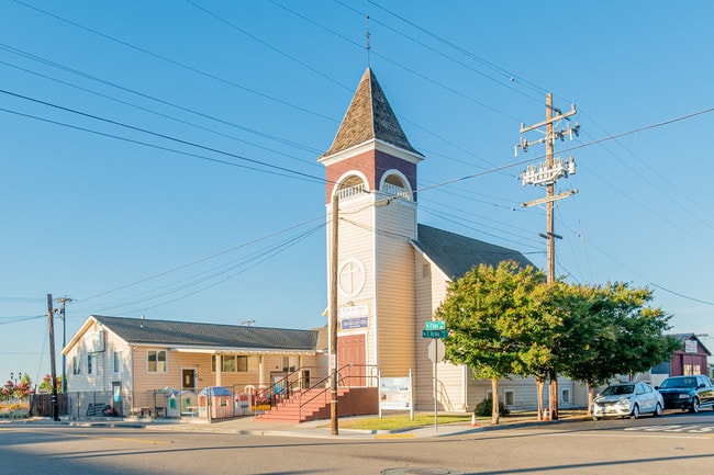


Property Detail
132 Ohara Ave
Oakland-Fremont-Berkeley, CA
TOWN OF OAKLEY LOTS 11 & 12 BLK 1
035-121-006-7
Contra Costa
Publicschool
California
B and X Area of moderate flood hazard, usually the area between the limits of the 100-year and 500-year floods.
11,12
2025
0.21 AC
2025
Antioch/Pittsburg
302007
East Bay/Oakland
5,380 SF
NEARBY LISTINGS FOR SALE OR LEASE
-
-
View all Oakley listings for sale on LoopNet.com
DEMOGRAPHICS near 132 Ohara Ave
1 mile
3 mile
5 mile
2025 Total Population
14,411
64,296
161,523
2030 Population
14,527
65,564
164,084
Pop Growth 2025-2030
+ 0.80%
+ 1.97%
+ 1.59%
Average Age
38
38
39
2025 Total Households
4,513
18,957
48,861
HH Growth 2025-2030
+ 0.82%
+ 1.98%
+ 1.57%
Median Household Inc
$115,749
$131,201
$123,784
Avg Household Size
3.10
3.30
3.20
2025 Avg HH Vehicles
3.00
3.00
3.00
Median Home Value
$666,496
$736,962
$735,847
Median Year Built
1986
1998
1995
Nearby Places
Map Layers
Map Styles
 Street
 Aerial
Layers
 Traffic
 Biking
Places
Listings with unknown addresses are not visible on the map
- Restaurants
- Banks
- Shops
- Fitness
- Groceries
PUBLIC TRANSPORTATION
AIRPORT
Stockton Metro
Drive
Walk
Distance
Stockton Metro
56 min
35.9 mi
Freight Ports
Port of Stockton
Drive
Walk
Distance
Port of Stockton
52 min
33.6 mi
SALE & LEASE HISTORY
LISTING DATE
SALE/LEASE

Sep 24, 2020
For Sale
May 17, 2021
For Sale
Aug 26, 2019
For Sale
Nearby Properties
Address
Land Use
TOTAL SIZE
Lot Size
Zoning
Address
Land Use
TOTAL SIZE
Lot Size
Zoning
24,286 SF
13.89 AC
Address
Land Use
TOTAL SIZE
Lot Size
Zoning
9,999 SF
32.23 AC
Address
Land Use
TOTAL SIZE
Lot Size
Zoning
55.08 AC
Address
Land Use
TOTAL SIZE
Lot Size
Zoning
479,414 SF
30.53 AC
Address
Land Use
TOTAL SIZE
Lot Size
Zoning
28,078 SF
6.46 AC
Address
Land Use
TOTAL SIZE
Lot Size
Zoning
67,133 SF
8.65 AC
Address
Land Use
TOTAL SIZE
Lot Size
Zoning
449,174 SF
38.31 AC
Address
Land Use
TOTAL SIZE
Lot Size
Zoning
145,503 SF
25.05 AC
Address
Land Use
TOTAL SIZE
Lot Size
Zoning
443,591 SF
23.43 AC
Address
Land Use
TOTAL SIZE
Lot Size
Zoning
115,013 SF
6.54 AC
Address
Land Use
TOTAL SIZE
Lot Size
Zoning
97,310 SF
5.85 AC
Address
Land Use
TOTAL SIZE
Lot Size
Zoning
184,623 SF
6.59 AC
Address
Land Use
TOTAL SIZE
Lot Size
Zoning
12,410 SF
5.38 AC
Address
Land Use
TOTAL SIZE
Lot Size
Zoning
40,054 SF
3.39 AC
Address
Land Use
TOTAL SIZE
Lot Size
Zoning
13,468 SF
8.77 AC
Address
Land Use
TOTAL SIZE
Lot Size
Zoning
126,509 SF
11.47 AC
Address
Land Use
TOTAL SIZE
Lot Size
Zoning
23,822 SF
7.16 AC
Address
Land Use
TOTAL SIZE
Lot Size
Zoning
40,995 SF
10.59 AC
Address
Land Use
TOTAL SIZE
Lot Size
Zoning
96,956 SF
10.49 AC
Address
Land Use
TOTAL SIZE
Lot Size
Zoning
141,267 SF
12.75 AC
Address
Land Use
TOTAL SIZE
Lot Size
Zoning
206,866 SF
12.21 AC
Address
Land Use
TOTAL SIZE
Lot Size
Zoning
150,783 SF
5.79 AC
Address
Land Use
TOTAL SIZE
Lot Size
Zoning
62,861 SF
27.55 AC
Address
Land Use
TOTAL SIZE
Lot Size
Zoning
36,915 SF
6.90 AC
Address
Land Use
TOTAL SIZE
Lot Size
Zoning
3,325 SF
447.38 AC
A3
Address
Land Use
TOTAL SIZE
Lot Size
Zoning
37,339 SF
6.68 AC
Address
Land Use
TOTAL SIZE
Lot Size
Zoning
58,039 SF
9.92 AC
Address
Land Use
TOTAL SIZE
Lot Size
Zoning
1,107 SF
425.97 AC
Address
Land Use
TOTAL SIZE
Lot Size
Zoning
23,243 SF
3.88 AC
Address
Land Use
TOTAL SIZE
Lot Size
Zoning
7,550 SF
3.47 AC
The World's #1 Commercial Real Estate Marketplace
Connect with us
© 2026 CoStar Group
The information above has been obtained from sources believed reliable. While we do not doubt its accuracy we have not verified it and make no guarantee, warranty or representation about it. It is your responsibility to independently confirm its accuracy and completeness. Any projections, opinions, assumptions, or estimates used are for example only and do not represent the current or future performance of the property. The value of this transaction to you depends on tax and other factors which should be evaluated by your tax, financial, and legal advisors. You and your advisors should conduct a careful, independent investigation of the property to determine to your satisfaction the suitability of the property for your needs.