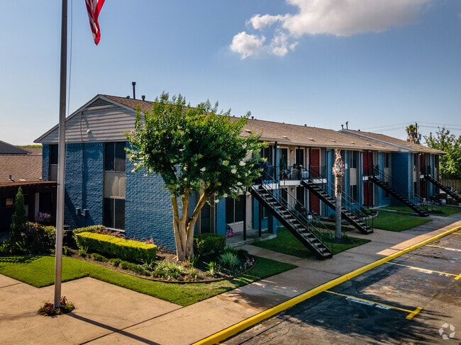
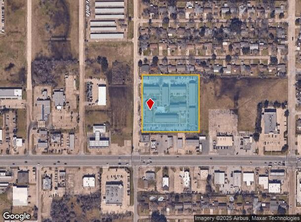
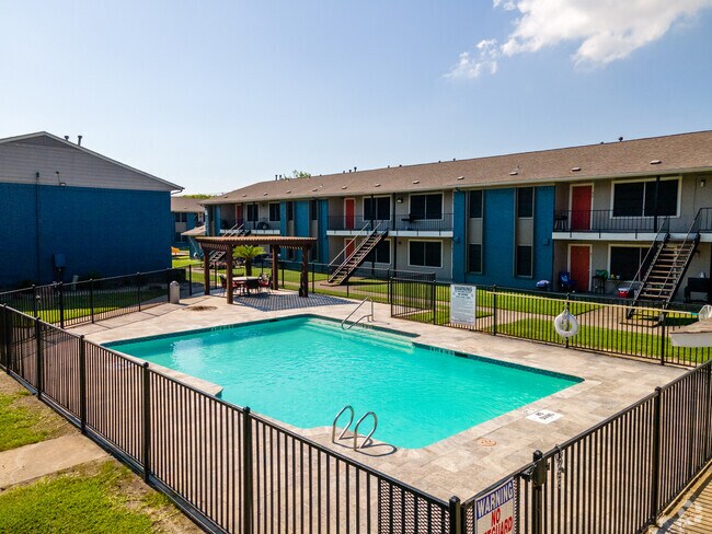
Property Record
1320 31St St N, Texas City, TX 77590

NEARBY LISTINGS FOR SALE OR LEASE
-
-
View all Texas City listings for sale on LoopNet.com
Property Detail
1320 31St St N
Houston-The Woodlands-Sugar Land, TX
Gulf Royal Sub (2008) Abst 142
3754-0000-0001-000
GULF ROYAL SUB (2008) ABST 142, LOT 1, ACRES 3.557
Apartment
Galveston
X
Texas
48167C0265G
1
2024
3.56 AC
2025
South Galveston County
721902
Houston
80,170 SF
DEMOGRAPHICS near 1320 31St St N
1 Mile
3 Mile
5 Mile
2024 Total Population
10,608
40,462
64,357
2029 Population
11,060
42,502
67,555
Pop Growth 2024-2029
+ 4.26%
+ 5.04%
+ 4.97%
Average Age
39
39
40
2024 Total Households
4,210
15,211
24,484
HH Growth 2024-2029
+ 4.39%
+ 5.27%
+ 5.21%
Median Household Inc
$47,657
$51,791
$57,096
Avg Household Size
2.50
2.60
2.50
2024 Avg HH Vehicles
2.00
2.00
2.00
Median Home Value
$135,558
$148,884
$164,137
Median Year Built
1976
1972
1977
Nearby Places
Map Layers
Map Styles
 Street
 Aerial
- Restaurants
- Banks
- Shops
- Fitness
- Groceries
PUBLIC TRANSPORTATION
AIRPORT
William P Hobby
DRIVE
WALK
Distance
William P Hobby
42 min
29.2 mi
Freight Ports
Port of Galveston
DRIVE
WALK
Distance
Port of Galveston
18 min
13.9 mi
SALE & LEASE HISTORY
LISTING DATE
SALE/LEASE

Mar 08, 2022
For Sale
Feb 25, 2022
For Sale
Nearby Properties
Address
Land Use
TOTAL SIZE
Lot Size
Zoning
Address
Land Use
TOTAL SIZE
Lot Size
Zoning
Address
Land Use
TOTAL SIZE
Lot Size
Zoning
Address
Land Use
TOTAL SIZE
Lot Size
Zoning
700,740 SF
31.58 AC
A
Address
Land Use
TOTAL SIZE
Lot Size
Zoning
Address
Land Use
TOTAL SIZE
Lot Size
Zoning
Address
Land Use
TOTAL SIZE
Lot Size
Zoning
Address
Land Use
TOTAL SIZE
Lot Size
Zoning
Address
Land Use
TOTAL SIZE
Lot Size
Zoning
Address
Land Use
TOTAL SIZE
Lot Size
Zoning
Address
Land Use
TOTAL SIZE
Lot Size
Zoning
Address
Land Use
TOTAL SIZE
Lot Size
Zoning
Address
Land Use
TOTAL SIZE
Lot Size
Zoning
107,300 SF
25.86 AC
Address
Land Use
TOTAL SIZE
Lot Size
Zoning
206,560 SF
7.08 AC
Address
Land Use
TOTAL SIZE
Lot Size
Zoning
191,320 SF
9.16 AC
Address
Land Use
TOTAL SIZE
Lot Size
Zoning
Address
Land Use
TOTAL SIZE
Lot Size
Zoning
109,000 SF
43 AC
Address
Land Use
TOTAL SIZE
Lot Size
Zoning
205,260 SF
10.38 AC
Address
Land Use
TOTAL SIZE
Lot Size
Zoning
161,960 SF
8.32 AC
Address
Land Use
TOTAL SIZE
Lot Size
Zoning
171,099 SF
9.99 AC
Address
Land Use
TOTAL SIZE
Lot Size
Zoning
Address
Land Use
TOTAL SIZE
Lot Size
Zoning
Address
Land Use
TOTAL SIZE
Lot Size
Zoning
319,685 SF
28.84 AC
Address
Land Use
TOTAL SIZE
Lot Size
Zoning
162,050 SF
9.14 AC
Address
Land Use
TOTAL SIZE
Lot Size
Zoning
60,288 SF
4.96 AC
Address
Land Use
TOTAL SIZE
Lot Size
Zoning
168,850 SF
10.28 AC
C
Address
Land Use
TOTAL SIZE
Lot Size
Zoning
99,550 SF
9.34 AC
E
Address
Land Use
TOTAL SIZE
Lot Size
Zoning
97,358 SF
6.43 AC
Address
Land Use
TOTAL SIZE
Lot Size
Zoning
46,563 SF
6.46 AC
F
Address
Land Use
TOTAL SIZE
Lot Size
Zoning
114,410 SF
55.31 AC
Address
Land Use
TOTAL SIZE
Lot Size
Zoning
86,894 SF
9.38 AC
A
The World's #1 Commercial Real Estate Marketplace
Connect with us
© 2025 CoStar Group
The information above has been obtained from sources believed reliable. While we do not doubt its accuracy we have not verified it and make no guarantee, warranty or representation about it. It is your responsibility to independently confirm its accuracy and completeness. Any projections, opinions, assumptions, or estimates used are for example only and do not represent the current or future performance of the property. The value of this transaction to you depends on tax and other factors which should be evaluated by your tax, financial, and legal advisors. You and your advisors should conduct a careful, independent investigation of the property to determine to your satisfaction the suitability of the property for your needs.