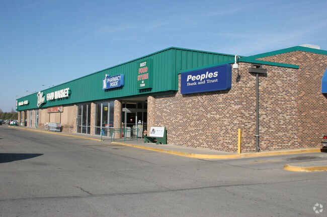
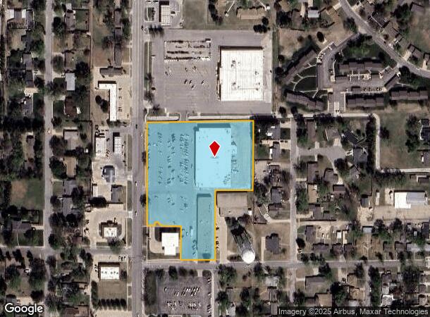
Property Record
1320 N Main St, Mcpherson, KS 67460
NEARBY LISTINGS FOR SALE OR LEASE
Property Detail
1320 N Main St
McPherson, KS
Cook's Subdivision
135-21-0-30-08-002.00-0
COOK'S SUBDIVISION, S21, T19, R03, CA NW/C LT 12 BLK 2 FOR POB TH E462.5' S302.6' W162.5' S300' W150.6' N170' W8 8.7'
Supermarket
Mcpherson
X
Kansas
20113C0218E
12
2024
4.71 AC
2025
Kansas Area
788400
Other Market Areas
39,170 SF
DEMOGRAPHICS near 1320 N Main St
1 Mile
3 Mile
5 Mile
2024 Total Population
7,749
15,059
15,504
2029 Population
7,728
15,042
15,477
Pop Growth 2024-2029
(0.27%)
(0.11%)
(0.17%)
Average Age
42
40
40
2024 Total Households
3,187
6,032
6,207
HH Growth 2024-2029
(0.35%)
(0.17%)
(0.24%)
Median Household Inc
$67,745
$61,178
$61,684
Avg Household Size
2.30
2.30
2.30
2024 Avg HH Vehicles
2.00
2.00
2.00
Median Home Value
$188,105
$172,823
$173,963
Median Year Built
1978
1976
1976
Nearby Places
Map Layers
Map Styles
 Street
 Aerial
- Restaurants
- Banks
- Shops
- Fitness
- Groceries
SALE & LEASE HISTORY
LISTING DATE
SALE/LEASE

Sep 25, 2016
For Lease
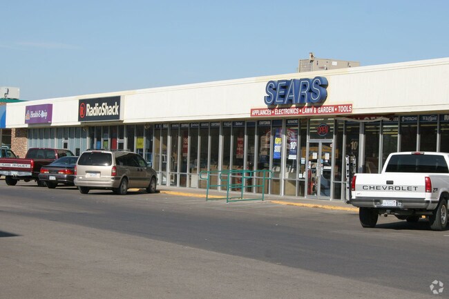
Nearby Properties
Address
Land Use
TOTAL SIZE
Lot Size
Zoning
Address
Land Use
TOTAL SIZE
Lot Size
Zoning
19,502 SF
39.67 AC
Address
Land Use
TOTAL SIZE
Lot Size
Zoning
2,400 SF
405.10 AC
Address
Land Use
TOTAL SIZE
Lot Size
Zoning
158,285 SF
43.11 AC
Address
Land Use
TOTAL SIZE
Lot Size
Zoning
10,384 SF
10.01 AC
Address
Land Use
TOTAL SIZE
Lot Size
Zoning
516,003 SF
94.95 AC
Address
Land Use
TOTAL SIZE
Lot Size
Zoning
150,465 SF
13.17 AC
Address
Land Use
TOTAL SIZE
Lot Size
Zoning
50,269 SF
5.27 AC
Address
Land Use
TOTAL SIZE
Lot Size
Zoning
84,670 SF
33.75 AC
Address
Land Use
TOTAL SIZE
Lot Size
Zoning
2,080 SF
189.39 AC
Address
Land Use
TOTAL SIZE
Lot Size
Zoning
15,083 SF
15.74 AC
Address
Land Use
TOTAL SIZE
Lot Size
Zoning
573,437 SF
151.89 AC
Address
Land Use
TOTAL SIZE
Lot Size
Zoning
125,666 SF
7.56 AC
Address
Land Use
TOTAL SIZE
Lot Size
Zoning
64,152 SF
5.09 AC
Address
Land Use
TOTAL SIZE
Lot Size
Zoning
49,496 SF
9.83 AC
Address
Land Use
TOTAL SIZE
Lot Size
Zoning
48,617 SF
6.34 AC
B6
Address
Land Use
TOTAL SIZE
Lot Size
Zoning
52,060 SF
17.13 AC
Address
Land Use
TOTAL SIZE
Lot Size
Zoning
31,840 SF
4.44 AC
Address
Land Use
TOTAL SIZE
Lot Size
Zoning
25,777 SF
4.25 AC
I2
Address
Land Use
TOTAL SIZE
Lot Size
Zoning
55,426 SF
2.77 AC
Address
Land Use
TOTAL SIZE
Lot Size
Zoning
32,489 SF
0.67 AC
B3
Address
Land Use
TOTAL SIZE
Lot Size
Zoning
51,052 SF
3.51 AC
Address
Land Use
TOTAL SIZE
Lot Size
Zoning
565 SF
54.98 AC
Address
Land Use
TOTAL SIZE
Lot Size
Zoning
42,112 SF
6.24 AC
Address
Land Use
TOTAL SIZE
Lot Size
Zoning
38,200 SF
3.33 AC
R2
Address
Land Use
TOTAL SIZE
Lot Size
Zoning
27,835 SF
4.81 AC
I2
Address
Land Use
TOTAL SIZE
Lot Size
Zoning
16,296 SF
9.11 AC
Address
Land Use
TOTAL SIZE
Lot Size
Zoning
5,000 SF
55.21 AC
Address
Land Use
TOTAL SIZE
Lot Size
Zoning
20,620 SF
9.97 AC
Address
Land Use
TOTAL SIZE
Lot Size
Zoning
23,666 SF
1.18 AC
Address
Land Use
TOTAL SIZE
Lot Size
Zoning
18,918 SF
2.34 AC
The World's #1 Commercial Real Estate Marketplace
Connect with us
© 2025 CoStar Group
The information above has been obtained from sources believed reliable. While we do not doubt its accuracy we have not verified it and make no guarantee, warranty or representation about it. It is your responsibility to independently confirm its accuracy and completeness. Any projections, opinions, assumptions, or estimates used are for example only and do not represent the current or future performance of the property. The value of this transaction to you depends on tax and other factors which should be evaluated by your tax, financial, and legal advisors. You and your advisors should conduct a careful, independent investigation of the property to determine to your satisfaction the suitability of the property for your needs.