Property Record
13200 Conant St, Hamtramck, MI 48212

NEARBY LISTINGS FOR SALE OR LEASE
Property Detail
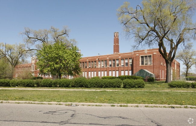
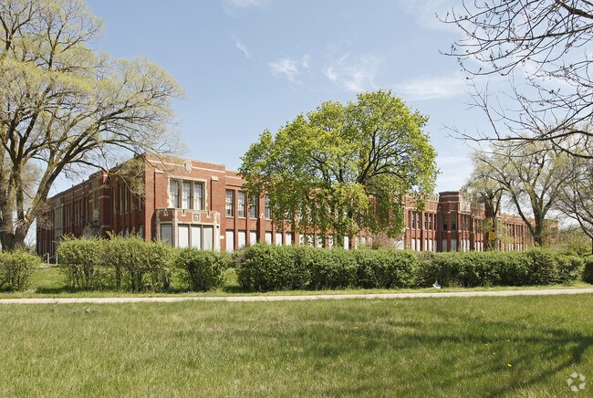
13200 Conant St
13-024945-001
Craig Mayburys
Officebuilding
E CONANT 1 THRU 14 419 THRU 437 W 25 FT OF 438 512 THRU 543 W 25 FT OF 511 & 544 618 THRU 630 W 25 FT OF 617 & VAC STREETS & ALLEYS ADJ CRAIG & MAYBURYS SUB L10 P26 PLATS, W.C.R. 13/217 522.11 IRREG 6.95 A.C.
X
Wayne
26163C0125E
Michigan
2025
6.95 AC
2025
Detroit E of Woodward
511300
Detroit
116,060 SF
Detroit-Warren-Dearborn, MI
DEMOGRAPHICS near 13200 Conant St
1 Mile
3 Mile
5 Mile
2024 Total Population
25,283
129,750
381,766
2029 Population
24,767
129,309
383,993
Pop Growth 2024-2029
(2.04%)
(0.34%)
+ 0.58%
Average Age
34
37
38
2024 Total Households
7,369
47,767
153,425
HH Growth 2024-2029
(1.68%)
+ 0.04%
+ 0.66%
Median Household Inc
$35,271
$35,050
$36,919
Avg Household Size
3.20
2.60
2.40
2024 Avg HH Vehicles
1.00
1.00
1.00
Median Home Value
$81,183
$72,113
$86,648
Median Year Built
1947
1948
1949
Nearby Places
Map Layers
Map Styles
 Street
 Aerial
- Restaurants
- Banks
- Shops
- Fitness
- Groceries
PUBLIC TRANSPORTATION
COMMUTER RAIL
Detroit (Wolverine - Amtrak)
DRIVE
WALK
Distance
Detroit (Wolverine - Amtrak)
10 min
5.0 mi
AIRPORT
Windsor International
DRIVE
WALK
Distance
Windsor International
34 min
16.8 mi
Detroit Metro Wayne County
DRIVE
WALK
Distance
Detroit Metro Wayne County
39 min
26.5 mi
Freight Ports
Port of Toledo
DRIVE
WALK
Distance
Port of Toledo
85 min
67.4 mi
Nearby Properties
Address
Land Use
TOTAL SIZE
Lot Size
Zoning
Address
Land Use
TOTAL SIZE
Lot Size
Zoning
3,793,609 SF
265.70 AC
M4
Address
Land Use
TOTAL SIZE
Lot Size
Zoning
996,200 SF
2.14 AC
Address
Land Use
TOTAL SIZE
Lot Size
Zoning
506,404 SF
198 AC
M4
Address
Land Use
TOTAL SIZE
Lot Size
Zoning
678,539 SF
3.52 AC
B5
Address
Land Use
TOTAL SIZE
Lot Size
Zoning
892,351 SF
92.45 AC
I
Address
Land Use
TOTAL SIZE
Lot Size
Zoning
449,083 SF
2.39 AC
B2
Address
Land Use
TOTAL SIZE
Lot Size
Zoning
331,559 SF
11.42 AC
M4
Address
Land Use
TOTAL SIZE
Lot Size
Zoning
564,958 SF
9.69 AC
M4
Address
Land Use
TOTAL SIZE
Lot Size
Zoning
135,296 SF
1.09 AC
R5
Address
Land Use
TOTAL SIZE
Lot Size
Zoning
263,240 SF
1.21 AC
B4
Address
Land Use
TOTAL SIZE
Lot Size
Zoning
446,500 SF
27.90 AC
Address
Land Use
TOTAL SIZE
Lot Size
Zoning
300,000 SF
0.29 AC
M4
Address
Land Use
TOTAL SIZE
Lot Size
Zoning
123,844 SF
1.81 AC
R2
Address
Land Use
TOTAL SIZE
Lot Size
Zoning
405,004 SF
28.13 AC
M4
Address
Land Use
TOTAL SIZE
Lot Size
Zoning
156,250 SF
8.79 AC
B4
Address
Land Use
TOTAL SIZE
Lot Size
Zoning
214,306 SF
3.76 AC
R3
Address
Land Use
TOTAL SIZE
Lot Size
Zoning
455,634 SF
0.58 AC
Address
Land Use
TOTAL SIZE
Lot Size
Zoning
292,032 SF
20.25 AC
B4
Address
Land Use
TOTAL SIZE
Lot Size
Zoning
353,800 SF
15.70 AC
Address
Land Use
TOTAL SIZE
Lot Size
Zoning
410,359 SF
27.52 AC
M4
Address
Land Use
TOTAL SIZE
Lot Size
Zoning
301,000 SF
Address
Land Use
TOTAL SIZE
Lot Size
Zoning
500,072 SF
12.50 AC
SD2
Address
Land Use
TOTAL SIZE
Lot Size
Zoning
286,023 SF
M4
Address
Land Use
TOTAL SIZE
Lot Size
Zoning
641,836 SF
20.69 AC
M4
Address
Land Use
TOTAL SIZE
Lot Size
Zoning
72,270 SF
0.20 AC
M3
Address
Land Use
TOTAL SIZE
Lot Size
Zoning
2,216,908 SF
44.80 AC
Address
Land Use
TOTAL SIZE
Lot Size
Zoning
217,000 SF
11.91 AC
Address
Land Use
TOTAL SIZE
Lot Size
Zoning
224,148 SF
8.59 AC
M4
Address
Land Use
TOTAL SIZE
Lot Size
Zoning
110,000 SF
1.36 AC
The World's #1 Commercial Real Estate Marketplace
Connect with us
© 2026 CoStar Group
The information above has been obtained from sources believed reliable. While we do not doubt its accuracy we have not verified it and make no guarantee, warranty or representation about it. It is your responsibility to independently confirm its accuracy and completeness. Any projections, opinions, assumptions, or estimates used are for example only and do not represent the current or future performance of the property. The value of this transaction to you depends on tax and other factors which should be evaluated by your tax, financial, and legal advisors. You and your advisors should conduct a careful, independent investigation of the property to determine to your satisfaction the suitability of the property for your needs.