Property Record
13200 E State Highway 29, Georgetown, TX 78626

Property Detail
13200 E State Highway 29
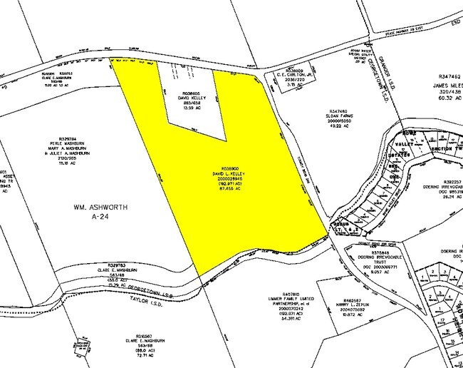
R038900
AW0024 AW0024 - ASHWORTH, WM. SUR., ACRES 11.994, [MH R654371]
Farms
Williamson
B and X Area of moderate flood hazard, usually the area between the limits of the 100-year and 500-year floods.
Texas
2024
11.99 AC
2025
Georgetown
021300
Austin
1,316 SF
Austin-Round Rock-San Marcos, TX
NEARBY LISTINGS FOR SALE OR LEASE
DEMOGRAPHICS near 13200 E State Highway 29
1 mile
3 mile
5 mile
2024 Total Population
58
603
11,735
2029 Population
65
688
13,384
Pop Growth 2024-2029
+ 12.07%
+ 14.10%
+ 14.05%
Average Age
43
42
40
2024 Total Households
22
228
4,383
HH Growth 2024-2029
+ 13.64%
+ 14.47%
+ 14.51%
Median Household Inc
$90,624
$81,428
$84,495
Avg Household Size
2.50
2.60
2.60
2024 Avg HH Vehicles
2.00
2.00
2.00
Median Home Value
$479,999
$469,047
$322,131
Median Year Built
1997
2000
1988
Nearby Places
Map Layers
Map Styles
 Street
 Aerial
Transit
 Traffic
 Biking
Places
Listings with unknown addresses are not visible on the map
- Restaurants
- Banks
- Shops
- Fitness
- Groceries
PUBLIC TRANSPORTATION
COMMUTER RAIL
Taylor Amtrak (Texas Eagle - Amtrak)
Drive
Walk
Distance
Taylor Amtrak (Texas Eagle - Amtrak)
13 min
8.4 mi
Freight Ports
Port of Houston
Drive
Walk
Distance
Port of Houston
210 min
170.7 mi
Nearby Properties
Address
Land Use
TOTAL SIZE
Lot Size
Zoning
Address
Land Use
TOTAL SIZE
Lot Size
Zoning
352.69 AC
Address
Land Use
TOTAL SIZE
Lot Size
Zoning
1,891 SF
15.97 AC
Address
Land Use
TOTAL SIZE
Lot Size
Zoning
20.64 AC
Address
Land Use
TOTAL SIZE
Lot Size
Zoning
11,920 SF
42.30 AC
Address
Land Use
TOTAL SIZE
Lot Size
Zoning
6,827 SF
7.77 AC
Address
Land Use
TOTAL SIZE
Lot Size
Zoning
30.80 AC
Address
Land Use
TOTAL SIZE
Lot Size
Zoning
399.02 AC
Address
Land Use
TOTAL SIZE
Lot Size
Zoning
28,475 SF
10.25 AC
Address
Land Use
TOTAL SIZE
Lot Size
Zoning
1,784 SF
20.07 AC
Address
Land Use
TOTAL SIZE
Lot Size
Zoning
20.91 AC
Address
Land Use
TOTAL SIZE
Lot Size
Zoning
15,820 SF
2.63 AC
Address
Land Use
TOTAL SIZE
Lot Size
Zoning
130 SF
2.60 AC
Address
Land Use
TOTAL SIZE
Lot Size
Zoning
160.46 AC
Address
Land Use
TOTAL SIZE
Lot Size
Zoning
23 SF
3.02 AC
Address
Land Use
TOTAL SIZE
Lot Size
Zoning
37.16 AC
Address
Land Use
TOTAL SIZE
Lot Size
Zoning
1,353 SF
13.90 AC
Address
Land Use
TOTAL SIZE
Lot Size
Zoning
30.80 AC
Address
Land Use
TOTAL SIZE
Lot Size
Zoning
5,479 SF
20 AC
Address
Land Use
TOTAL SIZE
Lot Size
Zoning
6,312 SF
21.42 AC
Address
Land Use
TOTAL SIZE
Lot Size
Zoning
2,400 SF
0.78 AC
Address
Land Use
TOTAL SIZE
Lot Size
Zoning
6,610 SF
422.22 AC
Address
Land Use
TOTAL SIZE
Lot Size
Zoning
6,864 SF
6.47 AC
Address
Land Use
TOTAL SIZE
Lot Size
Zoning
15,786 SF
4.54 AC
Address
Land Use
TOTAL SIZE
Lot Size
Zoning
1,093 SF
10.17 AC
Address
Land Use
TOTAL SIZE
Lot Size
Zoning
24.65 AC
Address
Land Use
TOTAL SIZE
Lot Size
Zoning
29.27 AC
Address
Land Use
TOTAL SIZE
Lot Size
Zoning
9,000 SF
3.94 AC
Address
Land Use
TOTAL SIZE
Lot Size
Zoning
Address
Land Use
TOTAL SIZE
Lot Size
Zoning
3,521 SF
22 AC
Address
Land Use
TOTAL SIZE
Lot Size
Zoning
3,480 SF
107.33 AC
The World's #1 Commercial Real Estate Marketplace
Connect with us
© 2026 CoStar Group
The information above has been obtained from sources believed reliable. While we do not doubt its accuracy we have not verified it and make no guarantee, warranty or representation about it. It is your responsibility to independently confirm its accuracy and completeness. Any projections, opinions, assumptions, or estimates used are for example only and do not represent the current or future performance of the property. The value of this transaction to you depends on tax and other factors which should be evaluated by your tax, financial, and legal advisors. You and your advisors should conduct a careful, independent investigation of the property to determine to your satisfaction the suitability of the property for your needs.