Property Record
13200 Fm 359 Rd, Hempstead, TX 77445
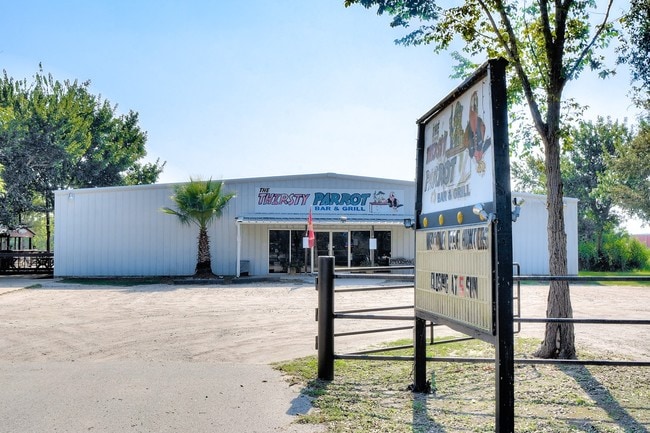


Property Detail
13200 Fm 359 Rd
238705
ABS A304100 A-41 JUSTO LIENDO TRACT 336-15 ACRES 2.729
Commercialnec
WALLER
B and X Area of moderate flood hazard, usually the area between the limits of the 100-year and 500-year floods.
Texas
2023
2.73 AC
2025
Northwest Outliers
680501
Houston
3,750 SF
Houston-Pasadena-The Woodlands, TX
NEARBY LISTINGS FOR SALE OR LEASE
-
-
View all Hempstead listings for sale on LoopNet.com
DEMOGRAPHICS near 13200 Fm 359 Rd
1 mile
3 mile
5 mile
2025 Total Population
192
1,125
2,862
2030 Population
212
1,243
3,164
Pop Growth 2025-2030
+ 10.42%
+ 10.49%
+ 10.55%
Average Age
42
41
40
2025 Total Households
75
422
1,052
HH Growth 2025-2030
+ 9.33%
+ 9.72%
+ 10.08%
Median Household Inc
$71,590
$69,818
$60,757
Avg Household Size
2.60
2.60
2.70
2025 Avg HH Vehicles
2.00
2.00
2.00
Median Home Value
$384,999
$371,428
$351,851
Median Year Built
2000
1999
1995
Nearby Places
Map Layers
Map Styles
 Street
 Aerial
Transit
 Traffic
 Biking
Places
Listings with unknown addresses are not visible on the map
- Restaurants
- Banks
- Shops
- Fitness
- Groceries
SALE & LEASE HISTORY
LISTING DATE
SALE/LEASE

Sep 24, 2016
For Sale
Sep 24, 2016
For Sale
Oct 19, 2021
For Sale
Oct 05, 2016
For Sale
Oct 05, 2016
For Sale
Nov 18, 2022
For Sale
Mar 09, 2019
For Sale
Jun 02, 2025
For Sale
Aug 09, 2024
For Sale
Aug 08, 2018
For Sale
Nearby Properties
Address
Land Use
TOTAL SIZE
Lot Size
Zoning
Address
Land Use
TOTAL SIZE
Lot Size
Zoning
82,818 SF
22.98 AC
Address
Land Use
TOTAL SIZE
Lot Size
Zoning
2,592 SF
26.05 AC
Address
Land Use
TOTAL SIZE
Lot Size
Zoning
1,908 SF
39.22 AC
Address
Land Use
TOTAL SIZE
Lot Size
Zoning
10,560 SF
5.04 AC
Address
Land Use
TOTAL SIZE
Lot Size
Zoning
1,536 SF
41 AC
Address
Land Use
TOTAL SIZE
Lot Size
Zoning
15,695 SF
48.95 AC
Address
Land Use
TOTAL SIZE
Lot Size
Zoning
4,992 SF
2.06 AC
Address
Land Use
TOTAL SIZE
Lot Size
Zoning
6,720 SF
149.86 AC
Address
Land Use
TOTAL SIZE
Lot Size
Zoning
1,104 SF
20 AC
Address
Land Use
TOTAL SIZE
Lot Size
Zoning
3,262 SF
2.80 AC
Address
Land Use
TOTAL SIZE
Lot Size
Zoning
720 SF
20 AC
Address
Land Use
TOTAL SIZE
Lot Size
Zoning
3,432 SF
20.48 AC
Address
Land Use
TOTAL SIZE
Lot Size
Zoning
1,524 SF
24.78 AC
Address
Land Use
TOTAL SIZE
Lot Size
Zoning
4,360 SF
12.28 AC
Address
Land Use
TOTAL SIZE
Lot Size
Zoning
3,174 SF
70 AC
Address
Land Use
TOTAL SIZE
Lot Size
Zoning
5,800 SF
20 AC
Address
Land Use
TOTAL SIZE
Lot Size
Zoning
2,680 SF
15 AC
Address
Land Use
TOTAL SIZE
Lot Size
Zoning
8,190 SF
0.93 AC
Address
Land Use
TOTAL SIZE
Lot Size
Zoning
3,573 SF
10.63 AC
Address
Land Use
TOTAL SIZE
Lot Size
Zoning
3,268 SF
12.45 AC
Address
Land Use
TOTAL SIZE
Lot Size
Zoning
3,121 SF
32.95 AC
Address
Land Use
TOTAL SIZE
Lot Size
Zoning
10,500 SF
3 AC
Address
Land Use
TOTAL SIZE
Lot Size
Zoning
2,534 SF
48.19 AC
Address
Land Use
TOTAL SIZE
Lot Size
Zoning
11,850 SF
2.24 AC
Address
Land Use
TOTAL SIZE
Lot Size
Zoning
5,679 SF
72.52 AC
Address
Land Use
TOTAL SIZE
Lot Size
Zoning
18,168 SF
0.99 AC
Address
Land Use
TOTAL SIZE
Lot Size
Zoning
5,922 SF
25.01 AC
Address
Land Use
TOTAL SIZE
Lot Size
Zoning
3,432 SF
47.23 AC
Address
Land Use
TOTAL SIZE
Lot Size
Zoning
1,832 SF
10.11 AC
The World's #1 Commercial Real Estate Marketplace
Connect with us
© 2026 CoStar Group
The information above has been obtained from sources believed reliable. While we do not doubt its accuracy we have not verified it and make no guarantee, warranty or representation about it. It is your responsibility to independently confirm its accuracy and completeness. Any projections, opinions, assumptions, or estimates used are for example only and do not represent the current or future performance of the property. The value of this transaction to you depends on tax and other factors which should be evaluated by your tax, financial, and legal advisors. You and your advisors should conduct a careful, independent investigation of the property to determine to your satisfaction the suitability of the property for your needs.