Property Record
13201 Belcher Rd S, Largo, FL 33773

NEARBY LISTINGS FOR SALE OR LEASE
Property Detail
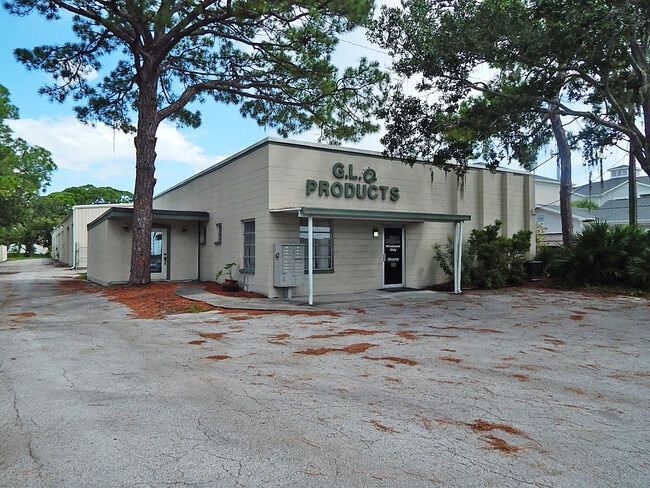
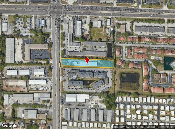
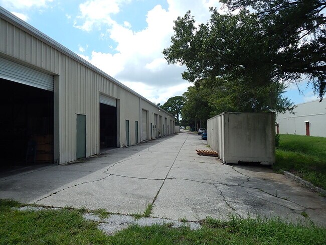
13201 Belcher Rd S
Tampa-St. Petersburg-Clearwater, FL
Pinellas Groves
07-30-16-70956-200-0607
PINELLAS GROVES NW 1/4, SEC 07-30-16 S 90FT OF LOT 6 LESS RD R/W ON W PER OR 52/602
Lightindustrial
Pinellas
X
Florida
12103C0138H
6
2024
1.32 AC
2025
South Pinellas
025020
Tampa/St Petersburg
13,128 SF
DEMOGRAPHICS near 13201 Belcher Rd S
1 Mile
3 Mile
5 Mile
2024 Total Population
16,081
94,696
258,288
2029 Population
16,133
94,841
259,584
Pop Growth 2024-2029
+ 0.32%
+ 0.15%
+ 0.50%
Average Age
45
47
46
2024 Total Households
7,250
43,727
117,813
HH Growth 2024-2029
+ 0.32%
0.00%
+ 0.45%
Median Household Inc
$62,245
$55,351
$57,161
Avg Household Size
2.10
2.10
2.10
2024 Avg HH Vehicles
2.00
2.00
2.00
Median Home Value
$145,520
$202,331
$233,558
Median Year Built
1983
1978
1976
Nearby Places
Map Layers
Map Styles
 Street
 Aerial
- Restaurants
- Banks
- Shops
- Fitness
- Groceries
PUBLIC TRANSPORTATION
AIRPORT
St Pete-Clearwater International
DRIVE
WALK
Distance
St Pete-Clearwater International
16 min
6.5 mi
Tampa International
DRIVE
WALK
Distance
Tampa International
29 min
18.0 mi
Freight Ports
Port of Tampa Bay
DRIVE
WALK
Distance
Port of Tampa Bay
38 min
23.4 mi
SALE & LEASE HISTORY
LISTING DATE
SALE/LEASE

Sep 03, 2020
For Sale
Jul 27, 2021
For Lease
Nearby Properties
Address
Land Use
TOTAL SIZE
Lot Size
Zoning
Address
Land Use
TOTAL SIZE
Lot Size
Zoning
795,890 SF
69.11 AC
M1
Address
Land Use
TOTAL SIZE
Lot Size
Zoning
537,958 SF
41.61 AC
C2
Address
Land Use
TOTAL SIZE
Lot Size
Zoning
520,871 SF
29 AC
R6
Address
Land Use
TOTAL SIZE
Lot Size
Zoning
367,411 SF
16.12 AC
Address
Land Use
TOTAL SIZE
Lot Size
Zoning
367,081 SF
13.80 AC
Address
Land Use
TOTAL SIZE
Lot Size
Zoning
382,389 SF
13.62 AC
Address
Land Use
TOTAL SIZE
Lot Size
Zoning
333,425 SF
33.66 AC
Address
Land Use
TOTAL SIZE
Lot Size
Zoning
337,954 SF
21 AC
R3
Address
Land Use
TOTAL SIZE
Lot Size
Zoning
588,657 SF
33 AC
Address
Land Use
TOTAL SIZE
Lot Size
Zoning
402,681 SF
18.40 AC
Address
Land Use
TOTAL SIZE
Lot Size
Zoning
364,675 SF
66.40 AC
AE
Address
Land Use
TOTAL SIZE
Lot Size
Zoning
384,124 SF
25.78 AC
C3
Address
Land Use
TOTAL SIZE
Lot Size
Zoning
446,556 SF
14.95 AC
M1
Address
Land Use
TOTAL SIZE
Lot Size
Zoning
362,618 SF
40.19 AC
R6
Address
Land Use
TOTAL SIZE
Lot Size
Zoning
266,396 SF
23.18 AC
Address
Land Use
TOTAL SIZE
Lot Size
Zoning
227,858 SF
64.31 AC
AE
Address
Land Use
TOTAL SIZE
Lot Size
Zoning
294,478 SF
44.79 AC
M1
Address
Land Use
TOTAL SIZE
Lot Size
Zoning
352,158 SF
47.45 AC
Address
Land Use
TOTAL SIZE
Lot Size
Zoning
160,014 SF
7.77 AC
Address
Land Use
TOTAL SIZE
Lot Size
Zoning
244,655 SF
16.84 AC
AE
Address
Land Use
TOTAL SIZE
Lot Size
Zoning
582,271 SF
17.14 AC
Address
Land Use
TOTAL SIZE
Lot Size
Zoning
225,515 SF
26.82 AC
Address
Land Use
TOTAL SIZE
Lot Size
Zoning
241,547 SF
9.27 AC
Address
Land Use
TOTAL SIZE
Lot Size
Zoning
249,699 SF
15 AC
Address
Land Use
TOTAL SIZE
Lot Size
Zoning
280,129 SF
Address
Land Use
TOTAL SIZE
Lot Size
Zoning
296,868 SF
20.99 AC
Address
Land Use
TOTAL SIZE
Lot Size
Zoning
319,725 SF
9.14 AC
Address
Land Use
TOTAL SIZE
Lot Size
Zoning
84,057 SF
34.26 AC
Address
Land Use
TOTAL SIZE
Lot Size
Zoning
261,486 SF
30.21 AC
RPD20
Address
Land Use
TOTAL SIZE
Lot Size
Zoning
222,575 SF
15.03 AC
R3
The World's #1 Commercial Real Estate Marketplace
Connect with us
© 2025 CoStar Group
The information above has been obtained from sources believed reliable. While we do not doubt its accuracy we have not verified it and make no guarantee, warranty or representation about it. It is your responsibility to independently confirm its accuracy and completeness. Any projections, opinions, assumptions, or estimates used are for example only and do not represent the current or future performance of the property. The value of this transaction to you depends on tax and other factors which should be evaluated by your tax, financial, and legal advisors. You and your advisors should conduct a careful, independent investigation of the property to determine to your satisfaction the suitability of the property for your needs.