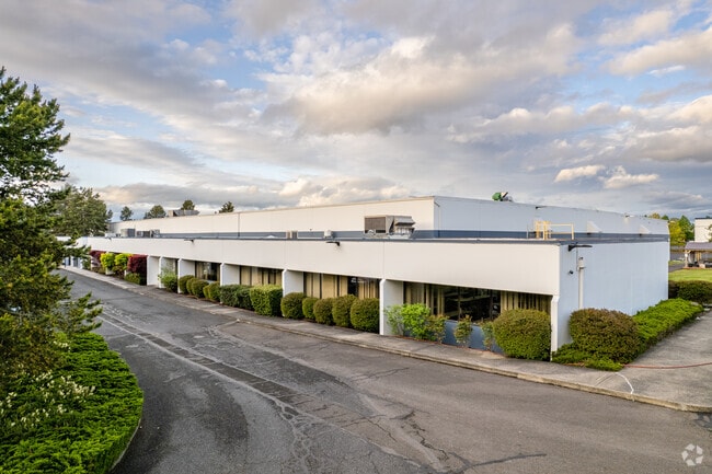
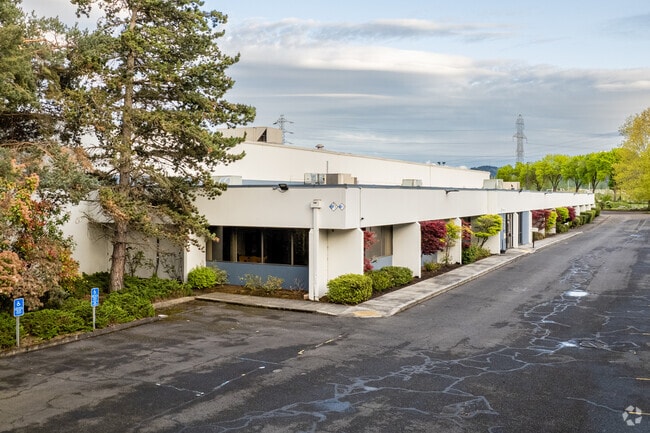
Property Record
13201 N Columbia Blvd, Portland, OR 97203


Property Detail
13201 N Columbia Blvd
R256290
RIVERGATE INDUSTRIAL DIS, BLOCK 15 TL 100, LAND ONLY SEE R256291 (R708883501) IMPS & R256292 (R708883502) FOR OTHER IMPS & R646266 (R708883503) FOR MACH & EQUIP
Industrialacreage
Multnomah
IH
Oregon
C and X Area of minimal flood hazard, usually depicted on FIRMs as above the 500-year flood level.
9.55 AC
2025
Rivergate
2025
Portland
007202
Portland-Vancouver-Hillsboro, OR-WA
NEARBY LISTINGS FOR SALE OR LEASE
DEMOGRAPHICS near 13201 N Columbia Blvd
1 mile
3 mile
5 mile
2025 Total Population
30
19,480
76,166
2030 Population
29
19,187
76,491
Pop Growth 2025-2030
(3.33%)
(1.50%)
+ 0.43%
Average Age
36
39
39
2025 Total Households
10
8,227
30,335
HH Growth 2025-2030
(10.00%)
(1.67%)
+ 0.65%
Median Household Inc
$52,500
$77,906
$96,974
Avg Household Size
2.40
2.30
2.30
2025 Avg HH Vehicles
2.00
2.00
2.00
Median Home Value
$199,999
$473,287
$570,948
Median Year Built
1984
1966
1975
Nearby Places
Map Layers
Map Styles
 Street
 Aerial
Layers
 Traffic
 Biking
Places
Listings with unknown addresses are not visible on the map
- Restaurants
- Banks
- Shops
- Fitness
- Groceries
PUBLIC TRANSPORTATION
COMMUTER RAIL
Drive
Walk
Distance
20 min
9.4 mi
Drive
Walk
Distance
20 min
9.8 mi
AIRPORT
Portland International
Drive
Walk
Distance
Portland International
27 min
12.9 mi
Nearby Properties
Address
Land Use
TOTAL SIZE
Lot Size
Zoning
Address
Land Use
TOTAL SIZE
Lot Size
Zoning
546,069 SF
142 AC
IH
Address
Land Use
TOTAL SIZE
Lot Size
Zoning
890,408 SF
22.48 AC
IH
Address
Land Use
TOTAL SIZE
Lot Size
Zoning
262,045 SF
17.10 AC
R5
Address
Land Use
TOTAL SIZE
Lot Size
Zoning
Address
Land Use
TOTAL SIZE
Lot Size
Zoning
Address
Land Use
TOTAL SIZE
Lot Size
Zoning
335.31 AC
OS
Address
Land Use
TOTAL SIZE
Lot Size
Zoning
48.39 AC
NULL
Address
Land Use
TOTAL SIZE
Lot Size
Zoning
918,400 SF
48.13 AC
IH
Address
Land Use
TOTAL SIZE
Lot Size
Zoning
75.20 AC
IH
Address
Land Use
TOTAL SIZE
Lot Size
Zoning
Address
Land Use
TOTAL SIZE
Lot Size
Zoning
5,045,000 SF
116.53 AC
IH
Address
Land Use
TOTAL SIZE
Lot Size
Zoning
100 SF
82.93 AC
IH
Address
Land Use
TOTAL SIZE
Lot Size
Zoning
37,770 SF
6.90 AC
EG2
Address
Land Use
TOTAL SIZE
Lot Size
Zoning
313,214 SF
NULL
Address
Land Use
TOTAL SIZE
Lot Size
Zoning
5,499,311 SF
40.90 AC
IH
Address
Land Use
TOTAL SIZE
Lot Size
Zoning
200 SF
50.40 AC
IH
Address
Land Use
TOTAL SIZE
Lot Size
Zoning
523,196 SF
21.97 AC
IHH
Address
Land Use
TOTAL SIZE
Lot Size
Zoning
425,395 SF
16.65 AC
IHH
Address
Land Use
TOTAL SIZE
Lot Size
Zoning
309,393 SF
14.87 AC
IH
Address
Land Use
TOTAL SIZE
Lot Size
Zoning
459,662 SF
19.41 AC
IHH
Address
Land Use
TOTAL SIZE
Lot Size
Zoning
385,275 SF
25.29 AC
IH
Address
Land Use
TOTAL SIZE
Lot Size
Zoning
573,020 SF
27.30 AC
IH
Address
Land Use
TOTAL SIZE
Lot Size
Zoning
96.34 AC
IH
Address
Land Use
TOTAL SIZE
Lot Size
Zoning
15 AC
IHH
Address
Land Use
TOTAL SIZE
Lot Size
Zoning
606,639 SF
27.62 AC
IH
Address
Land Use
TOTAL SIZE
Lot Size
Zoning
258.16 AC
OS
Address
Land Use
TOTAL SIZE
Lot Size
Zoning
137,784 SF
8.36 AC
RM1
Address
Land Use
TOTAL SIZE
Lot Size
Zoning
438,700 SF
21.30 AC
IH
Address
Land Use
TOTAL SIZE
Lot Size
Zoning
325,908 SF
17.61 AC
IHH
Address
Land Use
TOTAL SIZE
Lot Size
Zoning
491,262 SF
24.49 AC
IH
The World's #1 Commercial Real Estate Marketplace
Connect with us
© 2026 CoStar Group
The information above has been obtained from sources believed reliable. While we do not doubt its accuracy we have not verified it and make no guarantee, warranty or representation about it. It is your responsibility to independently confirm its accuracy and completeness. Any projections, opinions, assumptions, or estimates used are for example only and do not represent the current or future performance of the property. The value of this transaction to you depends on tax and other factors which should be evaluated by your tax, financial, and legal advisors. You and your advisors should conduct a careful, independent investigation of the property to determine to your satisfaction the suitability of the property for your needs.