Property Record
1321 3Rd St, Three Rivers, MI 49093
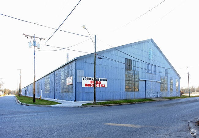


Property Detail
1321 3Rd St
051-299-038-00
COM INT S LN E BROADWAY ST & W LN THIRD ST TH W ALG E BROADWAY 347.83 FT TO POB TH W 52.17 FT TH S PRL WITH W LN THIRD ST 598
Industrialgeneral
Saint Joseph
I-2
Michigan
AE The base floodplain where base flood elevations are provided. AE Zones are now used on new format FIRMs instead of A1-A30 Zones.
21.30 AC
2025
Michigan Southwest Area
2025
Other Market Areas
040200
Sturgis, MI
239,049 SF
NEARBY LISTINGS FOR SALE OR LEASE
DEMOGRAPHICS near 1321 3Rd St
1 mile
3 mile
5 mile
2025 Total Population
4,075
10,796
14,777
2030 Population
4,077
10,787
14,810
Pop Growth 2025-2030
+ 0.05%
(0.08%)
+ 0.22%
Average Age
37
39
40
2025 Total Households
1,581
4,227
5,816
HH Growth 2025-2030
(0.13%)
(0.21%)
+ 0.14%
Median Household Inc
$50,909
$55,956
$61,819
Avg Household Size
2.50
2.50
2.50
2025 Avg HH Vehicles
2.00
2.00
2.00
Median Home Value
$125,540
$154,329
$176,454
Median Year Built
1966
1966
1969
Nearby Places
Map Layers
Map Styles
 Street
 Aerial
Layers
 Traffic
 Biking
Places
Listings with unknown addresses are not visible on the map
- Restaurants
- Banks
- Shops
- Fitness
- Groceries
PUBLIC TRANSPORTATION
AIRPORT
Kalamazoo/Battle Creek International
Drive
Walk
Distance
Kalamazoo/Battle Creek International
38 min
27.2 mi
Freight Ports
Port of Toledo
Drive
Walk
Distance
Port of Toledo
169 min
140.6 mi
Nearby Properties
Address
Land Use
TOTAL SIZE
Lot Size
Zoning
Address
Land Use
TOTAL SIZE
Lot Size
Zoning
2,160 SF
128.90 AC
I-2
Address
Land Use
TOTAL SIZE
Lot Size
Zoning
312,414 SF
58.17 AC
Address
Land Use
TOTAL SIZE
Lot Size
Zoning
140,468 SF
12.99 AC
Address
Land Use
TOTAL SIZE
Lot Size
Zoning
194,305 SF
29.62 AC
B-2
Address
Land Use
TOTAL SIZE
Lot Size
Zoning
Address
Land Use
TOTAL SIZE
Lot Size
Zoning
156,459 SF
10.03 AC
R-5
Address
Land Use
TOTAL SIZE
Lot Size
Zoning
183,162 SF
35.60 AC
B-2
Address
Land Use
TOTAL SIZE
Lot Size
Zoning
219,083 SF
8.90 AC
I-2
Address
Land Use
TOTAL SIZE
Lot Size
Zoning
123,612 SF
10 AC
B-2
Address
Land Use
TOTAL SIZE
Lot Size
Zoning
138,328 SF
10.25 AC
R-5
Address
Land Use
TOTAL SIZE
Lot Size
Zoning
41,325 SF
24.80 AC
I-2
Address
Land Use
TOTAL SIZE
Lot Size
Zoning
16,962 SF
3.77 AC
B3
Address
Land Use
TOTAL SIZE
Lot Size
Zoning
109,816 SF
7.14 AC
I-2
Address
Land Use
TOTAL SIZE
Lot Size
Zoning
255,000 SF
6.69 AC
I-2
Address
Land Use
TOTAL SIZE
Lot Size
Zoning
123,555 SF
10.67 AC
I-2
Address
Land Use
TOTAL SIZE
Lot Size
Zoning
91,200 SF
11.80 AC
B-2
Address
Land Use
TOTAL SIZE
Lot Size
Zoning
110,068 SF
10.87 AC
I-2
Address
Land Use
TOTAL SIZE
Lot Size
Zoning
26,218 SF
2.35 AC
R
Address
Land Use
TOTAL SIZE
Lot Size
Zoning
127,184 SF
12.68 AC
Address
Land Use
TOTAL SIZE
Lot Size
Zoning
80,772 SF
10.36 AC
I-2
Address
Land Use
TOTAL SIZE
Lot Size
Zoning
12,883 SF
2 AC
Address
Land Use
TOTAL SIZE
Lot Size
Zoning
40,440 SF
6.70 AC
B-2
Address
Land Use
TOTAL SIZE
Lot Size
Zoning
2,544 SF
215.58 AC
Address
Land Use
TOTAL SIZE
Lot Size
Zoning
50,583 SF
6.21 AC
I-1
Address
Land Use
TOTAL SIZE
Lot Size
Zoning
47,264 SF
7.30 AC
B-2
Address
Land Use
TOTAL SIZE
Lot Size
Zoning
50,058 SF
2.07 AC
R
Address
Land Use
TOTAL SIZE
Lot Size
Zoning
100,585 SF
8.25 AC
I-2
Address
Land Use
TOTAL SIZE
Lot Size
Zoning
19,448 SF
2.71 AC
Address
Land Use
TOTAL SIZE
Lot Size
Zoning
52,707 SF
5.83 AC
B-2
The World's #1 Commercial Real Estate Marketplace
Connect with us
© 2026 CoStar Group
The information above has been obtained from sources believed reliable. While we do not doubt its accuracy we have not verified it and make no guarantee, warranty or representation about it. It is your responsibility to independently confirm its accuracy and completeness. Any projections, opinions, assumptions, or estimates used are for example only and do not represent the current or future performance of the property. The value of this transaction to you depends on tax and other factors which should be evaluated by your tax, financial, and legal advisors. You and your advisors should conduct a careful, independent investigation of the property to determine to your satisfaction the suitability of the property for your needs.