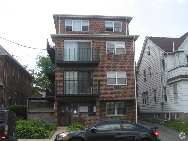
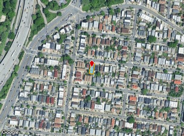
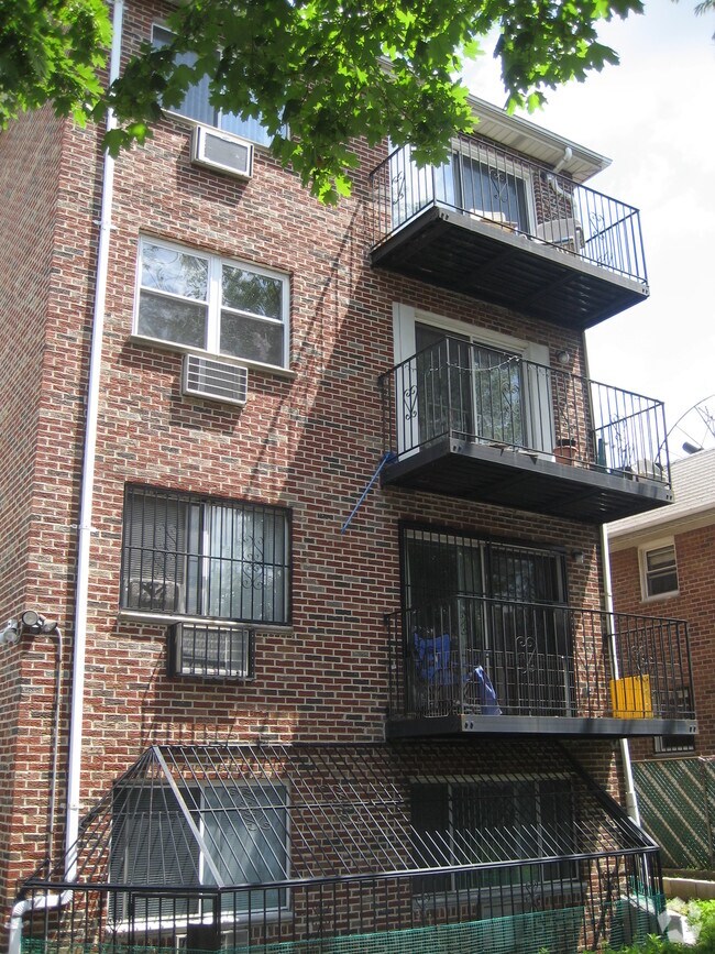
Property Record
13218 57Th Rd, Flushing, NY 11355

NEARBY LISTINGS FOR SALE OR LEASE
-
-
-
-
-
-
-
-
-
-
-
-
-
-
-
-
-
-
-
-
-
-
No Photo
-
-
-
-
-
-
-
-
-
View all Flushing listings for sale on LoopNet.com
Property Detail
13218 57Th Rd
06359-0008
Queensboro Hill Map 01/Prop/Qu
Multifamilydwelling
Queens
X
New York
3604970227F
8
2024
0.09 AC
2025
Queensboro Hill
080301
Long Island (New York)
5,280 SF
New York-Jersey City-White Plains, NY-NJ
DEMOGRAPHICS near 13218 57Th Rd
1 Mile
3 Mile
5 Mile
2024 Total Population
76,502
829,615
1,701,926
2029 Population
72,649
780,129
1,586,245
Pop Growth 2024-2029
(5.04%)
(5.96%)
(6.80%)
Average Age
44
42
41
2024 Total Households
26,626
288,991
592,351
HH Growth 2024-2029
(5.36%)
(6.01%)
(6.93%)
Median Household Inc
$47,844
$67,959
$72,232
Avg Household Size
2.70
2.70
2.70
2024 Avg HH Vehicles
1.00
1.00
1.00
Median Home Value
$691,241
$667,726
$690,108
Median Year Built
1962
1954
1951
Nearby Places
Map Layers
Map Styles
 Street
 Aerial
- Restaurants
- Banks
- Shops
- Fitness
- Groceries
PUBLIC TRANSPORTATION
TRANSIT/SUBWAY
Mets-Willets Point Station (Port Washington Branch - Long Island Rail Road)
DRIVE
WALK
Distance
Mets-Willets Point Station (Port Washington Branch - Long Island Rail Road)
5 min
18 min
0.9 mi
COMMUTER RAIL
Mets-Willets Point Station (Port Washington Branch - Long Island Rail Road)
DRIVE
WALK
Distance
Mets-Willets Point Station (Port Washington Branch - Long Island Rail Road)
5 min
18 min
0.9 mi
Flushing-Main Street Station (Port Washington Branch - Long Island Rail Road)
DRIVE
WALK
Distance
Flushing-Main Street Station (Port Washington Branch - Long Island Rail Road)
4 min
1.3 mi
AIRPORT
LaGuardia
DRIVE
WALK
Distance
LaGuardia
10 min
4.3 mi
John F Kennedy International
DRIVE
WALK
Distance
John F Kennedy International
16 min
9.4 mi
Newark Liberty International
DRIVE
WALK
Distance
Newark Liberty International
38 min
23.7 mi
Freight Ports
NY - Red Hook Container Terminal
DRIVE
WALK
Distance
NY - Red Hook Container Terminal
22 min
12.4 mi
Nearby Properties
Address
Land Use
TOTAL SIZE
Lot Size
Zoning
Address
Land Use
TOTAL SIZE
Lot Size
Zoning
4,528,000 SF
94.27 AC
R4
Address
Land Use
TOTAL SIZE
Lot Size
Zoning
2,078,606 SF
58.93 AC
R4
Address
Land Use
TOTAL SIZE
Lot Size
Zoning
1,258,350 SF
410.24 AC
PARK
Address
Land Use
TOTAL SIZE
Lot Size
Zoning
1,069,367 SF
14.65 AC
R4
Address
Land Use
TOTAL SIZE
Lot Size
Zoning
1,502,532 SF
6.35 AC
R7B
Address
Land Use
TOTAL SIZE
Lot Size
Zoning
772,163 SF
5.24 AC
C4-5X
Address
Land Use
TOTAL SIZE
Lot Size
Zoning
1,292,074 SF
C4-2F
Address
Land Use
TOTAL SIZE
Lot Size
Zoning
234,891 SF
3.17 AC
C4-5X
Address
Land Use
TOTAL SIZE
Lot Size
Zoning
1,516,458 SF
5.97 AC
R7-1
Address
Land Use
TOTAL SIZE
Lot Size
Zoning
15,000 SF
255.27 AC
PARK
Address
Land Use
TOTAL SIZE
Lot Size
Zoning
4,800 SF
80.10 AC
PARK
Address
Land Use
TOTAL SIZE
Lot Size
Zoning
1,000 SF
210.07 AC
R3-2
Address
Land Use
TOTAL SIZE
Lot Size
Zoning
332,266 SF
12.57 AC
M2-1
Address
Land Use
TOTAL SIZE
Lot Size
Zoning
1,186,778 SF
31.45 AC
R4
Address
Land Use
TOTAL SIZE
Lot Size
Zoning
344,116 SF
0.92 AC
R7-1
Address
Land Use
TOTAL SIZE
Lot Size
Zoning
577,654 SF
5.38 AC
R6
Address
Land Use
TOTAL SIZE
Lot Size
Zoning
2,193 SF
94.72 AC
PARK
Address
Land Use
TOTAL SIZE
Lot Size
Zoning
521,944 SF
16.68 AC
R4
Address
Land Use
TOTAL SIZE
Lot Size
Zoning
360,000 SF
5.88 AC
C4-2
Address
Land Use
TOTAL SIZE
Lot Size
Zoning
307,038 SF
7.84 AC
M1-1
Address
Land Use
TOTAL SIZE
Lot Size
Zoning
234,452 SF
2.99 AC
R4
Address
Land Use
TOTAL SIZE
Lot Size
Zoning
248,200 SF
1.25 AC
R6
Address
Land Use
TOTAL SIZE
Lot Size
Zoning
377,896 SF
11.36 AC
R3-2
Address
Land Use
TOTAL SIZE
Lot Size
Zoning
384,249 SF
5.56 AC
R5
Address
Land Use
TOTAL SIZE
Lot Size
Zoning
364,424 SF
C5-3
Address
Land Use
TOTAL SIZE
Lot Size
Zoning
250,577 SF
23.17 AC
M2-1
Address
Land Use
TOTAL SIZE
Lot Size
Zoning
266,195 SF
4.59 AC
C4-2
Address
Land Use
TOTAL SIZE
Lot Size
Zoning
272,081 SF
4.59 AC
C4-2
Address
Land Use
TOTAL SIZE
Lot Size
Zoning
240,000 SF
2.09 AC
R6
Address
Land Use
TOTAL SIZE
Lot Size
Zoning
281,416 SF
2.57 AC
C4-2
The World's #1 Commercial Real Estate Marketplace
Connect with us
© 2026 CoStar Group
The information above has been obtained from sources believed reliable. While we do not doubt its accuracy we have not verified it and make no guarantee, warranty or representation about it. It is your responsibility to independently confirm its accuracy and completeness. Any projections, opinions, assumptions, or estimates used are for example only and do not represent the current or future performance of the property. The value of this transaction to you depends on tax and other factors which should be evaluated by your tax, financial, and legal advisors. You and your advisors should conduct a careful, independent investigation of the property to determine to your satisfaction the suitability of the property for your needs.