Property Record
1322 Everett St, Madison, WI 53704

Property Detail
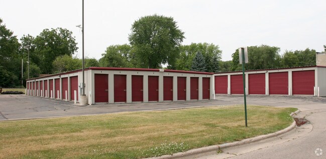
1322 Everett St
0810-312-2451-2
CERTIFIED SURVEY MAP NO 13374 AS RECORDED IN DANE COUNTY REGISTER OF DEEDS IN VO L 86 PAGE 303 OF CERTIFIED SURVEYS, LOT 3
Commercialnec
DANE
IL
Wisconsin
B and X Area of moderate flood hazard, usually the area between the limits of the 100-year and 500-year floods.
86
2025
0.43 AC
2025
Northeast Madison
002500
Milwaukee/Madison
8,120 SF
Madison, WI
NEARBY LISTINGS FOR SALE OR LEASE
DEMOGRAPHICS near 1322 Everett St
1 mile
3 mile
5 mile
2024 Total Population
8,952
60,622
207,414
2029 Population
9,341
62,949
220,944
Pop Growth 2024-2029
+ 4.35%
+ 3.84%
+ 6.52%
Average Age
41
40
36
2024 Total Households
4,500
30,100
92,823
HH Growth 2024-2029
+ 4.67%
+ 4.16%
+ 6.87%
Median Household Inc
$58,893
$70,827
$66,557
Avg Household Size
1.90
1.90
2.00
2024 Avg HH Vehicles
1.00
1.00
1.00
Median Home Value
$294,726
$320,531
$360,392
Median Year Built
1955
1966
1979
Nearby Places
Map Layers
Map Styles
 Street
 Aerial
Transit
 Traffic
 Biking
Places
Listings with unknown addresses are not visible on the map
- Restaurants
- Banks
- Shops
- Fitness
- Groceries
PUBLIC TRANSPORTATION
AIRPORT
Dane County Regional/Truax Field
Drive
Walk
Distance
Dane County Regional/Truax Field
5 min
2.2 mi
Nearby Properties
Address
Land Use
TOTAL SIZE
Lot Size
Zoning
Address
Land Use
TOTAL SIZE
Lot Size
Zoning
287,341 SF
40.17 AC
IL
Address
Land Use
TOTAL SIZE
Lot Size
Zoning
461,594 SF
3.37 AC
CC-T
Address
Land Use
TOTAL SIZE
Lot Size
Zoning
278,154 SF
3.88 AC
TE
Address
Land Use
TOTAL SIZE
Lot Size
Zoning
296,708 SF
1 AC
WP-24
Address
Land Use
TOTAL SIZE
Lot Size
Zoning
289,884 SF
19.36 AC
SR-V2
Address
Land Use
TOTAL SIZE
Lot Size
Zoning
211,457 SF
329.05 AC
WP-24
Address
Land Use
TOTAL SIZE
Lot Size
Zoning
145,539 SF
0.60 AC
UMX
Address
Land Use
TOTAL SIZE
Lot Size
Zoning
194,232 SF
2.25 AC
TR-U2
Address
Land Use
TOTAL SIZE
Lot Size
Zoning
268,388 SF
1 AC
WP-24
Address
Land Use
TOTAL SIZE
Lot Size
Zoning
216,017 SF
3.35 AC
TE
Address
Land Use
TOTAL SIZE
Lot Size
Zoning
189,583 SF
0.01 AC
PD
Address
Land Use
TOTAL SIZE
Lot Size
Zoning
141,058 SF
WP-24
Address
Land Use
TOTAL SIZE
Lot Size
Zoning
115,920 SF
2.38 AC
WP-24
Address
Land Use
TOTAL SIZE
Lot Size
Zoning
137,835 SF
1.49 AC
WP-17
Address
Land Use
TOTAL SIZE
Lot Size
Zoning
148,747 SF
0.83 AC
WP-24
Address
Land Use
TOTAL SIZE
Lot Size
Zoning
547,019 SF
29.06 AC
RMX
Address
Land Use
TOTAL SIZE
Lot Size
Zoning
103,769 SF
11.21 AC
WP-15
Address
Land Use
TOTAL SIZE
Lot Size
Zoning
77,504 SF
0.50 AC
WP-24
Address
Land Use
TOTAL SIZE
Lot Size
Zoning
176,088 SF
6.29 AC
PD
Address
Land Use
TOTAL SIZE
Lot Size
Zoning
109,450 SF
4.33 AC
TR-U1
Address
Land Use
TOTAL SIZE
Lot Size
Zoning
99,697 SF
0.33 AC
WP-17
Address
Land Use
TOTAL SIZE
Lot Size
Zoning
109,396 SF
3 AC
PD
Address
Land Use
TOTAL SIZE
Lot Size
Zoning
14,058 SF
0.60 AC
WP-17
Address
Land Use
TOTAL SIZE
Lot Size
Zoning
63,081 SF
3.36 AC
PD
Address
Land Use
TOTAL SIZE
Lot Size
Zoning
74,286 SF
1.02 AC
CC-T
Address
Land Use
TOTAL SIZE
Lot Size
Zoning
150,439 SF
4.71 AC
CC-T
Address
Land Use
TOTAL SIZE
Lot Size
Zoning
87,541 SF
1.85 AC
TR-U2
Address
Land Use
TOTAL SIZE
Lot Size
Zoning
171,521 SF
1.19 AC
UOR
Address
Land Use
TOTAL SIZE
Lot Size
Zoning
134,088 SF
6.45 AC
PD
Address
Land Use
TOTAL SIZE
Lot Size
Zoning
105,743 SF
9.50 AC
IG
The World's #1 Commercial Real Estate Marketplace
Connect with us
© 2026 CoStar Group
The information above has been obtained from sources believed reliable. While we do not doubt its accuracy we have not verified it and make no guarantee, warranty or representation about it. It is your responsibility to independently confirm its accuracy and completeness. Any projections, opinions, assumptions, or estimates used are for example only and do not represent the current or future performance of the property. The value of this transaction to you depends on tax and other factors which should be evaluated by your tax, financial, and legal advisors. You and your advisors should conduct a careful, independent investigation of the property to determine to your satisfaction the suitability of the property for your needs.