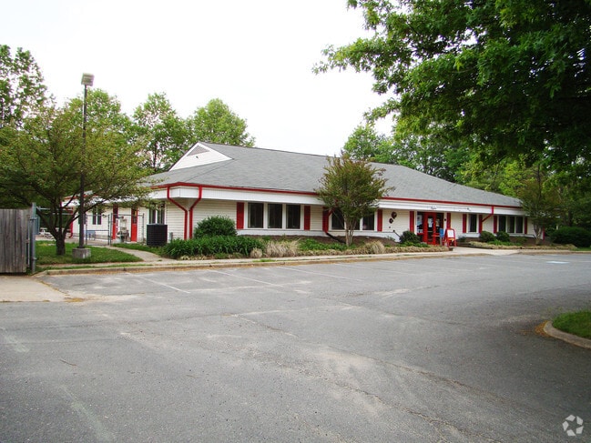
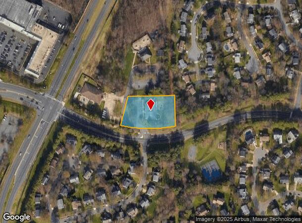
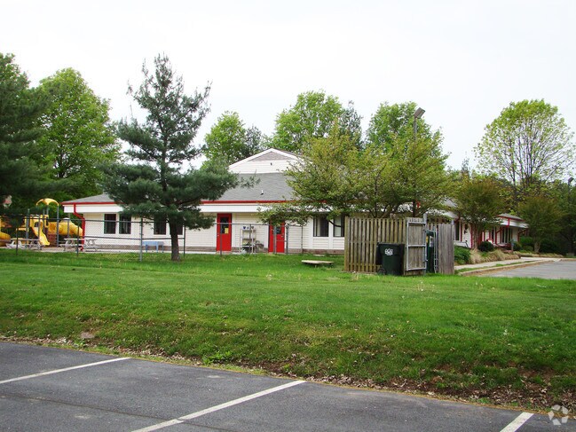
Property Record
13220 Franklin Farm Rd, Herndon, VA 20171
NEARBY LISTINGS FOR SALE OR LEASE
Property Detail
13220 Franklin Farm Rd
Washington-Arlington-Alexandria, DC-VA-MD-WV
Franklin Farm
0351-0419-C1
FRANKLIN FARM PCL C-1 SEC 19
Daycare
Fairfax
X
Virginia
51059C0120E
c
2024
1.42 AC
2025
Route 28 Corridor South
482504
Washington, DC
6,016 SF
DEMOGRAPHICS near 13220 Franklin Farm Rd
1 Mile
3 Mile
5 Mile
2024 Total Population
12,422
90,448
250,821
2029 Population
12,161
89,027
248,317
Pop Growth 2024-2029
(2.10%)
(1.57%)
(1.00%)
Average Age
40
39
38
2024 Total Households
3,963
30,050
93,901
HH Growth 2024-2029
(2.27%)
(1.62%)
(0.92%)
Median Household Inc
$192,903
$160,324
$136,177
Avg Household Size
3.10
2.90
2.60
2024 Avg HH Vehicles
2.00
2.00
2.00
Median Home Value
$738,861
$720,743
$662,681
Median Year Built
1985
1987
1990
Nearby Places
Map Layers
Map Styles
 Street
 Aerial
- Restaurants
- Banks
- Shops
- Fitness
- Groceries
PUBLIC TRANSPORTATION
AIRPORT
Washington Dulles International
DRIVE
WALK
Distance
Washington Dulles International
18 min
7.8 mi
Ronald Reagan Washington Ntl
DRIVE
WALK
Distance
Ronald Reagan Washington Ntl
39 min
26.3 mi
Freight Ports
Port of Baltimore
DRIVE
WALK
Distance
Port of Baltimore
82 min
59.7 mi
Nearby Properties
Address
Land Use
TOTAL SIZE
Lot Size
Zoning
Address
Land Use
TOTAL SIZE
Lot Size
Zoning
760,000 SF
2,461.49 AC
110
Address
Land Use
TOTAL SIZE
Lot Size
Zoning
1,030,157 SF
47.95 AC
550
Address
Land Use
TOTAL SIZE
Lot Size
Zoning
440,870 SF
47.69 AC
550
Address
Land Use
TOTAL SIZE
Lot Size
Zoning
602,129 SF
32.09 AC
220
Address
Land Use
TOTAL SIZE
Lot Size
Zoning
565,554 SF
21.17 AC
402
Address
Land Use
TOTAL SIZE
Lot Size
Zoning
520,500 SF
7.29 AC
400
Address
Land Use
TOTAL SIZE
Lot Size
Zoning
451,000 SF
7.50 AC
550
Address
Land Use
TOTAL SIZE
Lot Size
Zoning
325,000 SF
22.05 AC
550
Address
Land Use
TOTAL SIZE
Lot Size
Zoning
519,708 SF
18.73 AC
316
Address
Land Use
TOTAL SIZE
Lot Size
Zoning
507,264 SF
10.44 AC
400
Address
Land Use
TOTAL SIZE
Lot Size
Zoning
423,718 SF
26.11 AC
596
Address
Land Use
TOTAL SIZE
Lot Size
Zoning
513,947 SF
22.23 AC
400
Address
Land Use
TOTAL SIZE
Lot Size
Zoning
387,620 SF
6.01 AC
350
Address
Land Use
TOTAL SIZE
Lot Size
Zoning
492,219 SF
16.89 AC
330
Address
Land Use
TOTAL SIZE
Lot Size
Zoning
349,581 SF
28.70 AC
460
Address
Land Use
TOTAL SIZE
Lot Size
Zoning
378,000 SF
9.06 AC
550
Address
Land Use
TOTAL SIZE
Lot Size
Zoning
453,939 SF
17.70 AC
320
Address
Land Use
TOTAL SIZE
Lot Size
Zoning
205,376 SF
15.23 AC
396
Address
Land Use
TOTAL SIZE
Lot Size
Zoning
270,152 SF
6.94 AC
180
Address
Land Use
TOTAL SIZE
Lot Size
Zoning
328,057 SF
8.27 AC
312
Address
Land Use
TOTAL SIZE
Lot Size
Zoning
302,950 SF
12.72 AC
316
Address
Land Use
TOTAL SIZE
Lot Size
Zoning
248,146 SF
12.44 AC
540
Address
Land Use
TOTAL SIZE
Lot Size
Zoning
10.98 AC
402
Address
Land Use
TOTAL SIZE
Lot Size
Zoning
178,723 SF
32.94 AC
550
Address
Land Use
TOTAL SIZE
Lot Size
Zoning
71,552 SF
127.91 AC
596
Address
Land Use
TOTAL SIZE
Lot Size
Zoning
192,875 SF
20.99 AC
400
Address
Land Use
TOTAL SIZE
Lot Size
Zoning
142,665 SF
9.99 AC
400
Address
Land Use
TOTAL SIZE
Lot Size
Zoning
208,000 SF
6.51 AC
550
Address
Land Use
TOTAL SIZE
Lot Size
Zoning
452,565 SF
12.47 AC
550
The World's #1 Commercial Real Estate Marketplace
Connect with us
© 2025 CoStar Group
The information above has been obtained from sources believed reliable. While we do not doubt its accuracy we have not verified it and make no guarantee, warranty or representation about it. It is your responsibility to independently confirm its accuracy and completeness. Any projections, opinions, assumptions, or estimates used are for example only and do not represent the current or future performance of the property. The value of this transaction to you depends on tax and other factors which should be evaluated by your tax, financial, and legal advisors. You and your advisors should conduct a careful, independent investigation of the property to determine to your satisfaction the suitability of the property for your needs.