Property Record
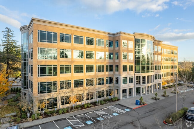
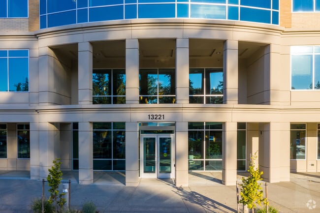
13221 Sw 68Th Pkwy, Portland, OR 97223


Property Detail
13221 Sw 68Th Pkwy
R2064147
ACRES 5.18
Commercialbuilding
WASHINGTON
TMU
Oregon
B and X Area of moderate flood hazard, usually the area between the limits of the 100-year and 500-year floods.
5.18 AC
2024
Tigard
2026
Portland
030700
Portland-Vancouver-Hillsboro, OR-WA
229,219 SF
NEARBY LISTINGS FOR SALE OR LEASE
DEMOGRAPHICS near 13221 Sw 68Th Pkwy
1 mile
3 mile
5 mile
2025 Total Population
10,465
109,840
282,956
2030 Population
10,600
110,382
283,929
Pop Growth 2025-2030
+ 1.29%
+ 0.49%
+ 0.34%
Average Age
41
43
42
2025 Total Households
4,261
45,423
115,685
HH Growth 2025-2030
+ 1.46%
+ 0.54%
+ 0.36%
Median Household Inc
$110,409
$110,764
$109,099
Avg Household Size
2.40
2.40
2.40
2025 Avg HH Vehicles
2.00
2.00
2.00
Median Home Value
$769,633
$712,916
$707,380
Median Year Built
1986
1981
1981
Nearby Places
Map Layers
Map Styles
 Street
 Aerial
Transit
 Traffic
 Biking
Places
Listings with unknown addresses are not visible on the map
- Restaurants
- Banks
- Shops
- Fitness
- Groceries
PUBLIC TRANSPORTATION
COMMUTER RAIL
Tigard Transit Center (Westside Express Service - Tri-County Metropolitan Transportation District of Oregon Rail (TriMet Rail))
Drive
Walk
Distance
Tigard Transit Center (Westside Express Service - Tri-County Metropolitan Transportation District of Oregon Rail (TriMet Rail))
7 min
2.3 mi
Hall/Nimbus (Westside Express Service - Tri-County Metropolitan Transportation District of Oregon Rail (TriMet Rail))
Drive
Walk
Distance
Hall/Nimbus (Westside Express Service - Tri-County Metropolitan Transportation District of Oregon Rail (TriMet Rail))
9 min
4.1 mi
AIRPORT
Portland International
Drive
Walk
Distance
Portland International
34 min
20.7 mi
Freight Ports
Port of Portland
Drive
Walk
Distance
Port of Portland
20 min
11.9 mi
SALE & LEASE HISTORY
LISTING DATE
SALE/LEASE

Sep 25, 2016
For Lease
Sep 25, 2016
For Lease
Oct 18, 2016
For Lease
Jun 02, 2021
For Lease
Dec 21, 2016
For Lease
Aug 19, 2021
For Lease
Apr 04, 2025
For Lease
Nearby Properties
Address
Land Use
TOTAL SIZE
Lot Size
Zoning
Address
Land Use
TOTAL SIZE
Lot Size
Zoning
49.34 AC
I-P
Address
Land Use
TOTAL SIZE
Lot Size
Zoning
828,566 SF
54.77 AC
CI2
Address
Land Use
TOTAL SIZE
Lot Size
Zoning
511,394 SF
18.68 AC
MUC
Address
Land Use
TOTAL SIZE
Lot Size
Zoning
888,084 SF
31.12 AC
MUC
Address
Land Use
TOTAL SIZE
Lot Size
Zoning
1 SF
16 AC
R-5
Address
Land Use
TOTAL SIZE
Lot Size
Zoning
175,880 SF
36.43 AC
OS
Address
Land Use
TOTAL SIZE
Lot Size
Zoning
Address
Land Use
TOTAL SIZE
Lot Size
Zoning
43.20 AC
R-4.5
Address
Land Use
TOTAL SIZE
Lot Size
Zoning
216,381 SF
24.95 AC
CG
Address
Land Use
TOTAL SIZE
Lot Size
Zoning
14.77 AC
MUE
Address
Land Use
TOTAL SIZE
Lot Size
Zoning
88,000 SF
15.49 AC
R-4.5
Address
Land Use
TOTAL SIZE
Lot Size
Zoning
20.82 AC
R-5
Address
Land Use
TOTAL SIZE
Lot Size
Zoning
6 AC
MC
Address
Land Use
TOTAL SIZE
Lot Size
Zoning
43,537 SF
3.59 AC
MUC
Address
Land Use
TOTAL SIZE
Lot Size
Zoning
183,133 SF
8.17 AC
R-25
Address
Land Use
TOTAL SIZE
Lot Size
Zoning
Address
Land Use
TOTAL SIZE
Lot Size
Zoning
11,736 SF
2.85 AC
MUE-1
Address
Land Use
TOTAL SIZE
Lot Size
Zoning
5,724 SF
13.95 AC
NC/R-0
Address
Land Use
TOTAL SIZE
Lot Size
Zoning
18 AC
RMH
Address
Land Use
TOTAL SIZE
Lot Size
Zoning
10.81 AC
RH
Address
Land Use
TOTAL SIZE
Lot Size
Zoning
190,012 SF
4.59 AC
IP
Address
Land Use
TOTAL SIZE
Lot Size
Zoning
88,000 SF
12.62 AC
R-4.5
Address
Land Use
TOTAL SIZE
Lot Size
Zoning
4,046 SF
4.08 AC
MUE-1
Address
Land Use
TOTAL SIZE
Lot Size
Zoning
294,220 SF
15.10 AC
RH
Address
Land Use
TOTAL SIZE
Lot Size
Zoning
301,940 SF
15.04 AC
MU-CBD
Address
Land Use
TOTAL SIZE
Lot Size
Zoning
517,403 SF
3.21 AC
MUE-1
Address
Land Use
TOTAL SIZE
Lot Size
Zoning
140,938 SF
7.02 AC
C-WS
Address
Land Use
TOTAL SIZE
Lot Size
Zoning
262,880 SF
0.95 AC
CX
Address
Land Use
TOTAL SIZE
Lot Size
Zoning
71,930 SF
22.68 AC
CO
Address
Land Use
TOTAL SIZE
Lot Size
Zoning
The World's #1 Commercial Real Estate Marketplace
Connect with us
© 2026 CoStar Group
The information above has been obtained from sources believed reliable. While we do not doubt its accuracy we have not verified it and make no guarantee, warranty or representation about it. It is your responsibility to independently confirm its accuracy and completeness. Any projections, opinions, assumptions, or estimates used are for example only and do not represent the current or future performance of the property. The value of this transaction to you depends on tax and other factors which should be evaluated by your tax, financial, and legal advisors. You and your advisors should conduct a careful, independent investigation of the property to determine to your satisfaction the suitability of the property for your needs.