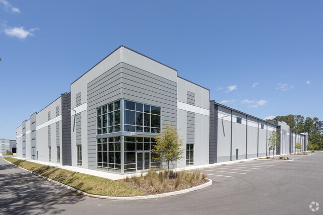
Property Record
13225 Vantage Way, Jacksonville, FL 32218


NEARBY LISTINGS FOR SALE OR LEASE
Property Detail
13225 Vantage Way
Jacksonville, FL
Section Land
019364-0100
25-1N-26E 8.85 PT GOVT LOT 3 RECD O/R 19842-1291 BEING PARCEL TWO
Warehouse
Duval
X
Florida
12031C0182J
3
2024
8.85 AC
2025
North Side
010301
Jacksonville (Florida)
119,830 SF
DEMOGRAPHICS near 13225 Vantage Way
1 Mile
3 Mile
5 Mile
2024 Total Population
2,411
31,773
72,362
2029 Population
2,669
33,772
76,581
Pop Growth 2024-2029
+ 10.70%
+ 6.29%
+ 5.83%
Average Age
37
38
38
2024 Total Households
1,229
12,491
27,289
HH Growth 2024-2029
+ 10.82%
+ 6.58%
+ 6.07%
Median Household Inc
$47,713
$59,014
$58,681
Avg Household Size
2.00
2.50
2.60
2024 Avg HH Vehicles
2.00
2.00
2.00
Median Home Value
$234,868
$220,233
$229,154
Median Year Built
2010
2001
1999
Nearby Places
Map Layers
Map Styles
 Street
 Aerial
- Restaurants
- Banks
- Shops
- Fitness
- Groceries
PUBLIC TRANSPORTATION
AIRPORT
Jacksonville International
DRIVE
WALK
Distance
Jacksonville International
10 min
3.1 mi
Freight Ports
Jacksonville Port
DRIVE
WALK
Distance
Jacksonville Port
22 min
13.6 mi
SALE & LEASE HISTORY
LISTING DATE
SALE/LEASE

Apr 05, 2019
For Lease
Nearby Properties
Address
Land Use
TOTAL SIZE
Lot Size
Zoning
Address
Land Use
TOTAL SIZE
Lot Size
Zoning
2,547,783 SF
5,204.78 AC
PUD
Address
Land Use
TOTAL SIZE
Lot Size
Zoning
877,030 SF
135.59 AC
IBP
Address
Land Use
TOTAL SIZE
Lot Size
Zoning
371,466 SF
42.67 AC
PUD
Address
Land Use
TOTAL SIZE
Lot Size
Zoning
1,170,252 SF
201.15 AC
IH
Address
Land Use
TOTAL SIZE
Lot Size
Zoning
226,421 SF
1.89 AC
PUD
Address
Land Use
TOTAL SIZE
Lot Size
Zoning
403,103 SF
31.05 AC
PUD
Address
Land Use
TOTAL SIZE
Lot Size
Zoning
189,895 SF
35.11 AC
PUD
Address
Land Use
TOTAL SIZE
Lot Size
Zoning
307,351 SF
34.25 AC
PUD
Address
Land Use
TOTAL SIZE
Lot Size
Zoning
658,743 SF
36.71 AC
PUD
Address
Land Use
TOTAL SIZE
Lot Size
Zoning
328,039 SF
18.88 AC
PUD
Address
Land Use
TOTAL SIZE
Lot Size
Zoning
846,897 SF
47.02 AC
PUD
Address
Land Use
TOTAL SIZE
Lot Size
Zoning
240,988 SF
18.11 AC
PUD
Address
Land Use
TOTAL SIZE
Lot Size
Zoning
201,630 SF
21.59 AC
PUD
Address
Land Use
TOTAL SIZE
Lot Size
Zoning
210,341 SF
8.84 AC
PUD
Address
Land Use
TOTAL SIZE
Lot Size
Zoning
205,093 SF
10.93 AC
CRO
Address
Land Use
TOTAL SIZE
Lot Size
Zoning
237,807 SF
13.52 AC
CRO
Address
Land Use
TOTAL SIZE
Lot Size
Zoning
556,924 SF
29.11 AC
PUD
Address
Land Use
TOTAL SIZE
Lot Size
Zoning
640,660 SF
28.30 AC
PUD
Address
Land Use
TOTAL SIZE
Lot Size
Zoning
317,695 SF
15.88 AC
PUD
Address
Land Use
TOTAL SIZE
Lot Size
Zoning
317,815 SF
17.56 AC
PUD
Address
Land Use
TOTAL SIZE
Lot Size
Zoning
163,276 SF
8.39 AC
PUD
Address
Land Use
TOTAL SIZE
Lot Size
Zoning
395,655 SF
21.86 AC
PUD
Address
Land Use
TOTAL SIZE
Lot Size
Zoning
214,742 SF
20.13 AC
PUD
Address
Land Use
TOTAL SIZE
Lot Size
Zoning
170,638 SF
10.77 AC
PUD
Address
Land Use
TOTAL SIZE
Lot Size
Zoning
287,410 SF
43.31 AC
RMD-C
Address
Land Use
TOTAL SIZE
Lot Size
Zoning
210,520 SF
34.87 AC
PUD
Address
Land Use
TOTAL SIZE
Lot Size
Zoning
336,566 SF
25.63 AC
PUD
Address
Land Use
TOTAL SIZE
Lot Size
Zoning
283,689 SF
21.28 AC
RLD-60
Address
Land Use
TOTAL SIZE
Lot Size
Zoning
149,367 SF
810.98 AC
PUD
Address
Land Use
TOTAL SIZE
Lot Size
Zoning
320,372 SF
18.41 AC
PUD
The World's #1 Commercial Real Estate Marketplace
Connect with us
© 2025 CoStar Group
The information above has been obtained from sources believed reliable. While we do not doubt its accuracy we have not verified it and make no guarantee, warranty or representation about it. It is your responsibility to independently confirm its accuracy and completeness. Any projections, opinions, assumptions, or estimates used are for example only and do not represent the current or future performance of the property. The value of this transaction to you depends on tax and other factors which should be evaluated by your tax, financial, and legal advisors. You and your advisors should conduct a careful, independent investigation of the property to determine to your satisfaction the suitability of the property for your needs.