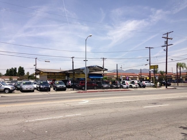
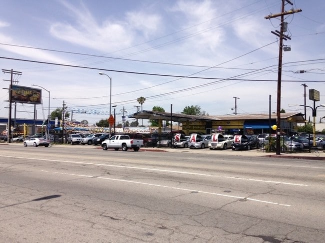
Property Record
13235 Osborne St, Arleta, CA 91331


Current Lease Availabilities
Property Detail
13235 Osborne St
2622-014-034
LOT COM AT MOST E COR OF LOT 11 TRACT NO 14706 TH NW ON NE LINE OF SD TR 120 FT TH N 48 38 E TO SW LINE OF REMICK AVE TH SE THEREON AND SW ON NW LINE OF OSBORNE ST TO BEG PART OF BLK 304 THE NO 16708 AND PART OF LOT 5 TR NO 18466
Servicestation
Los Angeles
LAC2
California
B and X Area of moderate flood hazard, usually the area between the limits of the 100-year and 500-year floods.
11
2025
0.37 AC
2025
Eastern SFV
104822
Los Angeles
1,568 SF
Los Angeles-Long Beach-Glendale, CA
NEARBY LISTINGS FOR SALE OR LEASE
DEMOGRAPHICS near 13235 Osborne St
1 mile
3 mile
5 mile
2025 Total Population
30,954
265,081
632,653
2030 Population
29,881
262,281
628,276
Pop Growth 2025-2030
(3.47%)
(1.06%)
(0.69%)
Average Age
38
38
39
2025 Total Households
6,933
68,365
182,178
HH Growth 2025-2030
(4.01%)
(1.20%)
(0.83%)
Median Household Inc
$90,027
$71,619
$72,419
Avg Household Size
4.10
3.70
3.30
2025 Avg HH Vehicles
3.00
2.00
2.00
Median Home Value
$718,936
$701,591
$742,768
Median Year Built
1956
1965
1966
Nearby Places
Map Layers
Map Styles
 Street
 Aerial
Layers
 Traffic
 Biking
Places
Listings with unknown addresses are not visible on the map
- Restaurants
- Banks
- Shops
- Fitness
- Groceries
PUBLIC TRANSPORTATION
COMMUTER RAIL
Van Nuys (Ventura County Line - Southern California Regional Rail Authority (Metrolink))
Drive
Walk
Distance
Van Nuys (Ventura County Line - Southern California Regional Rail Authority (Metrolink))
7 min
3.7 mi
Sun Valley (Antelope Valley Line - Southern California Regional Rail Authority (Metrolink))
Drive
Walk
Distance
Sun Valley (Antelope Valley Line - Southern California Regional Rail Authority (Metrolink))
5 min
4.0 mi
AIRPORT
Bob Hope
Drive
Walk
Distance
Bob Hope
9 min
5.8 mi
Los Angeles International
Drive
Walk
Distance
Los Angeles International
37 min
26.3 mi
Freight Ports
Port of Long Beach
Drive
Walk
Distance
Port of Long Beach
55 min
43.0 mi
Nearby Properties
Address
Land Use
TOTAL SIZE
Lot Size
Zoning
Address
Land Use
TOTAL SIZE
Lot Size
Zoning
838,226 SF
11.23 AC
LARA
Address
Land Use
TOTAL SIZE
Lot Size
Zoning
72,420 SF
17.08 AC
LAP
Address
Land Use
TOTAL SIZE
Lot Size
Zoning
204,387 SF
8.46 AC
LAM2
Address
Land Use
TOTAL SIZE
Lot Size
Zoning
154,631 SF
11.62 AC
LAC2
Address
Land Use
TOTAL SIZE
Lot Size
Zoning
768,483 SF
6.87 AC
LAC1
Address
Land Use
TOTAL SIZE
Lot Size
Zoning
281,288 SF
34.03 AC
LAM2
Address
Land Use
TOTAL SIZE
Lot Size
Zoning
196,404 SF
10.06 AC
LARD1.5
Address
Land Use
TOTAL SIZE
Lot Size
Zoning
185,568 SF
9.06 AC
LARD1.5
Address
Land Use
TOTAL SIZE
Lot Size
Zoning
370,138 SF
9.84 AC
LAM2
Address
Land Use
TOTAL SIZE
Lot Size
Zoning
408,735 SF
LAC2
Address
Land Use
TOTAL SIZE
Lot Size
Zoning
160,858 SF
2.40 AC
LAR3
Address
Land Use
TOTAL SIZE
Lot Size
Zoning
144,626 SF
5.15 AC
LAM2
Address
Land Use
TOTAL SIZE
Lot Size
Zoning
193,465 SF
4.67 AC
LAM3
Address
Land Use
TOTAL SIZE
Lot Size
Zoning
417,674 SF
10.20 AC
LACM
Address
Land Use
TOTAL SIZE
Lot Size
Zoning
248,500 SF
11.01 AC
LAM2
Address
Land Use
TOTAL SIZE
Lot Size
Zoning
61,315 SF
0.84 AC
LARAS4
Address
Land Use
TOTAL SIZE
Lot Size
Zoning
211,654 SF
2.20 AC
LAM1
Address
Land Use
TOTAL SIZE
Lot Size
Zoning
257,802 SF
4.52 AC
LARA
Address
Land Use
TOTAL SIZE
Lot Size
Zoning
180,277 SF
4.13 AC
LAM1, LAC2
Address
Land Use
TOTAL SIZE
Lot Size
Zoning
776,594 SF
16.18 AC
LAC2
Address
Land Use
TOTAL SIZE
Lot Size
Zoning
96,792 SF
5.52 AC
LARD2
Address
Land Use
TOTAL SIZE
Lot Size
Zoning
114,140 SF
4.94 AC
LAA1
Address
Land Use
TOTAL SIZE
Lot Size
Zoning
143,203 SF
1.52 AC
LAR4
Address
Land Use
TOTAL SIZE
Lot Size
Zoning
155,788 SF
4.58 AC
LAR1
Address
Land Use
TOTAL SIZE
Lot Size
Zoning
56,396 SF
0.74 AC
LARAS4
Address
Land Use
TOTAL SIZE
Lot Size
Zoning
80,455 SF
1.17 AC
LAR3
Address
Land Use
TOTAL SIZE
Lot Size
Zoning
75,050 SF
2.09 AC
LAC2
Address
Land Use
TOTAL SIZE
Lot Size
Zoning
165,573 SF
60.97 AC
LAM3
Address
Land Use
TOTAL SIZE
Lot Size
Zoning
74,764 SF
2.81 AC
LAR3
The World's #1 Commercial Real Estate Marketplace
Connect with us
© 2026 CoStar Group
The information above has been obtained from sources believed reliable. While we do not doubt its accuracy we have not verified it and make no guarantee, warranty or representation about it. It is your responsibility to independently confirm its accuracy and completeness. Any projections, opinions, assumptions, or estimates used are for example only and do not represent the current or future performance of the property. The value of this transaction to you depends on tax and other factors which should be evaluated by your tax, financial, and legal advisors. You and your advisors should conduct a careful, independent investigation of the property to determine to your satisfaction the suitability of the property for your needs.