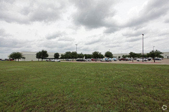
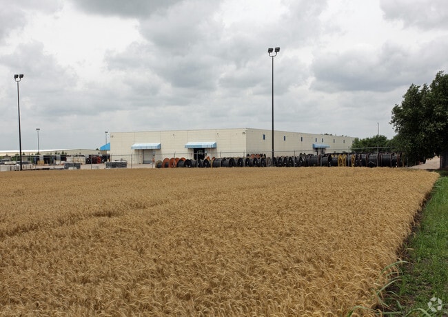
Property Record
1325 Cornell Rd, Lancaster, TX 75134


Property Detail
1325 Cornell Rd
360040000101R0000
BELL INDUSTRIAL PARK BLK 1 PT LT 1R ACS 43.2952 VOL86119/1571 DD061786 CO-DALLAS 0040000101R00 2CN00400001
Officebuilding
DALLAS
Z239
Texas
B and X Area of moderate flood hazard, usually the area between the limits of the 100-year and 500-year floods.
1r
2024
43.30 AC
2025
SE Dallas/I-45
016903
Dallas/Ft Worth
550,137 SF
Dallas-Fort Worth-Arlington, TX
NEARBY LISTINGS FOR SALE OR LEASE
DEMOGRAPHICS near 1325 Cornell Rd
1 mile
3 mile
5 mile
2025 Total Population
128
26,538
77,931
2030 Population
135
27,402
81,106
Pop Growth 2025-2030
+ 5.47%
+ 3.26%
+ 4.07%
Average Age
37
36
36
2025 Total Households
41
8,735
24,580
HH Growth 2025-2030
+ 4.88%
+ 3.22%
+ 4.13%
Median Household Inc
$78,125
$58,885
$61,420
Avg Household Size
3.00
3.00
3.00
2025 Avg HH Vehicles
2.00
2.00
2.00
Median Home Value
$241,666
$234,702
$234,732
Median Year Built
1985
1985
1991
Nearby Places
Map Layers
Map Styles
 Street
 Aerial
Layers
 Traffic
 Biking
Places
Listings with unknown addresses are not visible on the map
- Restaurants
- Banks
- Shops
- Fitness
- Groceries
PUBLIC TRANSPORTATION
AIRPORT
Dallas Love Field
Drive
Walk
Distance
Dallas Love Field
35 min
21.2 mi
Dallas-Fort Worth International
Drive
Walk
Distance
Dallas-Fort Worth International
49 min
36.7 mi
Freight Ports
Port of Shreveport
Drive
Walk
Distance
Port of Shreveport
214 min
197.0 mi
Nearby Properties
Address
Land Use
TOTAL SIZE
Lot Size
Zoning
Address
Land Use
TOTAL SIZE
Lot Size
Zoning
2,492,806 SF
273.09 AC
Z34
Address
Land Use
TOTAL SIZE
Lot Size
Zoning
1,358,690 SF
94.91 AC
Z268
Address
Land Use
TOTAL SIZE
Lot Size
Zoning
967,886 SF
80.90 AC
Z239
Address
Land Use
TOTAL SIZE
Lot Size
Zoning
1,217,840 SF
58.27 AC
Z239
Address
Land Use
TOTAL SIZE
Lot Size
Zoning
241,034 SF
301.97 AC
Z298
Address
Land Use
TOTAL SIZE
Lot Size
Zoning
1,225,000 SF
69.44 AC
Z04
Address
Land Use
TOTAL SIZE
Lot Size
Zoning
735,000 SF
159.91 AC
Z04
Address
Land Use
TOTAL SIZE
Lot Size
Zoning
1,015,340 SF
55.63 AC
Z239
Address
Land Use
TOTAL SIZE
Lot Size
Zoning
1,044,647 SF
65.80 AC
Z239
Address
Land Use
TOTAL SIZE
Lot Size
Zoning
1,025,640 SF
82.26 AC
Z125
Address
Land Use
TOTAL SIZE
Lot Size
Zoning
799,529 SF
56.34 AC
Address
Land Use
TOTAL SIZE
Lot Size
Zoning
917,700 SF
44.27 AC
Z125
Address
Land Use
TOTAL SIZE
Lot Size
Zoning
799,765 SF
45.66 AC
Z31
Address
Land Use
TOTAL SIZE
Lot Size
Zoning
527,731 SF
56.12 AC
Z298
Address
Land Use
TOTAL SIZE
Lot Size
Zoning
754,897 SF
42.75 AC
Z123
Address
Land Use
TOTAL SIZE
Lot Size
Zoning
753,200 SF
52.61 AC
Z239
Address
Land Use
TOTAL SIZE
Lot Size
Zoning
776,630 SF
58.40 AC
Z239
Address
Land Use
TOTAL SIZE
Lot Size
Zoning
713,000 SF
52.25 AC
Z125
Address
Land Use
TOTAL SIZE
Lot Size
Zoning
290,000 SF
51.91 AC
Z123
Address
Land Use
TOTAL SIZE
Lot Size
Zoning
554,600 SF
50.31 AC
Z298
Address
Land Use
TOTAL SIZE
Lot Size
Zoning
550,800 SF
26.52 AC
Z239
Address
Land Use
TOTAL SIZE
Lot Size
Zoning
648,960 SF
52.23 AC
Z06
Address
Land Use
TOTAL SIZE
Lot Size
Zoning
588,500 SF
32.61 AC
Z123
Address
Land Use
TOTAL SIZE
Lot Size
Zoning
627,000 SF
37.09 AC
Z125
Address
Land Use
TOTAL SIZE
Lot Size
Zoning
540,000 SF
40.02 AC
Z67
Address
Land Use
TOTAL SIZE
Lot Size
Zoning
506,285 SF
26.49 AC
Address
Land Use
TOTAL SIZE
Lot Size
Zoning
571,880 SF
19.42 AC
Z123
Address
Land Use
TOTAL SIZE
Lot Size
Zoning
696,622 SF
37.79 AC
Z116
Address
Land Use
TOTAL SIZE
Lot Size
Zoning
587,000 SF
33.94 AC
Z123
Address
Land Use
TOTAL SIZE
Lot Size
Zoning
1,084,462 SF
66.17 AC
The World's #1 Commercial Real Estate Marketplace
Connect with us
© 2026 CoStar Group
The information above has been obtained from sources believed reliable. While we do not doubt its accuracy we have not verified it and make no guarantee, warranty or representation about it. It is your responsibility to independently confirm its accuracy and completeness. Any projections, opinions, assumptions, or estimates used are for example only and do not represent the current or future performance of the property. The value of this transaction to you depends on tax and other factors which should be evaluated by your tax, financial, and legal advisors. You and your advisors should conduct a careful, independent investigation of the property to determine to your satisfaction the suitability of the property for your needs.