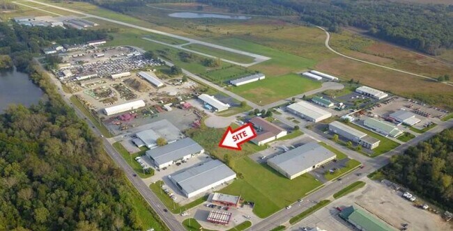
Property Record
1325 E Main St, Griffith, IN 46319

Current Lease Availabilities
Property Detail
1325 E Main St
Chicago-Naperville-Elgin, IL-IN
GATLINS ADDITION PHASE 1 LOT 2
45-11-01-101-003.000-033
LAKE
Warehouse
Indiana
B and X Area of moderate flood hazard, usually the area between the limits of the 100-year and 500-year floods.
2
2024
1.20 AC
2025
Indiana
041002
Chicago
24,336 SF
NEARBY LISTINGS FOR SALE OR LEASE
DEMOGRAPHICS near 1325 E Main St
1 mile
3 mile
5 mile
2025 Total Population
3,689
47,652
170,510
2030 Population
3,710
47,555
171,901
Pop Growth 2025-2030
+ 0.57%
(0.20%)
+ 0.82%
Average Age
41
41
41
2025 Total Households
1,494
19,228
68,432
HH Growth 2025-2030
+ 0.60%
(0.21%)
+ 0.73%
Median Household Inc
$81,488
$77,396
$68,368
Avg Household Size
2.40
2.40
2.40
2025 Avg HH Vehicles
2.00
2.00
2.00
Median Home Value
$210,904
$228,318
$234,238
Median Year Built
1958
1968
1970
Nearby Places
Map Layers
Map Styles
 Street
 Aerial
Layers
 Traffic
 Biking
Places
Listings with unknown addresses are not visible on the map
- Restaurants
- Banks
- Shops
- Fitness
- Groceries
Nearby Properties
Address
Land Use
TOTAL SIZE
Lot Size
Zoning
Address
Land Use
TOTAL SIZE
Lot Size
Zoning
168,766 SF
19.16 AC
Address
Land Use
TOTAL SIZE
Lot Size
Zoning
132,147 SF
44.38 AC
R33
Address
Land Use
TOTAL SIZE
Lot Size
Zoning
105,000 SF
2.90 AC
Address
Land Use
TOTAL SIZE
Lot Size
Zoning
64,971 SF
6.98 AC
Address
Land Use
TOTAL SIZE
Lot Size
Zoning
149,808 SF
15.07 AC
Address
Land Use
TOTAL SIZE
Lot Size
Zoning
34,116 SF
73.40 AC
Address
Land Use
TOTAL SIZE
Lot Size
Zoning
79,059 SF
7.07 AC
R3
Address
Land Use
TOTAL SIZE
Lot Size
Zoning
53,024 SF
43.30 AC
Address
Land Use
TOTAL SIZE
Lot Size
Zoning
159,134 SF
22 AC
Address
Land Use
TOTAL SIZE
Lot Size
Zoning
68.50 AC
Address
Land Use
TOTAL SIZE
Lot Size
Zoning
33,920 SF
83.34 AC
Address
Land Use
TOTAL SIZE
Lot Size
Zoning
44,960 SF
4.80 AC
Address
Land Use
TOTAL SIZE
Lot Size
Zoning
121,900 SF
8.79 AC
R3
Address
Land Use
TOTAL SIZE
Lot Size
Zoning
111,363 SF
9.60 AC
Address
Land Use
TOTAL SIZE
Lot Size
Zoning
98,658 SF
7.26 AC
R33
Address
Land Use
TOTAL SIZE
Lot Size
Zoning
14,501 SF
70.85 AC
Address
Land Use
TOTAL SIZE
Lot Size
Zoning
6,760 SF
77.37 AC
Address
Land Use
TOTAL SIZE
Lot Size
Zoning
41,406 SF
2.80 AC
R33
Address
Land Use
TOTAL SIZE
Lot Size
Zoning
24,964 SF
3.72 AC
Address
Land Use
TOTAL SIZE
Lot Size
Zoning
92,259 SF
6.41 AC
Address
Land Use
TOTAL SIZE
Lot Size
Zoning
88,434 SF
5 AC
Address
Land Use
TOTAL SIZE
Lot Size
Zoning
163,852 SF
30.82 AC
Address
Land Use
TOTAL SIZE
Lot Size
Zoning
45,022 SF
6.02 AC
Address
Land Use
TOTAL SIZE
Lot Size
Zoning
28,674 SF
6.87 AC
Address
Land Use
TOTAL SIZE
Lot Size
Zoning
69,004 SF
12.10 AC
Address
Land Use
TOTAL SIZE
Lot Size
Zoning
40,930 SF
4.82 AC
Address
Land Use
TOTAL SIZE
Lot Size
Zoning
86,292 SF
3.84 AC
Address
Land Use
TOTAL SIZE
Lot Size
Zoning
41,172 SF
1.56 AC
Address
Land Use
TOTAL SIZE
Lot Size
Zoning
5,287 SF
47.65 AC
Address
Land Use
TOTAL SIZE
Lot Size
Zoning
34,688 SF
4.03 AC
R33
The World's #1 Commercial Real Estate Marketplace
Connect with us
© 2026 CoStar Group
The information above has been obtained from sources believed reliable. While we do not doubt its accuracy we have not verified it and make no guarantee, warranty or representation about it. It is your responsibility to independently confirm its accuracy and completeness. Any projections, opinions, assumptions, or estimates used are for example only and do not represent the current or future performance of the property. The value of this transaction to you depends on tax and other factors which should be evaluated by your tax, financial, and legal advisors. You and your advisors should conduct a careful, independent investigation of the property to determine to your satisfaction the suitability of the property for your needs.