Property Record
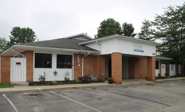
1325 E Walnut St, Westerville, OH 43081

Property Detail
1325 E Walnut St
080-010751
WALNUT STREET R17 T2 1/4T1 7-10 0.563 ACRE
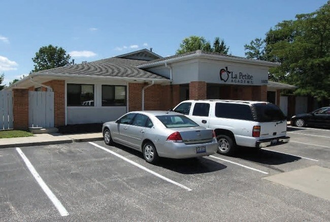
Daycare
Franklin
B and X Area of moderate flood hazard, usually the area between the limits of the 100-year and 500-year floods.
Ohio
2024
0.54 AC
2025
Westerville
007102
Columbus
5,295 SF
Columbus, OH
NEARBY LISTINGS FOR SALE OR LEASE
DEMOGRAPHICS near 1325 E Walnut St
1 mile
3 mile
5 mile
2024 Total Population
6,297
69,309
191,196
2029 Population
6,457
72,296
198,471
Pop Growth 2024-2029
+ 2.54%
+ 4.31%
+ 3.80%
Average Age
43
41
39
2024 Total Households
2,351
28,577
78,465
HH Growth 2024-2029
+ 2.72%
+ 4.52%
+ 3.91%
Median Household Inc
$136,434
$95,870
$91,114
Avg Household Size
2.60
2.40
2.40
2024 Avg HH Vehicles
2.00
2.00
2.00
Median Home Value
$400,173
$361,969
$352,786
Median Year Built
1981
1990
1991
Nearby Places
Map Layers
Map Styles
 Street
 Aerial
Transit
 Traffic
 Biking
Places
Listings with unknown addresses are not visible on the map
- Restaurants
- Banks
- Shops
- Fitness
- Groceries
PUBLIC TRANSPORTATION
AIRPORT
John Glenn Columbus International
Drive
Walk
Distance
John Glenn Columbus International
18 min
10.6 mi
Rickenbacker International
Drive
Walk
Distance
Rickenbacker International
37 min
26.1 mi
Freight Ports
Port of Toledo
Drive
Walk
Distance
Port of Toledo
178 min
139.2 mi
SALE & LEASE HISTORY
LISTING DATE
SALE/LEASE

Sep 25, 2016
For Lease
Sep 24, 2016
For Sale
Sep 24, 2016
For Sale
Mar 23, 2017
For Sale
Mar 22, 2017
For Sale
Dec 07, 2017
For Lease
Nearby Properties
Address
Land Use
TOTAL SIZE
Lot Size
Zoning
Address
Land Use
TOTAL SIZE
Lot Size
Zoning
426,490 SF
19.43 AC
Address
Land Use
TOTAL SIZE
Lot Size
Zoning
112,126 SF
19.09 AC
Address
Land Use
TOTAL SIZE
Lot Size
Zoning
446,516 SF
95.88 AC
Address
Land Use
TOTAL SIZE
Lot Size
Zoning
602,448 SF
24.71 AC
Address
Land Use
TOTAL SIZE
Lot Size
Zoning
320,022 SF
37.14 AC
Address
Land Use
TOTAL SIZE
Lot Size
Zoning
697,077 SF
40.91 AC
Address
Land Use
TOTAL SIZE
Lot Size
Zoning
45,135 SF
22.02 AC
Address
Land Use
TOTAL SIZE
Lot Size
Zoning
180,968 SF
12.77 AC
Address
Land Use
TOTAL SIZE
Lot Size
Zoning
3,263 SF
989.66 AC
Address
Land Use
TOTAL SIZE
Lot Size
Zoning
74,620 SF
9.03 AC
Address
Land Use
TOTAL SIZE
Lot Size
Zoning
58,928 SF
4.62 AC
Address
Land Use
TOTAL SIZE
Lot Size
Zoning
292,377 SF
36.29 AC
Address
Land Use
TOTAL SIZE
Lot Size
Zoning
151,892 SF
8.63 AC
Address
Land Use
TOTAL SIZE
Lot Size
Zoning
170,259 SF
16.30 AC
Address
Land Use
TOTAL SIZE
Lot Size
Zoning
151,935 SF
9 AC
Address
Land Use
TOTAL SIZE
Lot Size
Zoning
137,489 SF
14.73 AC
Address
Land Use
TOTAL SIZE
Lot Size
Zoning
51,376 SF
12.65 AC
Address
Land Use
TOTAL SIZE
Lot Size
Zoning
236,681 SF
7.83 AC
Address
Land Use
TOTAL SIZE
Lot Size
Zoning
96,086 SF
12.23 AC
Address
Land Use
TOTAL SIZE
Lot Size
Zoning
89,544 SF
4.82 AC
Address
Land Use
TOTAL SIZE
Lot Size
Zoning
27,978 SF
11.35 AC
Address
Land Use
TOTAL SIZE
Lot Size
Zoning
362,014 SF
37.08 AC
Address
Land Use
TOTAL SIZE
Lot Size
Zoning
133,524 SF
10.15 AC
Address
Land Use
TOTAL SIZE
Lot Size
Zoning
61,326 SF
15.78 AC
Address
Land Use
TOTAL SIZE
Lot Size
Zoning
46,080 SF
13.23 AC
Address
Land Use
TOTAL SIZE
Lot Size
Zoning
74,544 SF
10.52 AC
Address
Land Use
TOTAL SIZE
Lot Size
Zoning
175,042 SF
8.10 AC
Address
Land Use
TOTAL SIZE
Lot Size
Zoning
189,276 SF
16.25 AC
Address
Land Use
TOTAL SIZE
Lot Size
Zoning
166,382 SF
6.74 AC
Address
Land Use
TOTAL SIZE
Lot Size
Zoning
105,389 SF
8.16 AC
The World's #1 Commercial Real Estate Marketplace
Connect with us
© 2026 CoStar Group
The information above has been obtained from sources believed reliable. While we do not doubt its accuracy we have not verified it and make no guarantee, warranty or representation about it. It is your responsibility to independently confirm its accuracy and completeness. Any projections, opinions, assumptions, or estimates used are for example only and do not represent the current or future performance of the property. The value of this transaction to you depends on tax and other factors which should be evaluated by your tax, financial, and legal advisors. You and your advisors should conduct a careful, independent investigation of the property to determine to your satisfaction the suitability of the property for your needs.