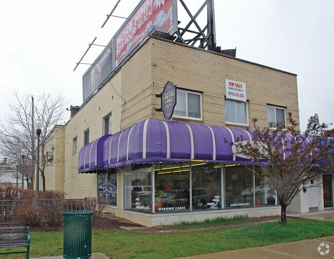
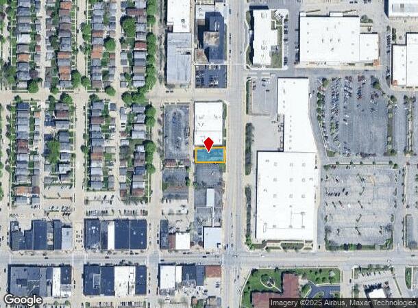
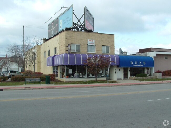
Property Record
1325 S 70Th St, Milwaukee, WI 53214
NEARBY LISTINGS FOR SALE OR LEASE
-
-
-
-
No Photo
-
-
-
-
View all Milwaukee listings for sale on LoopNet.com
Property Detail
1325 S 70Th St
Milwaukee-Waukesha-West Allis, WI
Otjen Pullen & Shenners
440-0242-000
OTJEN PULLEN & SHENNERS LOTS 33 & 34 BLK 1
Commercialnec
Milwaukee
X
Wisconsin
55133C0250G
33,34
2024
0.17 AC
2024
West Allis
100300
Milwaukee/Madison
DEMOGRAPHICS near 1325 S 70Th St
1 Mile
3 Mile
5 Mile
2024 Total Population
23,410
161,921
439,518
2029 Population
22,978
158,000
431,938
Pop Growth 2024-2029
(1.85%)
(2.42%)
(1.72%)
Average Age
38
39
37
2024 Total Households
10,454
69,684
181,499
HH Growth 2024-2029
(1.86%)
(2.43%)
(1.72%)
Median Household Inc
$54,621
$60,358
$55,202
Avg Household Size
2.10
2.20
2.30
2024 Avg HH Vehicles
2.00
2.00
1.00
Median Home Value
$159,323
$179,842
$190,588
Median Year Built
1949
1950
1952
Nearby Places
Map Layers
Map Styles
 Street
 Aerial
- Restaurants
- Banks
- Shops
- Fitness
- Groceries
PUBLIC TRANSPORTATION
COMMUTER RAIL
DRIVE
WALK
Distance
10 min
5.2 mi
AIRPORT
General Mitchell International
DRIVE
WALK
Distance
General Mitchell International
22 min
11.8 mi
Freight Ports
Port Milwaukee
DRIVE
WALK
Distance
Port Milwaukee
15 min
7.7 mi
Nearby Properties
Address
Land Use
TOTAL SIZE
Lot Size
Zoning
Address
Land Use
TOTAL SIZE
Lot Size
Zoning
8.63 AC
C2
Address
Land Use
TOTAL SIZE
Lot Size
Zoning
36.11 AC
Address
Land Use
TOTAL SIZE
Lot Size
Zoning
122.53 AC
TL
Address
Land Use
TOTAL SIZE
Lot Size
Zoning
23.16 AC
Address
Land Use
TOTAL SIZE
Lot Size
Zoning
13.48 AC
Address
Land Use
TOTAL SIZE
Lot Size
Zoning
5.12 AC
Address
Land Use
TOTAL SIZE
Lot Size
Zoning
Address
Land Use
TOTAL SIZE
Lot Size
Zoning
10.22 AC
SP-RP
Address
Land Use
TOTAL SIZE
Lot Size
Zoning
68.35 AC
TL
Address
Land Use
TOTAL SIZE
Lot Size
Zoning
Address
Land Use
TOTAL SIZE
Lot Size
Zoning
8,881 SF
7.52 AC
Address
Land Use
TOTAL SIZE
Lot Size
Zoning
13.39 AC
Address
Land Use
TOTAL SIZE
Lot Size
Zoning
9.33 AC
PUD
Address
Land Use
TOTAL SIZE
Lot Size
Zoning
47.96 AC
TL
Address
Land Use
TOTAL SIZE
Lot Size
Zoning
3.74 AC
PUD
Address
Land Use
TOTAL SIZE
Lot Size
Zoning
16.84 AC
Address
Land Use
TOTAL SIZE
Lot Size
Zoning
2.13 AC
SP-MED
Address
Land Use
TOTAL SIZE
Lot Size
Zoning
Address
Land Use
TOTAL SIZE
Lot Size
Zoning
39.81 AC
Address
Land Use
TOTAL SIZE
Lot Size
Zoning
29,664 SF
1.83 AC
C2
Address
Land Use
TOTAL SIZE
Lot Size
Zoning
8.78 AC
Address
Land Use
TOTAL SIZE
Lot Size
Zoning
0.36 AC
Address
Land Use
TOTAL SIZE
Lot Size
Zoning
Address
Land Use
TOTAL SIZE
Lot Size
Zoning
20.61 AC
TL
Address
Land Use
TOTAL SIZE
Lot Size
Zoning
7.55 AC
SP-RP
Address
Land Use
TOTAL SIZE
Lot Size
Zoning
132,289 SF
5.34 AC
PD
Address
Land Use
TOTAL SIZE
Lot Size
Zoning
Address
Land Use
TOTAL SIZE
Lot Size
Zoning
12.47 AC
Address
Land Use
TOTAL SIZE
Lot Size
Zoning
35.55 AC
INSTITUTIO
Address
Land Use
TOTAL SIZE
Lot Size
Zoning
4.63 AC
IO2
The World's #1 Commercial Real Estate Marketplace
Connect with us
© 2025 CoStar Group
The information above has been obtained from sources believed reliable. While we do not doubt its accuracy we have not verified it and make no guarantee, warranty or representation about it. It is your responsibility to independently confirm its accuracy and completeness. Any projections, opinions, assumptions, or estimates used are for example only and do not represent the current or future performance of the property. The value of this transaction to you depends on tax and other factors which should be evaluated by your tax, financial, and legal advisors. You and your advisors should conduct a careful, independent investigation of the property to determine to your satisfaction the suitability of the property for your needs.