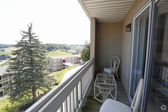
Property Record
1325 Stewartstown Rd, Morgantown, WV 26505

NEARBY LISTINGS FOR SALE OR LEASE
Property Detail
1325 Stewartstown Rd
Morgantown, WV
Sur West Run
08-4-00350000
4.4946 AC SUR WEST RUN (BON VISTA - 16 BLDG COMP)
Gardenaptcourtapt5plusunits
Monongalia
X
West Virginia
54061C0118F
4.50 AC
2025
West Virginia North Area
2025
Other Market Areas
010602
DEMOGRAPHICS near 1325 Stewartstown Rd
1 Mile
3 Mile
5 Mile
2024 Total Population
9,937
60,672
82,277
2029 Population
10,226
62,381
84,434
Pop Growth 2024-2029
+ 2.91%
+ 2.82%
+ 2.62%
Average Age
33
33
35
2024 Total Households
5,355
26,310
35,117
HH Growth 2024-2029
+ 2.91%
+ 2.94%
+ 2.72%
Median Household Inc
$44,112
$43,925
$52,296
Avg Household Size
1.80
2.00
2.10
2024 Avg HH Vehicles
2.00
2.00
2.00
Median Home Value
$239,727
$237,103
$242,226
Median Year Built
1995
1985
1986
Nearby Places
Map Layers
Map Styles
 Street
 Aerial
- Restaurants
- Banks
- Shops
- Fitness
- Groceries
PUBLIC TRANSPORTATION
AIRPORT
North Central West Virginia
DRIVE
WALK
Distance
North Central West Virginia
46 min
35.9 mi
Freight Ports
Port of Baltimore
DRIVE
WALK
Distance
Port of Baltimore
239 min
210.6 mi
Nearby Properties
Address
Land Use
TOTAL SIZE
Lot Size
Zoning
Address
Land Use
TOTAL SIZE
Lot Size
Zoning
23.86 AC
Address
Land Use
TOTAL SIZE
Lot Size
Zoning
5.15 AC
Address
Land Use
TOTAL SIZE
Lot Size
Zoning
14.68 AC
Address
Land Use
TOTAL SIZE
Lot Size
Zoning
137.68 AC
Address
Land Use
TOTAL SIZE
Lot Size
Zoning
75.75 AC
Address
Land Use
TOTAL SIZE
Lot Size
Zoning
31.67 AC
Address
Land Use
TOTAL SIZE
Lot Size
Zoning
109.09 AC
Address
Land Use
TOTAL SIZE
Lot Size
Zoning
3.07 AC
Address
Land Use
TOTAL SIZE
Lot Size
Zoning
Address
Land Use
TOTAL SIZE
Lot Size
Zoning
7.10 AC
Address
Land Use
TOTAL SIZE
Lot Size
Zoning
45.28 AC
Address
Land Use
TOTAL SIZE
Lot Size
Zoning
89.90 AC
Address
Land Use
TOTAL SIZE
Lot Size
Zoning
15.71 AC
Address
Land Use
TOTAL SIZE
Lot Size
Zoning
30.77 AC
Address
Land Use
TOTAL SIZE
Lot Size
Zoning
53.50 AC
Address
Land Use
TOTAL SIZE
Lot Size
Zoning
Address
Land Use
TOTAL SIZE
Lot Size
Zoning
Address
Land Use
TOTAL SIZE
Lot Size
Zoning
9.63 AC
Address
Land Use
TOTAL SIZE
Lot Size
Zoning
34.21 AC
Address
Land Use
TOTAL SIZE
Lot Size
Zoning
0.23 AC
Address
Land Use
TOTAL SIZE
Lot Size
Zoning
Address
Land Use
TOTAL SIZE
Lot Size
Zoning
Address
Land Use
TOTAL SIZE
Lot Size
Zoning
Address
Land Use
TOTAL SIZE
Lot Size
Zoning
9.94 AC
Address
Land Use
TOTAL SIZE
Lot Size
Zoning
61.24 AC
Address
Land Use
TOTAL SIZE
Lot Size
Zoning
0.11 AC
Address
Land Use
TOTAL SIZE
Lot Size
Zoning
15.03 AC
Address
Land Use
TOTAL SIZE
Lot Size
Zoning
8.87 AC
Address
Land Use
TOTAL SIZE
Lot Size
Zoning
28.10 AC
The World's #1 Commercial Real Estate Marketplace
Connect with us
© 2025 CoStar Group
The information above has been obtained from sources believed reliable. While we do not doubt its accuracy we have not verified it and make no guarantee, warranty or representation about it. It is your responsibility to independently confirm its accuracy and completeness. Any projections, opinions, assumptions, or estimates used are for example only and do not represent the current or future performance of the property. The value of this transaction to you depends on tax and other factors which should be evaluated by your tax, financial, and legal advisors. You and your advisors should conduct a careful, independent investigation of the property to determine to your satisfaction the suitability of the property for your needs.