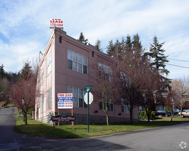
Property Record
1326 E Laurel St, Bellingham, WA 98225


NEARBY LISTINGS FOR SALE OR LEASE
Property Detail
1326 E Laurel St
Bellingham, WA
Molla Short Plat
380331-411231-0000
LOT C MOLLA SHORT PLAT AS REC BOOK 10 SHORT PLATS PG 4
Medicalbuilding
Whatcom
X
Washington
53073C1651E
c
2025
0.10 AC
2025
Samish Hill
001000
Other Market Areas
2,988 SF
DEMOGRAPHICS near 1326 E Laurel St
1 Mile
3 Mile
5 Mile
2024 Total Population
21,083
73,352
103,709
2029 Population
22,040
76,499
108,415
Pop Growth 2024-2029
+ 4.54%
+ 4.29%
+ 4.54%
Average Age
32
38
39
2024 Total Households
8,681
30,837
43,952
HH Growth 2024-2029
+ 5.06%
+ 4.49%
+ 4.73%
Median Household Inc
$43,402
$62,723
$63,809
Avg Household Size
2.10
2.20
2.20
2024 Avg HH Vehicles
2.00
2.00
2.00
Median Home Value
$553,499
$605,105
$589,639
Median Year Built
1985
1979
1986
Nearby Places
Map Layers
Map Styles
 Street
 Aerial
- Restaurants
- Banks
- Shops
- Fitness
- Groceries
PUBLIC TRANSPORTATION
COMMUTER RAIL
DRIVE
WALK
Distance
7 min
3.6 mi
AIRPORT
Bellingham International
DRIVE
WALK
Distance
Bellingham International
12 min
7.4 mi
Abbotsford International
DRIVE
WALK
Distance
Abbotsford International
50 min
29.6 mi
Freight Ports
Port of Bellingham, WA
DRIVE
WALK
Distance
Port of Bellingham, WA
5 min
1.4 mi
Nearby Properties
Address
Land Use
TOTAL SIZE
Lot Size
Zoning
Address
Land Use
TOTAL SIZE
Lot Size
Zoning
3,003 SF
196 AC
IN
Address
Land Use
TOTAL SIZE
Lot Size
Zoning
18,000,000 SF
33.02 AC
P
Address
Land Use
TOTAL SIZE
Lot Size
Zoning
507,750 SF
15.05 AC
IN
Address
Land Use
TOTAL SIZE
Lot Size
Zoning
32.09 AC
IN
Address
Land Use
TOTAL SIZE
Lot Size
Zoning
5.23 AC
WFUV
Address
Land Use
TOTAL SIZE
Lot Size
Zoning
203,749 SF
162.97 AC
CWF
Address
Land Use
TOTAL SIZE
Lot Size
Zoning
299,834 SF
15.25 AC
PC
Address
Land Use
TOTAL SIZE
Lot Size
Zoning
259,312 SF
2.76 AC
P
Address
Land Use
TOTAL SIZE
Lot Size
Zoning
290,450 SF
2.86 AC
RM1.0
Address
Land Use
TOTAL SIZE
Lot Size
Zoning
330,497 SF
30.17 AC
P
Address
Land Use
TOTAL SIZE
Lot Size
Zoning
154,763 SF
40.50 AC
P
Address
Land Use
TOTAL SIZE
Lot Size
Zoning
151,677 SF
12.84 AC
PCM
Address
Land Use
TOTAL SIZE
Lot Size
Zoning
256,155 SF
36.63 AC
PCW
Address
Land Use
TOTAL SIZE
Lot Size
Zoning
662,133 SF
118.82 AC
I
Address
Land Use
TOTAL SIZE
Lot Size
Zoning
239,925 SF
17.46 AC
PC
Address
Land Use
TOTAL SIZE
Lot Size
Zoning
201,508 SF
13.73 AC
P
Address
Land Use
TOTAL SIZE
Lot Size
Zoning
1.12 AC
RS12.0
Address
Land Use
TOTAL SIZE
Lot Size
Zoning
148,945 SF
1.51 AC
PCM
Address
Land Use
TOTAL SIZE
Lot Size
Zoning
159,238 SF
1.54 AC
PICR
Address
Land Use
TOTAL SIZE
Lot Size
Zoning
84,006 SF
16.20 AC
PICR4
Address
Land Use
TOTAL SIZE
Lot Size
Zoning
117,801 SF
3.61 AC
PC
Address
Land Use
TOTAL SIZE
Lot Size
Zoning
179,728 SF
9.51 AC
RM2.2
Address
Land Use
TOTAL SIZE
Lot Size
Zoning
146,187 SF
6.44 AC
PC
Address
Land Use
TOTAL SIZE
Lot Size
Zoning
158,200 SF
1.34 AC
PICR
Address
Land Use
TOTAL SIZE
Lot Size
Zoning
204,377 SF
14.72 AC
RM3.5
Address
Land Use
TOTAL SIZE
Lot Size
Zoning
143,818 SF
6.75 AC
RM2.0
Address
Land Use
TOTAL SIZE
Lot Size
Zoning
229,913 SF
15.28 AC
PI
Address
Land Use
TOTAL SIZE
Lot Size
Zoning
120,801 SF
2.89 AC
RM1.0
Address
Land Use
TOTAL SIZE
Lot Size
Zoning
86,616 SF
3.25 AC
PRM4.0
Address
Land Use
TOTAL SIZE
Lot Size
Zoning
38,135 SF
60.20 AC
WFUV
The World's #1 Commercial Real Estate Marketplace
Connect with us
© 2026 CoStar Group
The information above has been obtained from sources believed reliable. While we do not doubt its accuracy we have not verified it and make no guarantee, warranty or representation about it. It is your responsibility to independently confirm its accuracy and completeness. Any projections, opinions, assumptions, or estimates used are for example only and do not represent the current or future performance of the property. The value of this transaction to you depends on tax and other factors which should be evaluated by your tax, financial, and legal advisors. You and your advisors should conduct a careful, independent investigation of the property to determine to your satisfaction the suitability of the property for your needs.