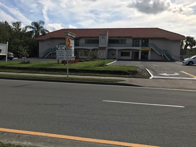
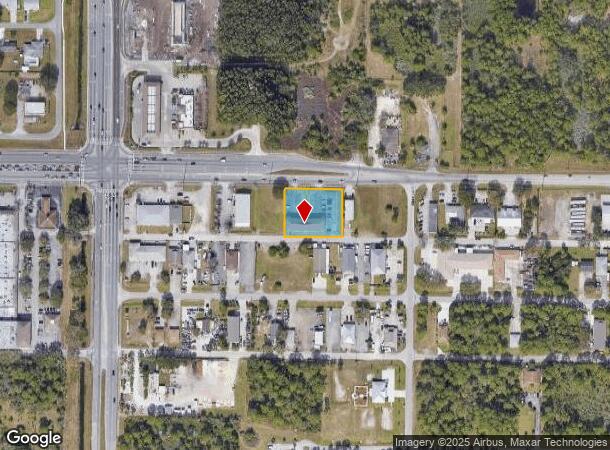
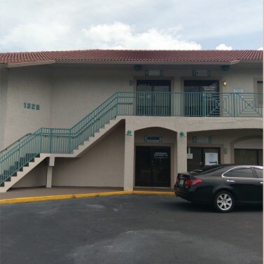
Property Record
1326 Malabar Rd Se, Palm Bay, FL 32907
Current Lease Availabilities
NEARBY LISTINGS FOR SALE OR LEASE
Property Detail
1326 Malabar Rd Se
Palm Bay-Melbourne-Titusville, FL
Port Malabar Unit 38
29-37-03-25-02211.0-0012.00
PORT MALABAR UNIT 38 LOTS 12, 13, 14 & 15 BLK 2211 EXC N 3 FT FOR RD R/W
Officebuilding
Brevard
X
Florida
12009C0680G
12
2024
0.77 AC
2025
Brevard County
065202
Orlando
10,628 SF
DEMOGRAPHICS near 1326 Malabar Rd Se
1 Mile
3 Mile
5 Mile
2024 Total Population
5,154
53,858
131,499
2029 Population
5,582
59,185
144,669
Pop Growth 2024-2029
+ 8.30%
+ 9.89%
+ 10.02%
Average Age
43
43
42
2024 Total Households
1,960
21,792
52,666
HH Growth 2024-2029
+ 8.06%
+ 9.71%
+ 9.83%
Median Household Inc
$49,970
$50,893
$54,328
Avg Household Size
2.50
2.40
2.40
2024 Avg HH Vehicles
2.00
2.00
2.00
Median Home Value
$224,627
$208,754
$220,818
Median Year Built
1984
1987
1990
Nearby Places
Map Layers
Map Styles
 Street
 Aerial
- Restaurants
- Banks
- Shops
- Fitness
- Groceries
PUBLIC TRANSPORTATION
AIRPORT
Melbourne Orlando International
DRIVE
WALK
Distance
Melbourne Orlando International
19 min
8.7 mi
Freight Ports
Port Canaveral
DRIVE
WALK
Distance
Port Canaveral
52 min
42.5 mi
Nearby Properties
Address
Land Use
TOTAL SIZE
Lot Size
Zoning
Address
Land Use
TOTAL SIZE
Lot Size
Zoning
1,695,838 SF
106.06 AC
Address
Land Use
TOTAL SIZE
Lot Size
Zoning
292,165 SF
24.39 AC
RM15
Address
Land Use
TOTAL SIZE
Lot Size
Zoning
282,680 SF
16 AC
IU
Address
Land Use
TOTAL SIZE
Lot Size
Zoning
393,147 SF
38.03 AC
RM20
Address
Land Use
TOTAL SIZE
Lot Size
Zoning
349,772 SF
16.27 AC
R2
Address
Land Use
TOTAL SIZE
Lot Size
Zoning
294,170 SF
70.66 AC
IU
Address
Land Use
TOTAL SIZE
Lot Size
Zoning
307,849 SF
39.14 AC
IU
Address
Land Use
TOTAL SIZE
Lot Size
Zoning
257,044 SF
14.99 AC
Address
Land Use
TOTAL SIZE
Lot Size
Zoning
276,936 SF
18.44 AC
RM20
Address
Land Use
TOTAL SIZE
Lot Size
Zoning
260,331 SF
9.90 AC
RM10
Address
Land Use
TOTAL SIZE
Lot Size
Zoning
201,017 SF
13.77 AC
RM20
Address
Land Use
TOTAL SIZE
Lot Size
Zoning
203,448 SF
10.36 AC
C2
Address
Land Use
TOTAL SIZE
Lot Size
Zoning
225,833 SF
14.45 AC
R2
Address
Land Use
TOTAL SIZE
Lot Size
Zoning
267,548 SF
23.10 AC
RM10
Address
Land Use
TOTAL SIZE
Lot Size
Zoning
205,308 SF
11.04 AC
RM20
Address
Land Use
TOTAL SIZE
Lot Size
Zoning
4,000 SF
12.20 AC
IU
Address
Land Use
TOTAL SIZE
Lot Size
Zoning
1,380 SF
21.87 AC
IU
Address
Land Use
TOTAL SIZE
Lot Size
Zoning
408,025 SF
24.10 AC
LI
Address
Land Use
TOTAL SIZE
Lot Size
Zoning
136,201 SF
11.93 AC
RM20
Address
Land Use
TOTAL SIZE
Lot Size
Zoning
143,529 SF
7.76 AC
RM20
Address
Land Use
TOTAL SIZE
Lot Size
Zoning
242,454 SF
14.13 AC
LI
Address
Land Use
TOTAL SIZE
Lot Size
Zoning
216,692 SF
28.97 AC
CC
Address
Land Use
TOTAL SIZE
Lot Size
Zoning
118,747 SF
11.43 AC
RM10
Address
Land Use
TOTAL SIZE
Lot Size
Zoning
166,648 SF
13.01 AC
RM20
Address
Land Use
TOTAL SIZE
Lot Size
Zoning
104,620 SF
12.82 AC
IU
Address
Land Use
TOTAL SIZE
Lot Size
Zoning
106,915 SF
11.01 AC
IU
Address
Land Use
TOTAL SIZE
Lot Size
Zoning
86,968 SF
9.86 AC
IU
Address
Land Use
TOTAL SIZE
Lot Size
Zoning
103,507 SF
24.90 AC
IU
Address
Land Use
TOTAL SIZE
Lot Size
Zoning
222,925 SF
12.75 AC
PUD
Address
Land Use
TOTAL SIZE
Lot Size
Zoning
202,908 SF
34.94 AC
LI
The World's #1 Commercial Real Estate Marketplace
Connect with us
© 2025 CoStar Group
The information above has been obtained from sources believed reliable. While we do not doubt its accuracy we have not verified it and make no guarantee, warranty or representation about it. It is your responsibility to independently confirm its accuracy and completeness. Any projections, opinions, assumptions, or estimates used are for example only and do not represent the current or future performance of the property. The value of this transaction to you depends on tax and other factors which should be evaluated by your tax, financial, and legal advisors. You and your advisors should conduct a careful, independent investigation of the property to determine to your satisfaction the suitability of the property for your needs.