Property Record
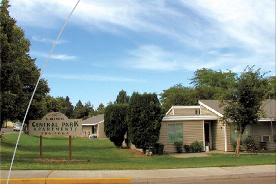
1326 W 7Th Pl, Kennewick, WA 99336
NEARBY LISTINGS FOR SALE OR LEASE
Property Detail
1326 W 7Th Pl
Kennewick-Richland, WA
Anderson Add
101893000013000
PORTION OF SECTION 1 TOWNSHIP 8 NORTH RANGE 29 EAST DEFINED AS FOLLOWS PORTION OF THE SOUTHWEST DEFINED AS FOLLOWS THE NORTH 468 FEET OF THE WEST 730 FEET OF THE PORTION OF THE SOUTHWEST LYING WEST OF AMENDED PLAT OF BLOCKS 1-2-3-4 ANDERSON
Multifamilydwelling
Benton
2024
Washington
2024
6.17 AC
011201
Yakima/Kennewick
64,420 SF
Other Market Areas
DEMOGRAPHICS near 1326 W 7Th Pl
1 Mile
3 Mile
5 Mile
2024 Total Population
17,963
88,441
149,161
2029 Population
19,388
95,027
160,689
Pop Growth 2024-2029
+ 7.93%
+ 7.45%
+ 7.73%
Average Age
34
36
36
2024 Total Households
6,278
30,746
50,692
HH Growth 2024-2029
+ 7.95%
+ 7.49%
+ 7.75%
Median Household Inc
$42,888
$62,219
$69,326
Avg Household Size
2.80
2.80
2.90
2024 Avg HH Vehicles
2.00
2.00
2.00
Median Home Value
$250,791
$288,207
$309,296
Median Year Built
1968
1974
1978
Nearby Places
Map Layers
Map Styles
 Street
 Aerial
- Restaurants
- Banks
- Shops
- Fitness
- Groceries
PUBLIC TRANSPORTATION
COMMUTER RAIL
Pasco Amtrak Station (Empire Builder - Amtrak)
DRIVE
WALK
Distance
Pasco Amtrak Station (Empire Builder - Amtrak)
10 min
4.4 mi
AIRPORT
Tri-Cities
DRIVE
WALK
Distance
Tri-Cities
11 min
6.0 mi
Freight Ports
Port of Tacoma
DRIVE
WALK
Distance
Port of Tacoma
273 min
238.5 mi
Nearby Properties
Address
Land Use
TOTAL SIZE
Lot Size
Zoning
Address
Land Use
TOTAL SIZE
Lot Size
Zoning
232,463 SF
31.54 AC
Address
Land Use
TOTAL SIZE
Lot Size
Zoning
294,855 SF
35.04 AC
KENNEWICK
Address
Land Use
TOTAL SIZE
Lot Size
Zoning
141,940 SF
7.49 AC
Address
Land Use
TOTAL SIZE
Lot Size
Zoning
377,541 SF
24.58 AC
Address
Land Use
TOTAL SIZE
Lot Size
Zoning
138,421 SF
31.09 AC
Address
Land Use
TOTAL SIZE
Lot Size
Zoning
148,301 SF
6.41 AC
Address
Land Use
TOTAL SIZE
Lot Size
Zoning
153,320 SF
7.37 AC
Address
Land Use
TOTAL SIZE
Lot Size
Zoning
113,585 SF
15.43 AC
Address
Land Use
TOTAL SIZE
Lot Size
Zoning
213,921 SF
22.78 AC
Address
Land Use
TOTAL SIZE
Lot Size
Zoning
52,900 SF
10.23 AC
Address
Land Use
TOTAL SIZE
Lot Size
Zoning
114,673 SF
6.58 AC
Address
Land Use
TOTAL SIZE
Lot Size
Zoning
84,951 SF
4.39 AC
Address
Land Use
TOTAL SIZE
Lot Size
Zoning
172,573 SF
15.30 AC
Address
Land Use
TOTAL SIZE
Lot Size
Zoning
84,680 SF
3 AC
Address
Land Use
TOTAL SIZE
Lot Size
Zoning
61,400 SF
11.50 AC
Address
Land Use
TOTAL SIZE
Lot Size
Zoning
164,172 SF
9.37 AC
35
Address
Land Use
TOTAL SIZE
Lot Size
Zoning
132,060 SF
6.74 AC
35
Address
Land Use
TOTAL SIZE
Lot Size
Zoning
67,635 SF
5.95 AC
Address
Land Use
TOTAL SIZE
Lot Size
Zoning
55,841 SF
12.30 AC
Address
Land Use
TOTAL SIZE
Lot Size
Zoning
86,190 SF
30.10 AC
Address
Land Use
TOTAL SIZE
Lot Size
Zoning
149,281 SF
10.79 AC
Address
Land Use
TOTAL SIZE
Lot Size
Zoning
67,748 SF
3.87 AC
Address
Land Use
TOTAL SIZE
Lot Size
Zoning
110,740 SF
18.15 AC
Address
Land Use
TOTAL SIZE
Lot Size
Zoning
55,809 SF
10.79 AC
Address
Land Use
TOTAL SIZE
Lot Size
Zoning
20,919 SF
58.49 AC
KENNEWICK
Address
Land Use
TOTAL SIZE
Lot Size
Zoning
103,115 SF
8.38 AC
Address
Land Use
TOTAL SIZE
Lot Size
Zoning
47,064 SF
13.70 AC
KENNEWICK
Address
Land Use
TOTAL SIZE
Lot Size
Zoning
47.42 AC
Address
Land Use
TOTAL SIZE
Lot Size
Zoning
118,219 SF
6.61 AC
35
Address
Land Use
TOTAL SIZE
Lot Size
Zoning
57,794 SF
14.38 AC
The World's #1 Commercial Real Estate Marketplace
Connect with us
© 2025 CoStar Group
The information above has been obtained from sources believed reliable. While we do not doubt its accuracy we have not verified it and make no guarantee, warranty or representation about it. It is your responsibility to independently confirm its accuracy and completeness. Any projections, opinions, assumptions, or estimates used are for example only and do not represent the current or future performance of the property. The value of this transaction to you depends on tax and other factors which should be evaluated by your tax, financial, and legal advisors. You and your advisors should conduct a careful, independent investigation of the property to determine to your satisfaction the suitability of the property for your needs.