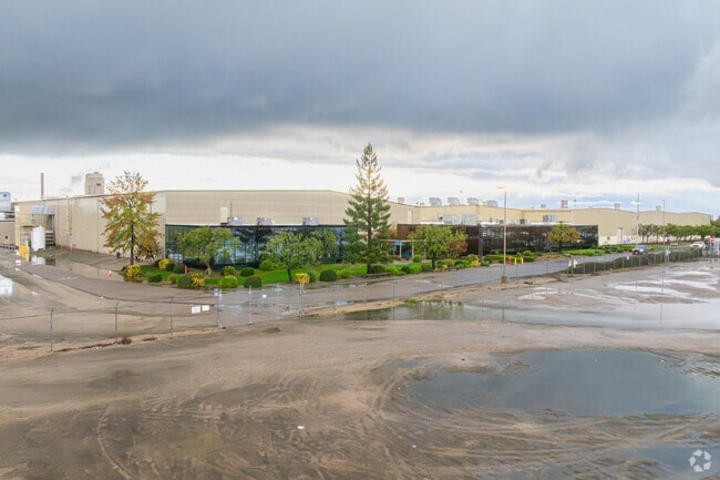
Property Record
13263 S Bethel Ave, Kingsburg, CA 93631


NEARBY LISTINGS FOR SALE OR LEASE
Property Detail
13263 S Bethel Ave
393-240-47S
SUR RT 68.10 AC IN P/M BK 26 PG 23 SEC 16 16/22
Industrialgeneral
Fresno
X
California
06019C2675H
68.10 AC
2025
S Fresno/Hwy 99 Corr
2025
Fresno
007004
Fresno, CA
606,174 SF
DEMOGRAPHICS near 13263 S Bethel Ave
1 Mile
3 Mile
5 Mile
2024 Total Population
153
30,130
49,204
2029 Population
151
30,830
50,194
Pop Growth 2024-2029
(1.31%)
+ 2.32%
+ 2.01%
Average Age
38
36
36
2024 Total Households
46
9,314
14,759
HH Growth 2024-2029
(2.17%)
+ 2.38%
+ 2.05%
Median Household Inc
$86,111
$58,277
$58,452
Avg Household Size
3.20
3.20
3.30
2024 Avg HH Vehicles
2.00
2.00
2.00
Median Home Value
$578,125
$296,380
$276,912
Median Year Built
1983
1980
1981
Nearby Places
Map Layers
Map Styles
 Street
 Aerial
- Restaurants
- Banks
- Shops
- Fitness
- Groceries
PUBLIC TRANSPORTATION
AIRPORT
Fresno Yosemite International
DRIVE
WALK
Distance
Fresno Yosemite International
29 min
19.8 mi
Freight Ports
Port of Stockton
DRIVE
WALK
Distance
Port of Stockton
169 min
144.9 mi
Nearby Properties
Address
Land Use
TOTAL SIZE
Lot Size
Zoning
Address
Land Use
TOTAL SIZE
Lot Size
Zoning
644,619 SF
49.55 AC
M1
Address
Land Use
TOTAL SIZE
Lot Size
Zoning
93,446 SF
4.40 AC
RM3
Address
Land Use
TOTAL SIZE
Lot Size
Zoning
14,024 SF
4.56 AC
M2
Address
Land Use
TOTAL SIZE
Lot Size
Zoning
169,349 SF
75.52 AC
M3
Address
Land Use
TOTAL SIZE
Lot Size
Zoning
396,501 SF
26.40 AC
M1
Address
Land Use
TOTAL SIZE
Lot Size
Zoning
314,498 SF
14.99 AC
IL
Address
Land Use
TOTAL SIZE
Lot Size
Zoning
86,314 SF
5.62 AC
R3
Address
Land Use
TOTAL SIZE
Lot Size
Zoning
43,200 SF
1.99 AC
CH
Address
Land Use
TOTAL SIZE
Lot Size
Zoning
109,547 SF
2.61 AC
M1
Address
Land Use
TOTAL SIZE
Lot Size
Zoning
60,138 SF
8.46 AC
PMD
Address
Land Use
TOTAL SIZE
Lot Size
Zoning
41,517 SF
4.32 AC
CH
Address
Land Use
TOTAL SIZE
Lot Size
Zoning
31,597 SF
1.38 AC
C3
Address
Land Use
TOTAL SIZE
Lot Size
Zoning
99,923 SF
5.11 AC
M1
Address
Land Use
TOTAL SIZE
Lot Size
Zoning
162,379 SF
12.71 AC
CH
Address
Land Use
TOTAL SIZE
Lot Size
Zoning
15,808 SF
2.42 AC
CC
Address
Land Use
TOTAL SIZE
Lot Size
Zoning
24,793 SF
30.63 AC
M3
Address
Land Use
TOTAL SIZE
Lot Size
Zoning
48,660 SF
4 AC
R3
Address
Land Use
TOTAL SIZE
Lot Size
Zoning
14,474 SF
1.82 AC
CC
Address
Land Use
TOTAL SIZE
Lot Size
Zoning
51,886 SF
3.35 AC
C2
Address
Land Use
TOTAL SIZE
Lot Size
Zoning
21,031 SF
1.34 AC
CH
Address
Land Use
TOTAL SIZE
Lot Size
Zoning
27,426 SF
1.88 AC
R1
Address
Land Use
TOTAL SIZE
Lot Size
Zoning
17,808 SF
2.08 AC
C3
Address
Land Use
TOTAL SIZE
Lot Size
Zoning
15,805 SF
1.67 AC
CH
Address
Land Use
TOTAL SIZE
Lot Size
Zoning
35,504 SF
3.77 AC
C3
Address
Land Use
TOTAL SIZE
Lot Size
Zoning
56,088 SF
2.93 AC
R3
Address
Land Use
TOTAL SIZE
Lot Size
Zoning
1,926 SF
37.89 AC
AE20
Address
Land Use
TOTAL SIZE
Lot Size
Zoning
4,185 SF
4.44 AC
C6
Address
Land Use
TOTAL SIZE
Lot Size
Zoning
23,536 SF
2.22 AC
C3
The World's #1 Commercial Real Estate Marketplace
Connect with us
© 2026 CoStar Group
The information above has been obtained from sources believed reliable. While we do not doubt its accuracy we have not verified it and make no guarantee, warranty or representation about it. It is your responsibility to independently confirm its accuracy and completeness. Any projections, opinions, assumptions, or estimates used are for example only and do not represent the current or future performance of the property. The value of this transaction to you depends on tax and other factors which should be evaluated by your tax, financial, and legal advisors. You and your advisors should conduct a careful, independent investigation of the property to determine to your satisfaction the suitability of the property for your needs.