Property Record
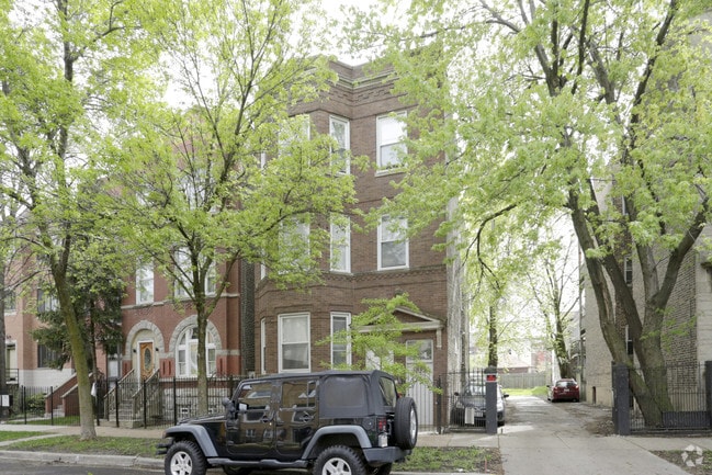
1329 N Artesian Ave, Chicago, IL 60622


Property Detail
1329 N Artesian Ave
16-01-221-013-0000
LOTS 35 & 36 IN BLK 1 IN WINSLOW & JACOBSONS SUB SE4 NE4 OF SEC01 T39 N R13E 3P
Apartment
Cook
22
Illinois
B and X Area of moderate flood hazard, usually the area between the limits of the 100-year and 500-year floods.
36,35
2023
0.07 AC
2025
Wicker Park
241100
Chicago
3,414 SF
Chicago-Naperville-Elgin, IL-IN
NEARBY LISTINGS FOR SALE OR LEASE
DEMOGRAPHICS near 1329 N Artesian Ave
1 mile
3 mile
5 mile
2025 Total Population
64,061
491,858
1,228,577
2030 Population
62,838
488,282
1,213,909
Pop Growth 2025-2030
(1.91%)
(0.73%)
(1.19%)
Average Age
35
36
37
2025 Total Households
29,915
227,458
557,878
HH Growth 2025-2030
(2.18%)
(0.55%)
(0.76%)
Median Household Inc
$125,826
$110,371
$95,098
Avg Household Size
2.10
2.10
2.10
2025 Avg HH Vehicles
1.00
1.00
1.00
Median Home Value
$639,744
$572,260
$447,326
Median Year Built
1948
1962
1956
Nearby Places
Map Layers
Map Styles
 Street
 Aerial
Layers
 Traffic
 Biking
Places
Listings with unknown addresses are not visible on the map
- Restaurants
- Banks
- Shops
- Fitness
- Groceries
PUBLIC TRANSPORTATION
TRANSIT/SUBWAY
Western Station (Blue Line - O'hare Branch) (Blue Line - Chicago Transit Authority "L" Trains (The "L"))
Drive
Walk
Distance
Western Station (Blue Line - O'hare Branch) (Blue Line - Chicago Transit Authority "L" Trains (The "L"))
3 min
15 min
0.8 mi
Damen Station (Blue Line) (Blue Line - Chicago Transit Authority "L" Trains (The "L"))
Drive
Walk
Distance
Damen Station (Blue Line) (Blue Line - Chicago Transit Authority "L" Trains (The "L"))
2 min
15 min
0.8 mi
COMMUTER RAIL
Clybourn Station (Union Pacific North Line - Northeast Illinois Regional Commuter Railroad (Metra), Union Pacific Northwest Line - Northeast Illinois Regional Commuter Railroad (Metra))
Drive
Walk
Distance
Clybourn Station (Union Pacific North Line - Northeast Illinois Regional Commuter Railroad (Metra), Union Pacific Northwest Line - Northeast Illinois Regional Commuter Railroad (Metra))
4 min
1.8 mi
Western Avenue Station (Md-N/Md-W/Ncs) (Milwaukee District North Line - Northeast Illinois Regional Commuter Railroad (Metra), Milwaukee District West Line - Northeast Illinois Regional Commuter Railroad (Metra), North Central Service - Northeast Illinois Regional Commuter Railroad (Metra))
Drive
Walk
Distance
Western Avenue Station (Md-N/Md-W/Ncs) (Milwaukee District North Line - Northeast Illinois Regional Commuter Railroad (Metra), Milwaukee District West Line - Northeast Illinois Regional Commuter Railroad (Metra), North Central Service - Northeast Illinois Regional Commuter Railroad (Metra))
4 min
1.9 mi
AIRPORT
Chicago Midway International
Drive
Walk
Distance
Chicago Midway International
20 min
10.7 mi
Chicago O'Hare International
Drive
Walk
Distance
Chicago O'Hare International
24 min
14.8 mi
Freight Ports
Port Milwaukee
Drive
Walk
Distance
Port Milwaukee
102 min
83.0 mi
Nearby Properties
Address
Land Use
TOTAL SIZE
Lot Size
Zoning
Address
Land Use
TOTAL SIZE
Lot Size
Zoning
1,396,750 SF
4.09 AC
PD 98
Address
Land Use
TOTAL SIZE
Lot Size
Zoning
1,362,475 SF
1.97 AC
PD 1226
Address
Land Use
TOTAL SIZE
Lot Size
Zoning
4,296,046 SF
6.15 AC
DC-16
Address
Land Use
TOTAL SIZE
Lot Size
Zoning
3,914,400 SF
5.70 AC
DC-16
Address
Land Use
TOTAL SIZE
Lot Size
Zoning
0.82 AC
PD 1115
Address
Land Use
TOTAL SIZE
Lot Size
Zoning
1,888,207 SF
2.03 AC
PD 264
Address
Land Use
TOTAL SIZE
Lot Size
Zoning
1,502,279 SF
3.79 AC
PD 98
Address
Land Use
TOTAL SIZE
Lot Size
Zoning
1,559,966 SF
1.38 AC
DC-12
Address
Land Use
TOTAL SIZE
Lot Size
Zoning
1,857,394 SF
3.13 AC
PD 447
Address
Land Use
TOTAL SIZE
Lot Size
Zoning
0.23 AC
PD 756
Address
Land Use
TOTAL SIZE
Lot Size
Zoning
1.09 AC
B1-3
Address
Land Use
TOTAL SIZE
Lot Size
Zoning
959,129 SF
1.32 AC
DC-16
Address
Land Use
TOTAL SIZE
Lot Size
Zoning
835,475 SF
0.58 AC
PD 486
Address
Land Use
TOTAL SIZE
Lot Size
Zoning
948,900 SF
0.74 AC
DC-16
Address
Land Use
TOTAL SIZE
Lot Size
Zoning
559,589 SF
1.72 AC
C3-5
Address
Land Use
TOTAL SIZE
Lot Size
Zoning
0.72 AC
PD 1403
Address
Land Use
TOTAL SIZE
Lot Size
Zoning
1.44 AC
PD 30
Address
Land Use
TOTAL SIZE
Lot Size
Zoning
73,700 SF
0.48 AC
RM-6.5
Address
Land Use
TOTAL SIZE
Lot Size
Zoning
0.47 AC
PD 779
Address
Land Use
TOTAL SIZE
Lot Size
Zoning
594,987 SF
1.11 AC
PD 1407
Address
Land Use
TOTAL SIZE
Lot Size
Zoning
1,232,426 SF
0.42 AC
PD 779
Address
Land Use
TOTAL SIZE
Lot Size
Zoning
781,284 SF
4.09 AC
PD 98
Address
Land Use
TOTAL SIZE
Lot Size
Zoning
796,755 SF
2.49 AC
DC-16,PD 1
Address
Land Use
TOTAL SIZE
Lot Size
Zoning
737,500 SF
0.67 AC
PD 431
Address
Land Use
TOTAL SIZE
Lot Size
Zoning
1,061,587 SF
0.56 AC
PD 431
Address
Land Use
TOTAL SIZE
Lot Size
Zoning
2,087,700 SF
0.96 AC
PD 98
Address
Land Use
TOTAL SIZE
Lot Size
Zoning
266,248 SF
Address
Land Use
TOTAL SIZE
Lot Size
Zoning
117,600 SF
2.14 AC
PD 233
Address
Land Use
TOTAL SIZE
Lot Size
Zoning
309,985 SF
0.78 AC
PD 1418
Address
Land Use
TOTAL SIZE
Lot Size
Zoning
0.82 AC
PD 1470
The World's #1 Commercial Real Estate Marketplace
Connect with us
© 2026 CoStar Group
The information above has been obtained from sources believed reliable. While we do not doubt its accuracy we have not verified it and make no guarantee, warranty or representation about it. It is your responsibility to independently confirm its accuracy and completeness. Any projections, opinions, assumptions, or estimates used are for example only and do not represent the current or future performance of the property. The value of this transaction to you depends on tax and other factors which should be evaluated by your tax, financial, and legal advisors. You and your advisors should conduct a careful, independent investigation of the property to determine to your satisfaction the suitability of the property for your needs.