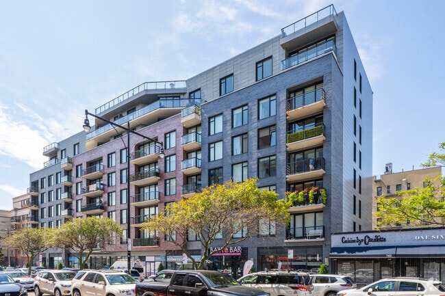
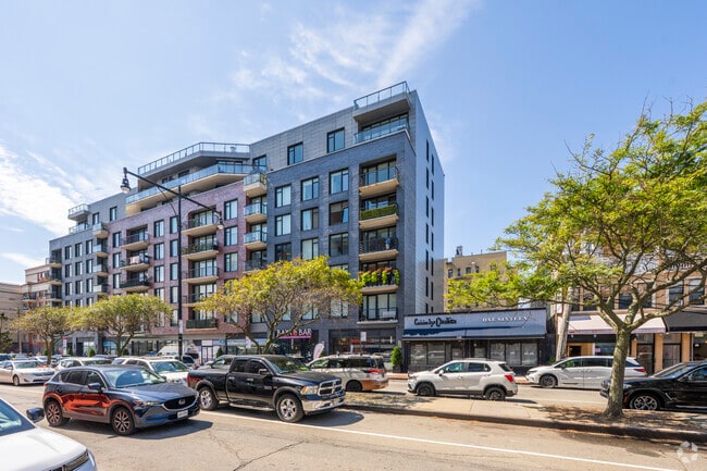
Property Record
133 Beach 116Th St, Rockaway Park, NY 11694
Current Lease Availabilities
NEARBY LISTINGS FOR SALE OR LEASE
Property Detail
133 Beach 116Th St
16226-1247
DOCID-2019012400322007
Condominium
Queens
X
New York
3604970379F
25
0
0.66 AC
2021
Rockaway Park
0934021000
Long Island (New York)
1,216 SF
New York-Jersey City-White Plains, NY-NJ
DEMOGRAPHICS near 133 Beach 116Th St
1 Mile
3 Mile
5 Mile
2024 Total Population
16,993
52,726
150,833
2029 Population
16,225
49,708
141,044
Pop Growth 2024-2029
(4.52%)
(5.72%)
(6.49%)
Average Age
46
42
41
2024 Total Households
7,108
20,292
53,734
HH Growth 2024-2029
(4.36%)
(5.81%)
(6.58%)
Median Household Inc
$72,383
$63,689
$64,560
Avg Household Size
2.20
2.40
2.60
2024 Avg HH Vehicles
1.00
1.00
1.00
Median Home Value
$669,240
$629,976
$685,935
Median Year Built
1961
1964
1963
Nearby Places
Map Layers
Map Styles
 Street
 Aerial
- Restaurants
- Banks
- Shops
- Fitness
- Groceries
PUBLIC TRANSPORTATION
TRANSIT/SUBWAY
Rockaway Park-Beach 116 Street (A - New York MTA Subway (The Subway), Rockaway Park Shuttle - New York MTA Subway (The Subway))
DRIVE
WALK
Distance
Rockaway Park-Beach 116 Street (A - New York MTA Subway (The Subway), Rockaway Park Shuttle - New York MTA Subway (The Subway))
2 min
8 min
0.4 mi
Beach 105 Street (A - New York MTA Subway (The Subway), Rockaway Park Shuttle - New York MTA Subway (The Subway))
DRIVE
WALK
Distance
Beach 105 Street (A - New York MTA Subway (The Subway), Rockaway Park Shuttle - New York MTA Subway (The Subway))
3 min
13 min
0.7 mi
COMMUTER RAIL
Far Rockaway Station (Far Rockaway Branch - Long Island Rail Road)
DRIVE
WALK
Distance
Far Rockaway Station (Far Rockaway Branch - Long Island Rail Road)
12 min
5.8 mi
Inwood Station (Far Rockaway Branch - Long Island Rail Road)
DRIVE
WALK
Distance
Inwood Station (Far Rockaway Branch - Long Island Rail Road)
13 min
7.1 mi
AIRPORT
John F Kennedy International
DRIVE
WALK
Distance
John F Kennedy International
24 min
12.0 mi
LaGuardia
DRIVE
WALK
Distance
LaGuardia
35 min
18.8 mi
Newark Liberty International
DRIVE
WALK
Distance
Newark Liberty International
54 min
32.8 mi
Freight Ports
NY - Red Hook Container Terminal
DRIVE
WALK
Distance
NY - Red Hook Container Terminal
32 min
15.3 mi
Nearby Properties
Address
Land Use
TOTAL SIZE
Lot Size
Zoning
Address
Land Use
TOTAL SIZE
Lot Size
Zoning
65.94 AC
PARKUS
Address
Land Use
TOTAL SIZE
Lot Size
Zoning
200.83 AC
PARK
Address
Land Use
TOTAL SIZE
Lot Size
Zoning
50,000 SF
149.22 AC
PARK
Address
Land Use
TOTAL SIZE
Lot Size
Zoning
2,000 SF
253.68 AC
R4
Address
Land Use
TOTAL SIZE
Lot Size
Zoning
42.84 AC
PARK
Address
Land Use
TOTAL SIZE
Lot Size
Zoning
169.01 AC
PARK
Address
Land Use
TOTAL SIZE
Lot Size
Zoning
1,085,148 SF
13.53 AC
R6
Address
Land Use
TOTAL SIZE
Lot Size
Zoning
407,218 SF
34.48 AC
R4
Address
Land Use
TOTAL SIZE
Lot Size
Zoning
820,910 SF
21.03 AC
R4
Address
Land Use
TOTAL SIZE
Lot Size
Zoning
18.71 AC
PARKUS
Address
Land Use
TOTAL SIZE
Lot Size
Zoning
20,000 SF
172.95 AC
PARK
Address
Land Use
TOTAL SIZE
Lot Size
Zoning
17.68 AC
PARK
Address
Land Use
TOTAL SIZE
Lot Size
Zoning
1,800 SF
65.66 AC
PARK
Address
Land Use
TOTAL SIZE
Lot Size
Zoning
160,315 SF
0.66 AC
R7A
Address
Land Use
TOTAL SIZE
Lot Size
Zoning
72,148 SF
0.44 AC
R6A
Address
Land Use
TOTAL SIZE
Lot Size
Zoning
666,256 SF
14.16 AC
R6
Address
Land Use
TOTAL SIZE
Lot Size
Zoning
145,883 SF
1.29 AC
R6
Address
Land Use
TOTAL SIZE
Lot Size
Zoning
3,120 SF
20.62 AC
PARK
Address
Land Use
TOTAL SIZE
Lot Size
Zoning
120,994 SF
1.71 AC
R6
Address
Land Use
TOTAL SIZE
Lot Size
Zoning
358,140 SF
8.13 AC
R5
Address
Land Use
TOTAL SIZE
Lot Size
Zoning
129,955 SF
0.34 AC
R8
Address
Land Use
TOTAL SIZE
Lot Size
Zoning
119,875 SF
3.16 AC
R4
Address
Land Use
TOTAL SIZE
Lot Size
Zoning
13.76 AC
PARK
Address
Land Use
TOTAL SIZE
Lot Size
Zoning
102,204 SF
2.32 AC
R6
Address
Land Use
TOTAL SIZE
Lot Size
Zoning
293,677 SF
4.48 AC
R5
Address
Land Use
TOTAL SIZE
Lot Size
Zoning
292,677 SF
4.90 AC
R5
Address
Land Use
TOTAL SIZE
Lot Size
Zoning
24,000,000 SF
55.42 AC
M1-1
Address
Land Use
TOTAL SIZE
Lot Size
Zoning
290,070 SF
5.29 AC
R5
Address
Land Use
TOTAL SIZE
Lot Size
Zoning
93,023 SF
3.17 AC
R4
Address
Land Use
TOTAL SIZE
Lot Size
Zoning
64,415 SF
1.14 AC
R5
The World's #1 Commercial Real Estate Marketplace
Connect with us
© 2026 CoStar Group
The information above has been obtained from sources believed reliable. While we do not doubt its accuracy we have not verified it and make no guarantee, warranty or representation about it. It is your responsibility to independently confirm its accuracy and completeness. Any projections, opinions, assumptions, or estimates used are for example only and do not represent the current or future performance of the property. The value of this transaction to you depends on tax and other factors which should be evaluated by your tax, financial, and legal advisors. You and your advisors should conduct a careful, independent investigation of the property to determine to your satisfaction the suitability of the property for your needs.